Understanding Cartograms and Their Uses
Interactive Video
•
Geography
•
9th - 10th Grade
•
Practice Problem
•
Hard

Patricia Brown
FREE Resource
Read more
10 questions
Show all answers
1.
MULTIPLE CHOICE QUESTION
30 sec • 1 pt
What is a key advantage of using regional cartograms?
They are only useful for historical data.
They allow for the visualization of any set of polygons.
They can only be used for population data.
They are limited to country-level data.
2.
MULTIPLE CHOICE QUESTION
30 sec • 1 pt
What is a cartogram?
A type of musical instrument.
A map that distorts area to represent data.
A device for tracking time.
A tool for measuring temperature.
3.
MULTIPLE CHOICE QUESTION
30 sec • 1 pt
What is a common misconception about cartograms?
They can only be used for global data.
They are not useful for visualizing changes over time.
They are only applicable to economic data.
They are difficult to create.
4.
MULTIPLE CHOICE QUESTION
30 sec • 1 pt
Which of the following is NOT a suggested use for cartograms?
Mapping population changes in states.
Visualizing river flow differences by watershed.
Tracking global temperature changes.
Displaying crime rates by neighborhood.
5.
MULTIPLE CHOICE QUESTION
30 sec • 1 pt
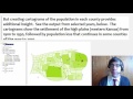
What trend was observed in Kansas from 1900 to 1930?
A decrease in urban centers.
An increase in river flow.
Settlement of the high plains.
A rise in crime rates.
6.
MULTIPLE CHOICE QUESTION
30 sec • 1 pt
Which city in Kansas experienced growth according to the cartograms?
Wichita
Dodge City
Salina
Hutchinson
7.
MULTIPLE CHOICE QUESTION
30 sec • 1 pt
Why is it beneficial to provide a standard map alongside cartograms?
To confuse the audience.
To reduce the size of the cartogram.
To make the cartogram look more colorful.
To help the audience understand the distortion of variables.
Access all questions and much more by creating a free account
Create resources
Host any resource
Get auto-graded reports
Continue with Google

Continue with Email
Continue with Classlink
Continue with Clever
or continue with
Microsoft
%20(1).png)
Apple
Others
Already have an account?
