Understanding Maps and Their Elements
Interactive Video
•
Geography
•
4th - 5th Grade
•
Practice Problem
•
Hard

Patricia Brown
FREE Resource
Read more
10 questions
Show all answers
1.
MULTIPLE CHOICE QUESTION
30 sec • 1 pt
What is the main focus of the geography unit introduced in the lesson?
Explaining maps and their elements
Learning about different cultures
Understanding historical events
Studying the solar system
2.
MULTIPLE CHOICE QUESTION
30 sec • 1 pt
Which of the following is NOT an element to locate on the map during the activity?
Hospital
Fire Station
Police Station
Library
3.
MULTIPLE CHOICE QUESTION
30 sec • 1 pt
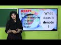
According to the lesson, what does the acronym BOLTS stand for?
Border, Orientation, Legend, Title, Scale
Border, Order, Legend, Text, Scale
Boundary, Order, Legend, Text, Size
Base, Orientation, Length, Title, Symbol
4.
MULTIPLE CHOICE QUESTION
30 sec • 1 pt
How is a globe different from a map?
A globe is flat, while a map is 3D
A globe is a 3D representation, while a map is flat
A globe shows only countries, while a map shows cities
A globe is used for navigation, while a map is not
5.
MULTIPLE CHOICE QUESTION
30 sec • 1 pt
What is the primary purpose of a map as described in the textbook reading?
To display various geographical distributions
To depict weather patterns
To show historical events
To illustrate cultural differences
6.
MULTIPLE CHOICE QUESTION
30 sec • 1 pt
Which element of a map helps in understanding the distance between locations?
Orientation
Scale
Title
Legend
7.
MULTIPLE CHOICE QUESTION
30 sec • 1 pt
What is the significance of the 'Legend' on a map?
It shows the map's title
It measures distances
It provides directions
It explains the symbols used on the map
Access all questions and much more by creating a free account
Create resources
Host any resource
Get auto-graded reports
Continue with Google

Continue with Email
Continue with Classlink
Continue with Clever
or continue with
Microsoft
%20(1).png)
Apple
Others
Already have an account?
Similar Resources on Wayground
Popular Resources on Wayground

15 questions
Fractions on a Number Line
Quiz
•
3rd Grade
20 questions
Equivalent Fractions
Quiz
•
3rd Grade
25 questions
Multiplication Facts
Quiz
•
5th Grade
54 questions
Analyzing Line Graphs & Tables
Quiz
•
4th Grade
22 questions
fractions
Quiz
•
3rd Grade
20 questions
Main Idea and Details
Quiz
•
5th Grade
20 questions
Context Clues
Quiz
•
6th Grade
15 questions
Equivalent Fractions
Quiz
•
4th Grade