Understanding Weather Maps and Charts
Interactive Video
•
Geography
•
9th - 10th Grade
•
Practice Problem
•
Hard

Patricia Brown
FREE Resource
Read more
10 questions
Show all answers
1.
MULTIPLE CHOICE QUESTION
30 sec • 1 pt
Why are weather maps considered less critical for VFR flying over short distances?
They are too complex to interpret.
They cover too wide an area.
They focus on long-term forecasts.
They are not updated frequently.
2.
MULTIPLE CHOICE QUESTION
30 sec • 1 pt
What is the primary focus of weather map symbols?
Temperature variations
Wind speed
Cloud formations
Isobars and fronts
3.
MULTIPLE CHOICE QUESTION
30 sec • 1 pt
What does a trough on a weather map indicate?
A sudden temperature drop
An elongated area of low pressure
A region of clear skies
A high-pressure area
4.
MULTIPLE CHOICE QUESTION
30 sec • 1 pt
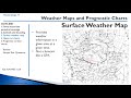
How do surface weather maps differ from forecasts?
They predict future weather conditions.
They provide current weather information.
They focus on temperature changes.
They are used for long-term planning.
5.
MULTIPLE CHOICE QUESTION
30 sec • 1 pt
What does a high-pressure region on a surface weather map indicate?
Rapid temperature changes
High wind speeds
Stormy conditions
Clear skies and calm weather
6.
MULTIPLE CHOICE QUESTION
30 sec • 1 pt
What do upper air charts primarily indicate?
Temperature at different altitudes
Altitude at specific pressure levels
Sea level pressure
Wind direction
7.
MULTIPLE CHOICE QUESTION
30 sec • 1 pt
What is the purpose of analysis charts in upper air maps?
To predict future weather
To indicate wind patterns
To provide current weather reports
To show temperature variations
Access all questions and much more by creating a free account
Create resources
Host any resource
Get auto-graded reports
Continue with Google

Continue with Email
Continue with Classlink
Continue with Clever
or continue with
Microsoft
%20(1).png)
Apple
Others
Already have an account?
