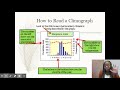
Understanding Climatographs and Precipitation
Interactive Video
•
Geography
•
6th - 7th Grade
•
Practice Problem
•
Hard

Patricia Brown
FREE Resource
Read more
10 questions
Show all answers
1.
MULTIPLE CHOICE QUESTION
30 sec • 1 pt
What two main types of data are represented in a climatograph?
Temperature and humidity
Temperature and precipitation
Precipitation and wind speed
Humidity and wind speed
2.
MULTIPLE CHOICE QUESTION
30 sec • 1 pt
Which of the following is NOT considered a type of precipitation?
Hail
Fog
Snow
Rain
3.
MULTIPLE CHOICE QUESTION
30 sec • 1 pt
Why is it important to know the temperature and precipitation of a location?
To determine the population density
To understand the types of vegetation that can grow
To predict the economic growth
To measure the altitude
4.
MULTIPLE CHOICE QUESTION
30 sec • 1 pt
Which of the following is a key question that climatograph data can help answer?
What is the altitude of the location?
What is the population size?
How much rain does the location receive?
What is the average income of the area?
5.
MULTIPLE CHOICE QUESTION
30 sec • 1 pt
What should you be careful about when looking at the units of precipitation in a climatograph?
The color of the graph
The scale of the graph
The units of measurement (millimeters or inches)
The font size
6.
MULTIPLE CHOICE QUESTION
30 sec • 1 pt
Why is it important to identify different pieces of information in a climatograph?
To calculate the average temperature
To predict future weather patterns
To gain a comprehensive understanding of the climate
To determine the best time to travel
7.
MULTIPLE CHOICE QUESTION
30 sec • 1 pt
What are the two units used to measure temperature in climatographs?
Celsius and Rankine
Kelvin and Celsius
Celsius and Fahrenheit
Fahrenheit and Kelvin
Access all questions and much more by creating a free account
Create resources
Host any resource
Get auto-graded reports
Continue with Google

Continue with Email
Continue with Classlink
Continue with Clever
or continue with
Microsoft
%20(1).png)
Apple
Others
Already have an account?
