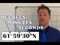
Understanding Coordinates and Measurements
Interactive Video
•
Geography
•
6th - 7th Grade
•
Practice Problem
•
Hard

Thomas White
FREE Resource
Read more
10 questions
Show all answers
1.
MULTIPLE CHOICE QUESTION
30 sec • 1 pt
What is the main focus of this video tutorial?
Degrees and basic coordinates
Advanced map drawing techniques
Historical maps and their significance
Minutes and seconds in coordinates
2.
MULTIPLE CHOICE QUESTION
30 sec • 1 pt
Where is the Greenwich Meridian located on the map discussed in the video?
To the west of the map
To the east of the map
To the north of the map
At the center of the map
3.
MULTIPLE CHOICE QUESTION
30 sec • 1 pt
How many minutes are there in one degree?
120 minutes
60 minutes
30 minutes
90 minutes
4.
MULTIPLE CHOICE QUESTION
30 sec • 1 pt
What is the significance of the equator in the context of this video?
It is irrelevant to coordinate determination
It is used to determine the north-south position
It divides the map into east and west
It marks the starting point for longitude
5.
MULTIPLE CHOICE QUESTION
30 sec • 1 pt
What happens to the degree value when you move from 59 minutes to 60 minutes?
It decreases by one minute
It remains the same
It increases by one degree
It decreases by one degree
6.
MULTIPLE CHOICE QUESTION
30 sec • 1 pt
What is the first step in determining the coordinates of a point?
Determine the longitude
Use a ruler to measure the map
Determine the latitude
Measure the distance from the equator
7.
MULTIPLE CHOICE QUESTION
30 sec • 1 pt
How do you determine the longitude of a point on the map?
By observing the increase in degree values as you move east
By using a compass
By checking the latitude lines
By measuring the distance from the equator
Access all questions and much more by creating a free account
Create resources
Host any resource
Get auto-graded reports
Continue with Google

Continue with Email
Continue with Classlink
Continue with Clever
or continue with
Microsoft
%20(1).png)
Apple
Others
Already have an account?
