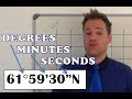
Mapping Concepts and Coordinates
Interactive Video
•
Geography
•
6th - 7th Grade
•
Practice Problem
•
Hard

Thomas White
FREE Resource
Read more
27 questions
Show all answers
1.
MULTIPLE CHOICE QUESTION
30 sec • 1 pt
What is the main focus of this video tutorial?
Explaining minutes and seconds in coordinates
Understanding degrees in coordinates
Learning about map symbols
Studying historical maps
2.
MULTIPLE CHOICE QUESTION
30 sec • 1 pt
What should you do if you are unfamiliar with the basics of coordinates?
Watch the previous video on degrees
Skip to the end of the video
Read a book on geography
Watch the entire video again
3.
MULTIPLE CHOICE QUESTION
30 sec • 1 pt
Why is it important to know the location of the Equator and Greenwich Meridian?
To find the shortest route between two points
To understand time zones
To determine the direction of north
To accurately read coordinates on a map
4.
MULTIPLE CHOICE QUESTION
30 sec • 1 pt
What does it mean if a line on a map is labeled 21° 15 minutes?
It is 21° 15 minutes north of the Equator
It is 21° 15 minutes south of the Equator
It is 21° 15 minutes west of the Greenwich Meridian
It is 21° 15 minutes east of the Greenwich Meridian
5.
MULTIPLE CHOICE QUESTION
30 sec • 1 pt
What is the significance of the Greenwich Meridian in mapping?
It marks the boundary between land and sea
It is used to measure altitude
It divides the Earth into eastern and western hemispheres
It is the starting point for measuring latitude
6.
MULTIPLE CHOICE QUESTION
30 sec • 1 pt
What is the significance of the Equator in mapping?
It is the starting point for measuring longitude
It divides the Earth into northern and southern hemispheres
It is used to measure altitude
It marks the boundary between land and sea
7.
MULTIPLE CHOICE QUESTION
30 sec • 1 pt
What happens to the numbers on a map as you move away from the Greenwich Meridian?
They fluctuate randomly
They increase
They stay the same
They decrease
Access all questions and much more by creating a free account
Create resources
Host any resource
Get auto-graded reports
Continue with Google

Continue with Email
Continue with Classlink
Continue with Clever
or continue with
Microsoft
%20(1).png)
Apple
Others
Already have an account?
Popular Resources on Wayground

15 questions
Fractions on a Number Line
Quiz
•
3rd Grade
20 questions
Equivalent Fractions
Quiz
•
3rd Grade
25 questions
Multiplication Facts
Quiz
•
5th Grade
54 questions
Analyzing Line Graphs & Tables
Quiz
•
4th Grade
22 questions
fractions
Quiz
•
3rd Grade
20 questions
Main Idea and Details
Quiz
•
5th Grade
20 questions
Context Clues
Quiz
•
6th Grade
15 questions
Equivalent Fractions
Quiz
•
4th Grade
Discover more resources for Geography
20 questions
Plate Tectonics and Earth's Structure
Quiz
•
6th Grade
21 questions
Continents and Oceans
Quiz
•
6th Grade
15 questions
SWA Geography SS7G5
Quiz
•
7th Grade
16 questions
Southern and Eastern Asia Government Basics
Quiz
•
7th Grade
10 questions
38a, b, c: Voluntary trade in Africa
Quiz
•
7th Grade
25 questions
Russia and the Eurasian Republics
Quiz
•
6th Grade
11 questions
OPEC
Quiz
•
6th Grade
16 questions
Culture
Quiz
•
7th Grade