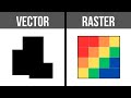
Understanding Vector and Raster Formats
Interactive Video
•
Geography
•
9th - 10th Grade
•
Practice Problem
•
Hard

Jennifer Brown
FREE Resource
5 questions
Show all answers
1.
MULTIPLE CHOICE QUESTION
30 sec • 1 pt
What is a key advantage of using vector format for digital maps?
It allows for easy mathematical calculations.
It is better for storing large quantities of data.
It is ideal for continuous data.
It retains shape geometry regardless of scale.
2.
MULTIPLE CHOICE QUESTION
30 sec • 1 pt
Which type of data is best represented using vector format?
Continuous data
Discrete data
Data with low resolution
Data with high resolution
3.
MULTIPLE CHOICE QUESTION
30 sec • 1 pt
What is a significant consideration when using raster format?
The shape of the polygons
The number of vertices
The resolution of the grid
The color of the cells
4.
MULTIPLE CHOICE QUESTION
30 sec • 1 pt
Why is raster format preferred for representing elevation?
It allows for easy calculation of slopes.
It retains geometry at any scale.
It uses polygons for precision.
It is better for discrete data.
5.
MULTIPLE CHOICE QUESTION
30 sec • 1 pt
What is the benefit of using both vector and raster data together?
It provides a more comprehensive geographic insight.
It reduces the need for high resolution.
It simplifies data storage.
It eliminates the need for mathematical operations.
Access all questions and much more by creating a free account
Create resources
Host any resource
Get auto-graded reports
Continue with Google

Continue with Email
Continue with Classlink
Continue with Clever
or continue with
Microsoft
%20(1).png)
Apple
Others
Already have an account?
Popular Resources on Wayground

8 questions
Spartan Way - Classroom Responsible
Quiz
•
9th - 12th Grade
15 questions
Fractions on a Number Line
Quiz
•
3rd Grade
14 questions
Boundaries & Healthy Relationships
Lesson
•
6th - 8th Grade
20 questions
Equivalent Fractions
Quiz
•
3rd Grade
3 questions
Integrity and Your Health
Lesson
•
6th - 8th Grade
25 questions
Multiplication Facts
Quiz
•
5th Grade
9 questions
FOREST Perception
Lesson
•
KG
20 questions
Main Idea and Details
Quiz
•
5th Grade