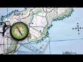
Navigating with a Compass and Topographic Map
Interactive Video
•
Geography
•
6th - 7th Grade
•
Practice Problem
•
Hard

Jennifer Brown
FREE Resource
5 questions
Show all answers
1.
MULTIPLE CHOICE QUESTION
30 sec • 1 pt
What is the starting point for the navigation exercise described in the video?
A World War II gun emplacement
A trig station in Duders Regional Park
A Taraire tree
A compass needle
2.
MULTIPLE CHOICE QUESTION
30 sec • 1 pt
What is the first step in aligning the compass with the map?
Ensure the compass housing does not turn
Fix your eye on a distant feature
Rotate the map until it points south
Align the compass edge with the starting and finishing points on the map
3.
MULTIPLE CHOICE QUESTION
30 sec • 1 pt
How do you ensure the compass is correctly oriented with the map?
Rotate the compass housing until the orienting arrow points south
Align the compass needle with the map's east-west lines
Rotate the map and compass together until the red needle points north
Fix your eye on a nearby tree
4.
MULTIPLE CHOICE QUESTION
30 sec • 1 pt
What should you do after aligning the compass and map?
Check the map for new directions
Start walking without checking the compass
Fix your eye on a distant feature in the direction of travel
Rotate the compass housing again
5.
MULTIPLE CHOICE QUESTION
30 sec • 1 pt
What is important to remember while moving towards the destination?
Rotate the compass housing frequently
Keep the compass housing stable
Ignore the compass needle
Change direction often
Access all questions and much more by creating a free account
Create resources
Host any resource
Get auto-graded reports
Continue with Google

Continue with Email
Continue with Classlink
Continue with Clever
or continue with
Microsoft
%20(1).png)
Apple
Others
Already have an account?
