
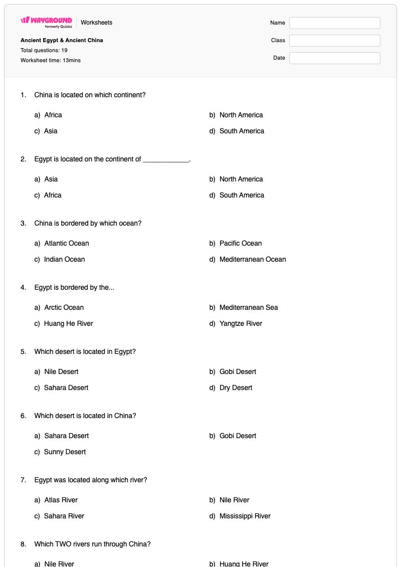

This Grade 3 social studies worksheet helps students compare key geographic and cultural features of Ancient Egypt and Ancient China. Across 19 questions, including 17 multiple-choice items and 2 multiple-select items, students identify each civilization’s continent, bordering body of water, major deserts and rivers, written language, inventions, and architectural achievements.
The questions build recognition and comparison skills by asking students to distinguish the Nile, Huang He, and Yangtze rivers; match hieroglyphics and characters and symbols to the correct civilization; and identify inventions such as paper, clocks, calendars, fireworks, silk, and kites. Students also connect the pyramids with Egypt and the Great Wall with China. This free printable worksheet includes a complete answer key and is suitable for classroom practice, review, or a knowledge check.
Worksheet settings
Font size
S
M
L
XL
Worksheets
Ancient Egypt & Ancient China
Total questions: 19
Name
Class
Date
1.
China is located on which continent?
a)
Africa
b)
North America
c)
Asia
d)
South America
2.
Egypt is located on the continent of ____________.
a)
Asia
b)
North America
c)
Africa
d)
South America
3.
China is bordered by which ocean?
a)
Atlantic Ocean
b)
Pacific Ocean
c)
Indian Ocean
d)
Mediterranean Ocean
4.
Egypt is bordered by the...
a)
Arctic Ocean
b)
Mediterranean Sea
c)
Huang He River
d)
Yangtze River
5.
Which desert is located in Egypt?
a)
Nile Desert
b)
Gobi Desert
c)
Sahara Desert
d)
Dry Desert
6.
Which desert is located in China?
a)
Sahara Desert
b)
Gobi Desert
c)
Sunny Desert
7.
Egypt was located along which river?
a)
Atlas River
b)
Nile River
c)
Sahara River
d)
Mississippi River
8.
Which TWO rivers run through China?
a)
Nile River
b)
Huang He River
c)
Yangtze River
d)
Amazon River
9.
Egypt's written language is ___________.
a)
Characters
b)
Symbols
c)
Hieroglyphics
d)
Numbers
10.
What is China's written language?
a)
Hieroglyphics
b)
Characters & Symbols
c)
Letters
d)
Pictures
11.
Which of the following are Ancient Egyptian inventions? (Multiple answers!)
a)
Paper
b)
Fireworks
c)
Clock
d)
Calendar
12.
Fireworks, compass, silk cloth, kite are all inventions of which civilization?
a)
China
b)
Egypt
13.
Which Ancient Egyptian invention is shown in this picture?
a)
Clock
b)
Paper
c)
Calendar
d)
Dates
14.
An example of Egyptian architecture is...
a)
The Great Wall
b)
Pyramids
c)
The Sahara Desert
d)
Triangles
15.
An example of China's architecture is the..
a)
Great Wall
b)
Pyramids
16.
Which word means "long, long ago"?
a)
Ancient
b)
Architecture
c)
Contribution
d)
Influence
17.
Which word means "the design of buildings?"
a)
Architecture
b)
Ancient
c)
Contribution
d)
Influence
18.
Africa is what color on this map?
a)
Yellow
b)
Green
c)
Blue
d)
Orange
19.
Asia is labeled which color on this map?
a)
Green
b)
Orange
c)
Blue
d)
Yellow
Answer Key
Ancient Egypt & Ancient China
Total questions: 19
1.
c)
Asia
2.
c)
Africa
3.
b)
Pacific Ocean
4.
b)
Mediterranean Sea
5.
c)
Sahara Desert
6.
b)
Gobi Desert
7.
b)
Nile River
8.
b)
Huang He River
, c)
Yangtze River
9.
c)
Hieroglyphics
10.
b)
Characters & Symbols
11.
a)
Paper
, c)
Clock
, d)
Calendar
12.
a)
China
13.
c)
Calendar
14.
b)
Pyramids
15.
a)
Great Wall
16.
a)
Ancient
17.
a)
Architecture
18.
d)
Orange
19.
d)
Yellow
140 %
Browse by subjects
Browse by grades
Browse by format
FAQs
What does the Ancient Egypt & Ancient China worksheet cover?
This Grade 3 worksheet uses 17 multiple-choice and 2 multiple-select questions to compare the geography and cultural achievements of Ancient Egypt and Ancient China. Students identify continents, oceans and seas, deserts, rivers, written languages, inventions, and architecture, including hieroglyphics, the Great Wall, and the pyramids.
How can I use this worksheet to teach Ancient Egypt and Ancient China?
Introduce the worksheet by having students locate Egypt and China on a map, then discuss how rivers, deserts, and nearby bodies of water appear in the questions. After students complete the items, ask them to sort the inventions, written languages, and architectural examples into two civilization groups and explain the clues they used. Review the multiple-select questions together so students understand why more than one answer can be correct.
What mistakes should I watch for when students complete this worksheet?
Students may confuse each civilization’s geographic features, such as selecting the Sahara Desert or Nile River for China, or mixing up the Pacific Ocean and Mediterranean Sea. They may also confuse hieroglyphics with China’s characters and symbols, or associate the pyramids with China and the Great Wall with Egypt. Watch the two multiple-select items especially closely: students must select both Chinese rivers and all three listed Egyptian inventions rather than choosing only one option.
How do I assign and grade this Ancient Egypt and Ancient China worksheet?
You can assign this worksheet as a printable PDF or as a digital quiz on Wayground, and it includes a complete answer key for checking the 19 responses. For printable submissions, scan student work with the Wayground for Teachers app to streamline grading. The printable format also gives schools an option for reducing screen time.
How can I differentiate this Ancient Egypt and Ancient China worksheet for my students?
Use the worksheet’s Advanced Settings to adjust font spacing or choose a larger font size so students can read and mark the geography, invention, and architecture questions more comfortably. You can also enable a dyslexia-friendly font or translate the worksheet into another language while preserving its multiple-choice and multiple-select format.
Where can I find more worksheets like this on Wayground?
Wayground offers a broad collection of free printable worksheets and practice problems across subjects, with downloadable PDFs and answer keys to support essential skills and concepts. Browse more resources at https://wayground.com/en-us/worksheets.