Reading Directions on a Map is a Grade 4 social studies worksheet that helps students identify and apply cardinal and intermediate directions. Through nine multiple-choice questions, students distinguish north, south, east, and west from northeast, southeast, northwest, and southwest, then use those direction terms to determine travel routes between U.S. cities such as Miami, Washington, D.C., Dallas, New York City, and Houston.
This worksheet gives students focused practice connecting map-based location reasoning with directional vocabulary. It is useful for introducing compass directions, reinforcing lessons on reading maps, or checking whether students can select a direction based on the relative locations of two places. This free printable worksheet includes a complete answer key for efficient review and grading.
Worksheet settings
Font size
S
M
L
XL
Worksheets
Reading Directions on a Map
Total questions: 9
Name
Class
Date
1.
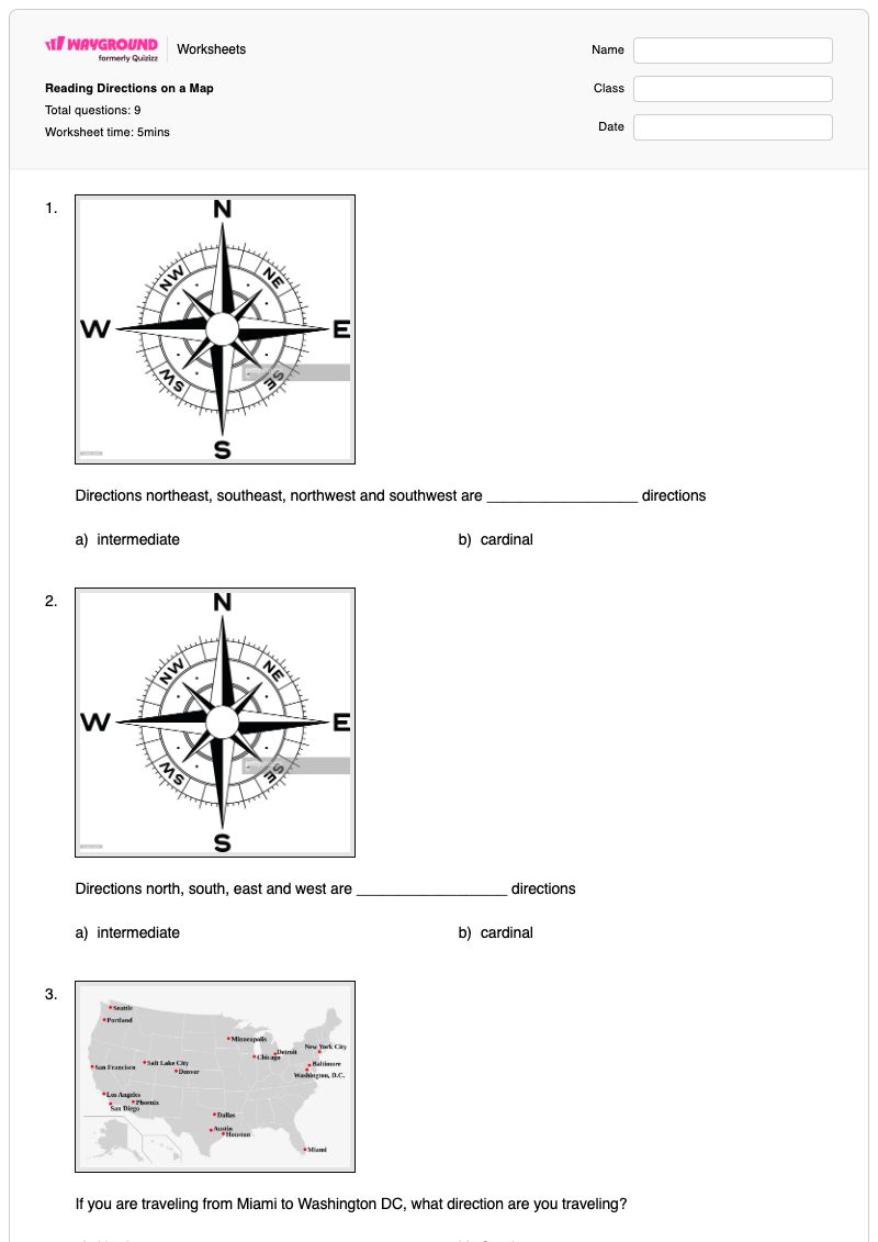
Directions northeast, southeast, northwest and southwest are __________________ directions
a)
intermediate
b)
cardinal
2.
Directions north, south, east and west are __________________ directions
a)
intermediate
b)
cardinal
3.
If you are traveling from Miami to Washington DC, what direction are you traveling?
a)
North
b)
South
c)
East
d)
West
4.
If you are traveling from Portland to Los Angeles, what direction are you traveling?
a)
North
b)
South
c)
East
d)
West
5.
If you are traveling from San Fransico to Denver, what direction are you traveling?
a)
North
b)
South
c)
East
d)
West
6.
If you are traveling from Dallas to New York City, what direction are you traveling?
a)
Northeast
b)
Southeast
c)
Northwest
d)
Southwest
7.
If you are traveling from Phoenix to San Fransico, what direction are you traveling?
a)
Northeast
b)
Southeast
c)
Northwest
d)
Southwest
8.
If you are traveling from Minneapoilis to Miami, what direction are you traveling?
a)
Northeast
b)
Southeast
c)
Northwest
d)
Southwest
9.
If you are traveling from New York City to Houston, what direction are you traveling?
a)
Northeast
b)
Southeast
c)
Northwest
d)
Southwest
Answer Key
Reading Directions on a Map
Total questions: 9
1.
a)
intermediate
2.
b)
cardinal
3.
a)
North
4.
b)
South
5.
c)
East
6.
a)
Northeast
7.
c)
Northwest
8.
b)
Southeast
9.
d)
Southwest
140 %
Browse by subjects
Browse by grades
Browse by format
FAQs
What does the Reading Directions on a Map worksheet cover?
This Grade 4 social studies worksheet covers cardinal directions—north, south, east, and west—and intermediate directions—northeast, southeast, northwest, and southwest. Its nine multiple-choice questions ask students to classify direction terms and determine the direction of travel between pairs of U.S. cities, building accuracy in applying directional vocabulary to map locations.
How can I use this worksheet to teach cardinal and intermediate directions?
Introduce the four cardinal directions first, then show how combining two cardinal directions creates intermediate directions such as northeast or southwest. Have students use a map to trace the city-to-city routes named in the worksheet, explain their reasoning aloud, and complete the multiple-choice items independently or with a partner.
What mistakes should I watch for when students complete this map directions worksheet?
Students may confuse cardinal directions with intermediate directions, especially when selecting northeast, southeast, northwest, or southwest for diagonal routes. They may also reverse the direction of travel by identifying where the starting city lies from the destination instead of determining where the destination lies from the starting city, such as choosing southwest rather than northeast for Dallas to New York City.
How do I assign and grade the Reading Directions on a Map worksheet?
You can assign this worksheet as a printable PDF or as a digital quiz on Wayground. It includes a complete answer key, and printable submissions can be graded by scanning student work with the Wayground for Teachers app. The printable format also gives schools an option for reducing screen time while students practise cardinal and intermediate directions.
How can I differentiate this worksheet for my students?
For the multiple-choice direction items, use the worksheet’s Advanced Settings to adjust font spacing and font size, or enable a dyslexia-friendly font to make the choices easier to read. You can also translate the worksheet into another language when students need language support while learning terms such as cardinal, intermediate, northeast, and southwest.
Where can I find more worksheets like this on Wayground?
Wayground offers a comprehensive collection of free printable worksheets and practice problems across all subjects, including downloadable PDFs and answer keys to support essential skills and concepts. Browse more resources at https://wayground.com/en-us/worksheets.

 Worksheets
