wayground logo

Free Printable Worksheets

Font size

S
M
L
XL
Worksheets

AP HUG Chapter 1 Basic Concepts Key Issues 1 & 2

Total questions: 20

Worksheet time: 40mins

Name
Class
Date
1.

Lines called _____________ and ____________ combine to form the "global grid," and are used to identify absolute location. CHOOSE TWO!

a)

parallels

b)

meridians

c)

coordinates

d)

topographic

2.

Which are TRUE statements about the use of maps in human and physical geography? CHOOSE AS MANY AS APPLY!

a)

Every map projection distorts the surface of the Earth in some way.

b)

Maps refelct the bias of the cartographer who created the map.

c)

Maps are used as both tools of reference and tools of communication.

d)

Maps have little value to geographers since they are not 100% accurate.

3.
Although human geographers do not concentrate on the study of physical processes, they recognize that physical processes often affect the "why of where."
a)
True
b)
False
4.
Success in HUG takes time, effort, and determination. What is NOT a good strategy for growth and achievement?
a)
Build a study group and work together as a team.
b)
Do "a little, a lot" so that information builds and deadlines do not sneak up on you.
c)
Ask for help as you go through the chapter.
d)
Say the course is too hard, and pull the covers over your head.  
5.

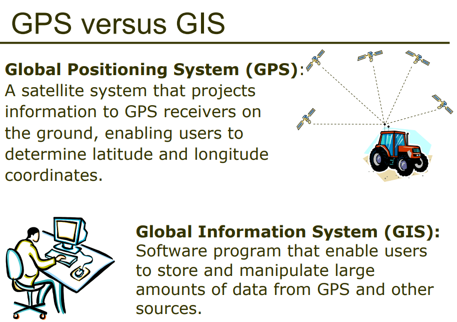
GPS and GIS are examples of contemporary mapping tools that rely on ______ technology.

a)

remote sensing/satellite

b)

computer

c)

smart phone/satellite

d)

International Space Station

6.
These terms are the four ways that geographers determine
a)
location
b)
place
c)
scale
d)
global grid
7.
Which is the best definition of human geography?
a)
Dictionary A
b)
Dictionary B
8.

When mapping a natural disaster such as Hurricane Harvey, human geographers concentrate on the theme of ______.

a)

location

b)

place

c)

HEI

d)

movement

9.

Geographers call the UNIQUE combination of ___________ and __________features Place, one of the 5 Themes. CHOOSE THE BEST TWO!

a)

human

b)

physical

c)

economic

d)

weather

10.
What term best fills in each blank of this paragraph?
a)
site
b)
situation
11.

Which are FALSE statements about the role of scale in geographic inquiry? CHOOSE AS MANY AS APPLY!

a)

Small and large scale maps depict data in similar ways.

b)

Scale affects level of detail and allows geographers multiple ways of looking at data.

c)

Scale is only used to determing distance on a map.

d)

Geographers do not consider scale when studying a particular issue.

12.
What term best fills in each blank of this paragraph?
a)
site
b)
situation
13.
Applying the Five Themes, a geographer would know this San Antonio Via bus route map depicts a  _____ region.
a)
formal/uniform
b)
functional/nodal
c)
perceptual/vernacular
14.
Applying the Five Themes, a geographer would identify this image as a  _____ region; these countries have established, widely-agreed on borders .
a)
formal/uniform
b)
functional/nodal
c)
perceptual/vernacular
15.
Applying the Five Themes, a geographer would say this postcard depicts Texas as a  collection of _________ regions.
a)
formal/uniform
b)
functional/nodal
c)
perceptual/vernacular
16.
The world's earliest maps were used as 
a)
reference tools
b)
communication tools
17.
Some people think map scale is confusing... but YOU know that the small scale map is ____.
a)
Map A
b)
Map B
18.
Meaning, "to take care of," ______ is also what we care about.
a)
culture
b)
history
c)
landmarks
d)
place
19.
Our classroom is north of Sonterra Blvd, east of Stone Oak Drive, west of Highway 281, and south of Evans Road. A geographer knows that this describes ______. 
a)
absolute location
b)
relative location
20.

Reading quizzes

a)

help you monitor your progress and mastery of the course content and become great review tools.

b)

gives your teacher data on which to base instruction and class activities.

c)

are a way to boost your daily average.

d)

All of these are benefits of reading quizzes!