
NEW
Font size
 Worksheets
Unit 1: Geography of the United States and Canada
Total questions: 52
Worksheet time: 40mins

What landform is this?
valley
canyon
mountain
plain
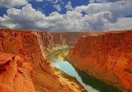
What landform is this?
plain
valley
mountain
canyon
What landform is a deep valley with very steep sides?
canyon
mountain
valley
plain
What landform is land completely surrounded by water?
plain
canyon
mountain
island
What landform is a flat region of lowlands?
mountain
canyon
plain
valley
What continent is the USA located on?
North America
South America
Europe
Africa

What mountain range is this?
Rockies
Alps
Smokey
Andes

What geographic region is this?
Great Plains
Rocky Mountains
Coastal Plain
Gobi Desert
Coal mining helped to develop the region of...
Appalachia
the Canadian Basin
ChiPItts
Boswash
In what way are all of the Great Lakes the same?
They are all the same depth.
They are all the same size.
They are all made up of freshwater.
They are all in the United States.
A river that is wide and deep enough to allow the passage of ships is called a ______________ river.
unnavigable
navigable
wetland
unpassable
How is the Mississippi River important for farming and trade? Choose the BEST answer.
The river is immense.
The river is navigable, allowing people to use it for travel and trade. The river also waters the surrounding land making it suitable for farming.
The river is unnavigable, so the people have nothing else to do but farm.
People trade on the river because it is long, and they also farm there because it's wet.


The northern arctic parts of Alaska and Canada have
warm days all year
a wet season and a dry season
cold winters, and hot, humid summers
long and cold winters, short and cool summers
Why do so many earthquakes happen along the Pacific Coast of North America? Choose the BEST answer.
Natural disasters occur here most often.
This region lies on a major fault zone.
It's an earthquake's favorite spot!
None of the above
To prevent flooding, New Orleans built _________, which are high walls along the banks of a river or lake.
water tables
wetlands
levees
irrigation
Where did Hurricane Katrina strike in August 2005?
only Mississippi
only New Orleans
the Atlantic coast of the United States
the Gulf coast of the United States
What body of water is north of New Orleans?
Gulf of Mexico
Atlantic Ocean
Lake Pontchartrain
Mississippi River
Global warming is caused partly by...
powerful earthquakes
moving plates
the burning of fossil fuels
air moving over large bodies of water
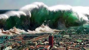

Long period of time without rain
Wildfire
Drought
Thunderstorm
Flood
Form above oceans with warm water
Tsunami
Hurricane
Earthquake
Flood
Earthquakes under the Ocean cause this natural disaster.
Hurricane
Flood
Tsunami
Thunderstorm
Plate tectonics is a theory that states that the surface of Earth is made up of huge slabs of rock.
True
False
What causes hurricane damage?
heavy rains
storm surge
wind
all of the above
Why can certain crops, like cotton only grow in the warm Southeast region?
The people who live down south love cotton.
It is difficult to grow cotton, and southerners have mastered it.
The Southeast has a longer growing season than some other regions of the United States.
The Southeast region is wet.







