wayground logo

Free Printable Worksheets

NEW

Font size

S
M
L
XL
Worksheets

Physical Geography Pre-Test

Total questions: 25

Worksheet time: 8mins
Name
Class
Date
1.
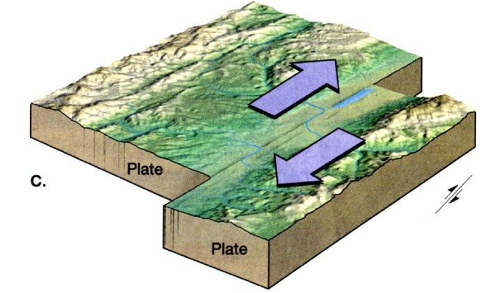
What type of plate boundary is this?
a)
Transform
b)
Convergent
c)
Divergent
d)
Plate
2.

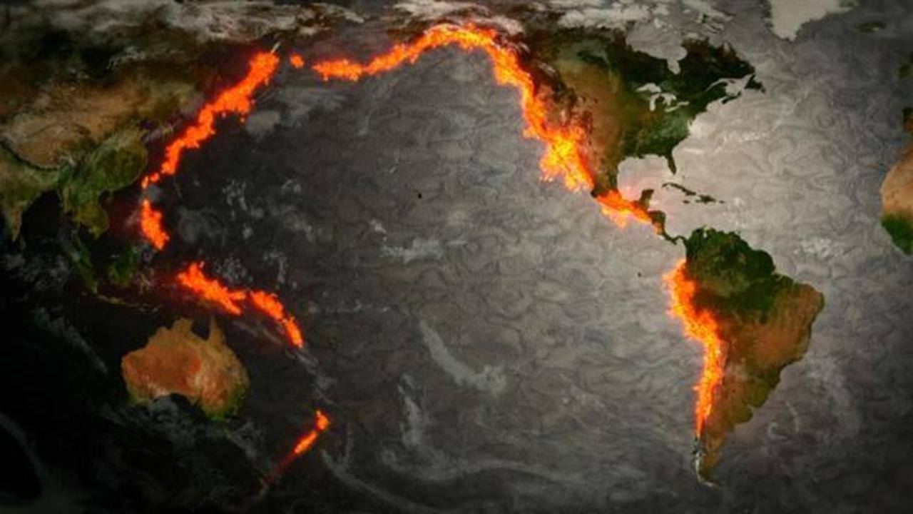
Which ocean is surrounded by the Ring of Fire?

a)
Atlantic
b)
Indian
c)
Arctic
d)
Pacific
3.
What is climate?
a)
What's happening in space at a time and place.
b)
What's happening in our atmosphere at a time and place
c)
The average weather over many years
d)
The average temperature over many years.
4.
What is weather?
a)
What's happening in space at a time and place.
b)
What's happening in our atmosphere at a time and place.
c)
The average weather over many years
d)
The average temperature over many years.
5.
Antarctica is cold all the time. What is it's climate?
a)
Tropical
b)
Polar
c)
Arid/Dry
d)
Temperate
6.
The seasons are caused by___________?
a)
The direction the Earth's axis is tilted toward the sun
b)
Tropical Storms
c)
Changes in the moon
d)
The Earth's rotation on its axis
7.
The biggest factor in determining climate is?
a)
elevation
b)
an ocean
c)
latitude
d)
mountain
8.
Which sentence best describes the relationship between elevation and air temperatures?
a)
 LOWER elevation = COLDER temperatures
b)
HIGHER elevation = COLDER temperatures
c)
HIGHER elevations = WARMER temperatures
d)
There is no relationship
9.
Climates are classified according to which two major factors?
a)
elevation & precipitation
b)
latitude & temperature
c)
elevation & latitude
d)
precipitation & temperature
10.

Surface currents are driven by _____________.

a)

sea critters

b)

differences in temperature

c)

wind

d)

the Equator

11.

biome

a)

the height of land above sea level

b)

a horizontal movement of ocean water caused by wind that occurs near the ocean's surface

c)

a large region characterized by a specific type of climate and certain types of plants and animals

d)

always have higher temperatures than the surrounding countryside

12.
Changes from minute-to-minute, hour-to-hour, day-to-day
a)
Climate
b)
Weather
13.
What climate zone is between the Tropic of Cancer and the Tropic of Capricorn?
a)
Tropics
b)
Temperate
c)
Polar
14.
This picture shows...
a)
Convectional rain
b)
Orographic rain
c)
Frontal rain
15.

What is weathering?

a)

The movement of sediment

b)

The breaking of sediment

c)

The dropping of sediment

16.

What is erosion?

a)

The movement of sediment

b)

The breaking of sediment

c)

The dropping of sediment

17.

What is a physical map?

a)

A map that represents landforms and bodies of water

b)

A map that only has things like countries and cities.

c)

A map that shows a specific set of information such as rainfall or population density.

18.

What is a political map?

a)

A map that represents landforms and bodies of water

b)

A map that only has things like countries and cities.

c)

A map that shows a specific set of information such as rainfall or population density.

19.

What is a thematic map?

a)

A map that represents landforms and bodies of water

b)

A map that only has things like countries and cities.

c)

A map that shows a specific set of information such as rainfall or population density.

20.

Which letter represents North America?

a)

A

b)

B

c)

C

d)

D

21.

Which letter represents the Pacific Ocean?

a)

G

b)

H

c)

J

d)

I

22.

What does a Scale help to determine on a map?

a)

Weight

b)

Elevation

c)

Distance

d)

Direction

23.

What does Elevation mean (when talking about geography)?

a)

How to go to a higher floor in a tall building

b)

The distance between two geographic features

c)

The height of land above sea level

d)

The cardinal directions of North, South, East and West

24.

What state can be found at 40⁰ N, 90⁰ W?

a)

New Mexico

b)

Illinios

c)

Hawaii

d)

Kentucky

25.

What is half of the Earth?

a)

piece

b)

half circle

c)

slice

d)

hemisphere