
 Worksheets
1st Rubenstein Reading Quiz AP Human Geo
Total questions: 12
Worksheet time: 8mins
What map scale would a cartographer choose if one inch of road on a map represents 54,000 inches on the ground?
2:27,000
24,000:1
1:54,000
54,000:1
1:24,000
What term refers to the physical gap between two objects?
site
place
scale
space
density
Lines of __________are drawn as east and west circles on the globe, and they measure distances north and south of the __________.
longitude; equator
latitude; prime meridian
latitude; equator
latitude; International Date Line
longitude; prime meridian
Which map scale shows the most detail?
1:10,000
1:62,500
1:100,000
1:250,000
1:2,500,000
The branch of geography that focuses upon natural landforms, climate, soils and vegetation of the Earth is:
cultural geography
human geography
physical geography
biogeography
Success in AP Human Geo takes time, effort, and determination. What is NOT a good strategy for growth and achievement?
Build a study group and work together as a team.
Do "a little, a lot" so that information builds and deadlines do not sneak up on you.
Ask for help as you go through the chapter.
Say the course is too hard, and pull the covers over your head.

Which are TRUE statements about the use of maps in human and physical geography? CHOOSE AS MANY AS APPLY!
Every map projection distorts the surface of the Earth in some way.
Maps refelct the bias of the cartographer who created the map.
Maps are used as both tools of reference and tools of communication.
Maps have little value to geographers since they are not 100% accurate.
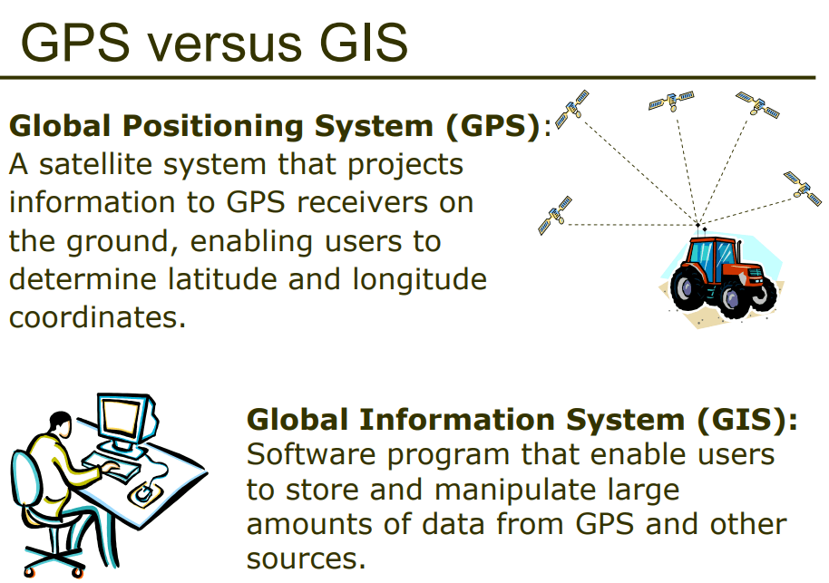
GPS and GIS are examples of contemporary mapping tools that rely on ______ technology.
remote sensing/satellite
computer
smart phone/satellite
International Space Station

