
 Worksheets
World Geo Unit 1 Review
Total questions: 47
Worksheet time: 53mins
Geography is...
The study of Earth and how we, the people who live there, interact with it.
The study of Earth and its atmosphere.
The study of rocks, minerals, and all physical attributes of Earth
The ____________ receives very little solar energy, therefore it is cold most of the time.
High latitudes/polar
Low latitudes/tropics
Middle latitudes/temperate
Equator
The _______ receive the most solar energy and are therefore warm the majority of the time.
High latitudes
Low latitudes
Middle Latitudes
Equator

Why don't all places on Earth receive the same amount of direct sunlight at the same place?
The Earth's axis is tilted.
The Earth receives sunlight in an unpredictable pattern.
The Earth rotates from east to west.
Weather in places changes over time.

Weathering breaks down rock and erosion moves weathered material. Which of these processes would be responsible for creating a plateau or mesa?
erosion
weathering
tectonic activity
none of the above

Landforms and the tectonic activity that created them are part of which sphere of the Earth?
atmosphere
biosphere
lithosphere
hydrosphere
An area with shared physical or human traits can best be classified as a
region
place
location
country
The climate of an area is determined by the combination of precipitation and temperature. Which of the following most affects these two factors?
proximity to water and latitude
convection and subduction
weathering and erosion
latitude and longitude

How would this barrier affect the climate on the leeward side?
The temperatures would be extremely cold and the amount of precipitation low.
The temperatures would be warm and the amount of precipitation low.
The temperatures would be warm and the amount of precipitation high.
The temperatures would be very cold and the amount of precipitation high.
Both volcanic eruptions and earthquakes cause human devastation and produce lasting changes to the —
lithosphere
hydrosphere
biosphere
atmosphere

Which physical process is most likely responsible for this landform?
Monsoons
Erosion
Volcanic activity
Tectonic divergence
Which of the following has the GREATEST influence on a place's climate?
Humidity
Wind velocity
Latitude
Rainfall amount
The polar regions are the coldest places on Earth because —
the sun's rays reach the high latitudes at a low angle
all of the nearby ocean currents are cold
no sunlight reaches the high latitudes
the large amount of ice present causes the air to be cold
Rotation : _________
Revolution : _________
Revolution + Tilt : ________.
season, day, year
day, season, year
day/night, year, season
year, day, season

GPS
system that accurately determines the precise position of something on Earth
computer system that captures, stores, queries, analyzes, and displays geographic data
scientific method of transferring locations on Earth's surface to a flat map
two-dimensional or flat-scale model of Earth's surface
Biosphere
sphere of earth that is made up of all the water on Earth
sphere of earth that is made up of land
all places on Earth that sustain life
smaller sphere that orbits a planet
Humans depending, modifying, and adapting to the environment is known as
region
place
movement
human-environment interaction
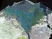

A region that is based on the way people see an area is a:
formal region
perceptual region
functional region
climate region
Which is an example of Relative location?
Lincoln High is across the street from McDonald's
Lincoln High is located at 40 degrees N, 96 degrees W
The U.S. Capitol is 38° 53′ 35″ N, 77° 00′ 32″ W
4055 Mockingbird Court
An example of a functional region is:
Dallas Fort Worth airport
St. Louis, MO
The Bible Belt
The Midwest
Which is true of movement?
Movement is the transfer of people, goods, and/or ideas from place to place.
Movement is a group of places that share common physical and human characteristics.
Movement is where something is.
Movement is how people and their environment affect each other.
What is a compass rose?
half of a circle that helps people find angles
a drawing showing different directions on a map
a device with a magnet that always points North
a pretty flower on a map that is red
What is a scale on a map?
a tool that allows you to measure your body weight
a way to balance the weights of the land and oceans
a ratio of the distance on the map to the actual distance
a piece of skin found on reptiles like snakes
What does the title show on a map?
shows the person who made the map
attracts the reader's attention
shows the purpose of the map
shows important information about the size
The part of a map that tells the name of the map
title
compass rose
scale
key
Part of the map that tells what the symbols and colors indicate.
title
scale
key
compass rose
Tells distance on a map in kilometers and miles
key
title
compass rose
scale
Gives the directions on a map. Two types cardinal and intermediate; NSEW, NW,NE,SW, SE
key
compass rose
scale
title

Which biome is the driest? It receives less than 10 inches of rain a year.
desert
grassland
deciduous forest
tropical rain forest
Which biome gets the most amount of rain every year?
decidious forest
tropical rain forest
desert
tundra

Which biome is the coldest?
tundra
desert
grassland
savanna

Which biome has conifer trees or evergreens? These trees have needles that are coated in a waxy substance and drop cones.
deciduous forest
desert
coniferous forest (taiga)
tropical rain forest


