
NEW
Font size
 Worksheets
Map Skills Review
Total questions: 13
Worksheet time: 23mins

A measure of distance on Earth that is east or west of the Prime Meridean
longitude
latitude
equator
hemisphere
Half a sphere; There are four -- Northern, Southern, Eastern, and Western
longitude
directions
latitude
hemisphere
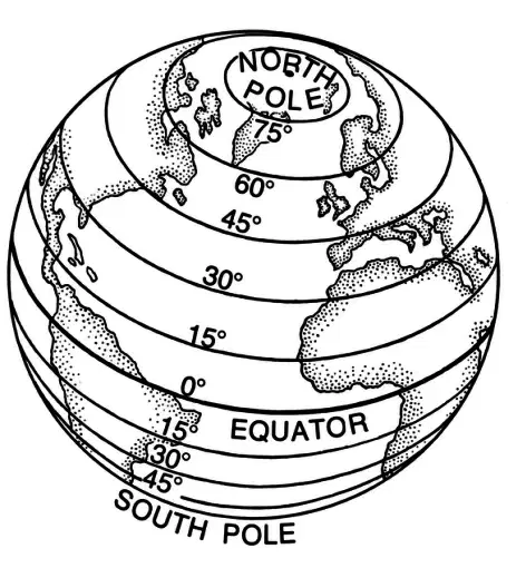
A measure of distance on Earth that is north or south of the equator
longitude
latitude
hemisphere
equator
A small drawing on map that shows direction
cardinal
intermediate
compass rose
inset map
Anything that stands for something else
map key
inset map
global grid
symbol
Earth has SEVEN great bodies of land. They are called _____
global grids
hemispheres
continents
equator
The crisscrossing lines of latitude and longitude form the ____________ found on a map or globe.
equator
global grid
prime meridian
map key
An explanation of what the symbols on a map represent
symbols
compass rose
map key (legend)
scale

The relationship between the distance shown on a map and the real distance on Earth
map scale
inset map
global grid
symbol
An imaginary line that lies halfway between the Northern and Southern Hemisphere, at 0 degrees LATITUDE
prime meridian
latitude
equator
longitude
An imaginary line that lies between the Eastern and Western Hemispheres, at 0 degrees LONGITUDE
prime meridian
equator
global grid
longitude
Northeast, Southeast, Southwest, Northwest are _______
Cardinal Directions
Intermediate Directions
Map Key
Symbols
North, East, South, and West are ________
Cardinal Directions
Intermediate Directions
Map Key
Symbols

