
 Worksheets
Mapping Skills
Total questions: 29
Worksheet time: 17mins
What is a hemisphere?
A diagram of a compass showing direction
Height above sea level
Half of Earth
A line of latitude that separates the Northern and Southern hemispheres
What is latitude?
Height above sea level
The distance in degrees north or south of the Equator
The distance east or west of the Prime Meridian
Half of Earth
What is longitude?
The distance east or west of the Prime Meridian
A diagram of a compass showing direction
Half of Earth
A place's exact position on Earth in terms of latitude and longitude
What is Absolute Location?
Map that shows physical features
Shows how much space on the map represents a given distance on the land
The distance north or south of the equator
A place's exact position on Earth in terms of latitude and longitude
What is the Prime Meridian?
A line of longitude that passes through Greenwich, England and separates the Eastern and Western Hemispheres
A line of latitude that separates the Northern and Southern Hemispheres
A place's exact position on Earth in terms of latitude and longitude
Height above sea level
What is the Equator?
A diagram of a compass showing direction
The distance in degrees east or west of the Prime Meridian
A line of latitude that separates the Northern and Southern Hemispheres
Half of Earth
What is a compass rose?
The distance north or south of the Equator
A diagram of a compass showing direction
Map that shows political units such as cities, states, and countries
Height above sea level
What is elevation?
Map that shows physical features
Height above sea level
Half of Earth
A place's exact position on Earth in terms of latitude and longitude
What is a map key?
Explains the symbols and shading on the map
A diagram of a compass showing directions
The distance in degrees east or west of the Prime Meridian
Shows how much space on the map represents a given distance on the land
What is a physical map?
Half of Earth
Map that shows political units such as cities, states, and countries
A line of latitude that separates the Northern and Southern Hemispheres
Map that shows physical (natural) features
What is a political map?
Half of Earth
The distance north or south of the Equator
Map that shows political units such as cities, states, and countries
Map that shows physical (natural) features
What is the biggest of the following?
Country
State
City/Town
County
Continent

What is the name of the person who makes maps?
Mapologist
Physicist
Meteorologist
Cartographer

What is the specific pattern used to measure absolute location on a map?
Planes
Grid
Checkered Lines
Scale

What type of map is this?
Physical
Physics
Political
Thematic (Special Purpose)

What type of map is this?
Physical
Political
Thematic (Special Purpose)
Government

What type of map is this?
Political
Physical
Thematic (Special Purpose)
Specific
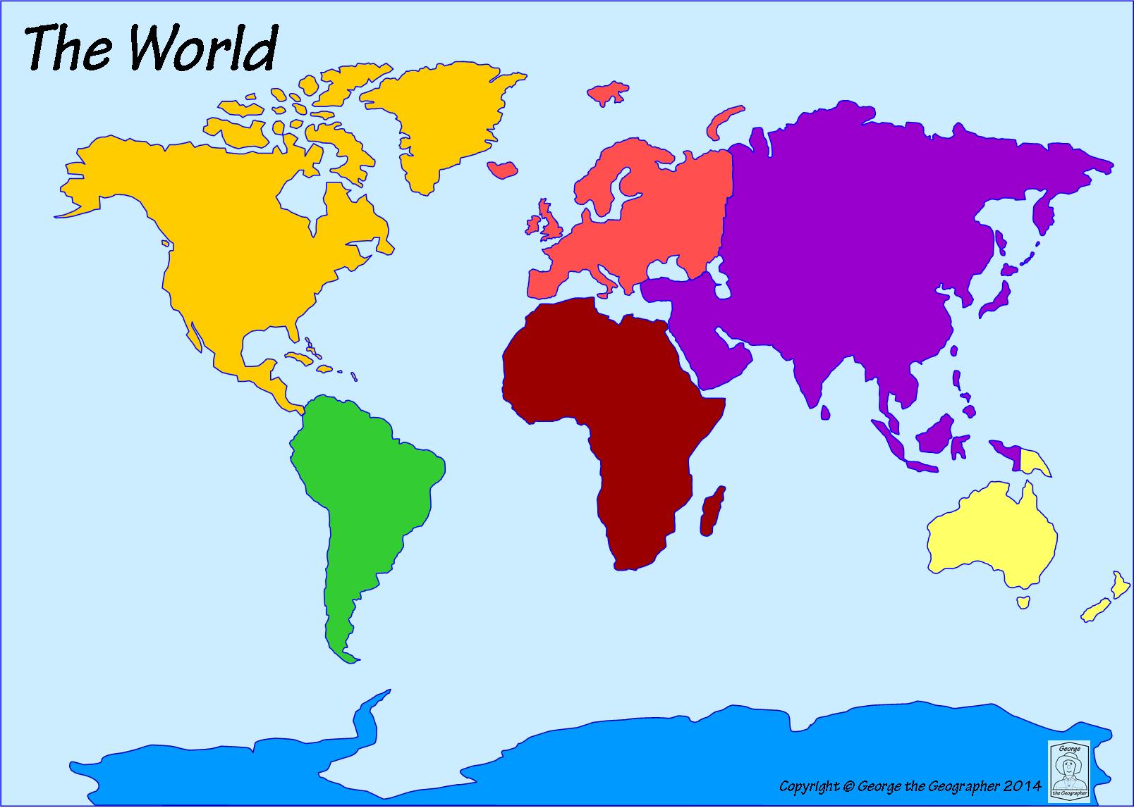
What is the name of the dark yellow continent?
South America
North America
Asia
Africa
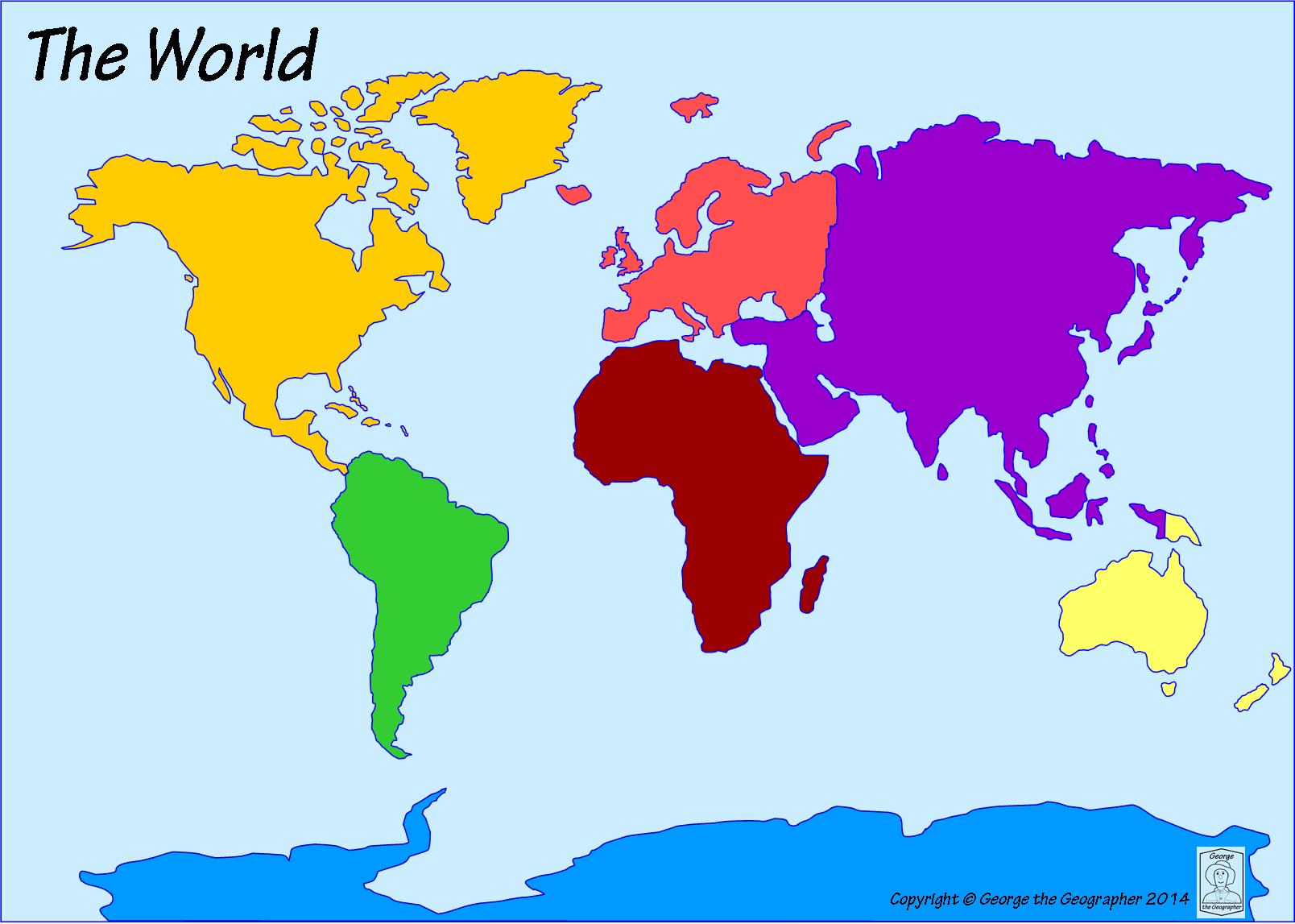
What continent is directly south of North America?
Australia
Europe
Africa
South America
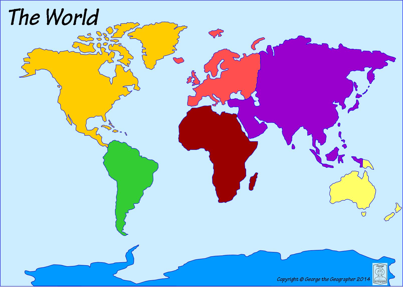
Which ocean is located off the east coast of North America?
Pacific Ocean
Atlantic Ocean
Indian Ocean
Southern Ocean
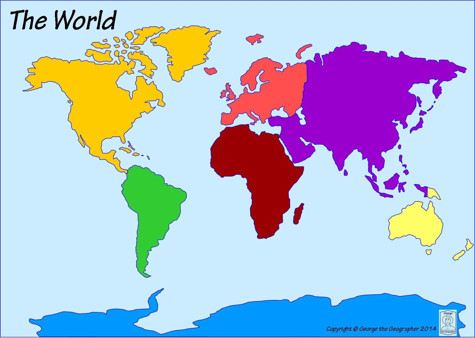
What is the name of the largest continent?
North America
Europe
Asia
Africa
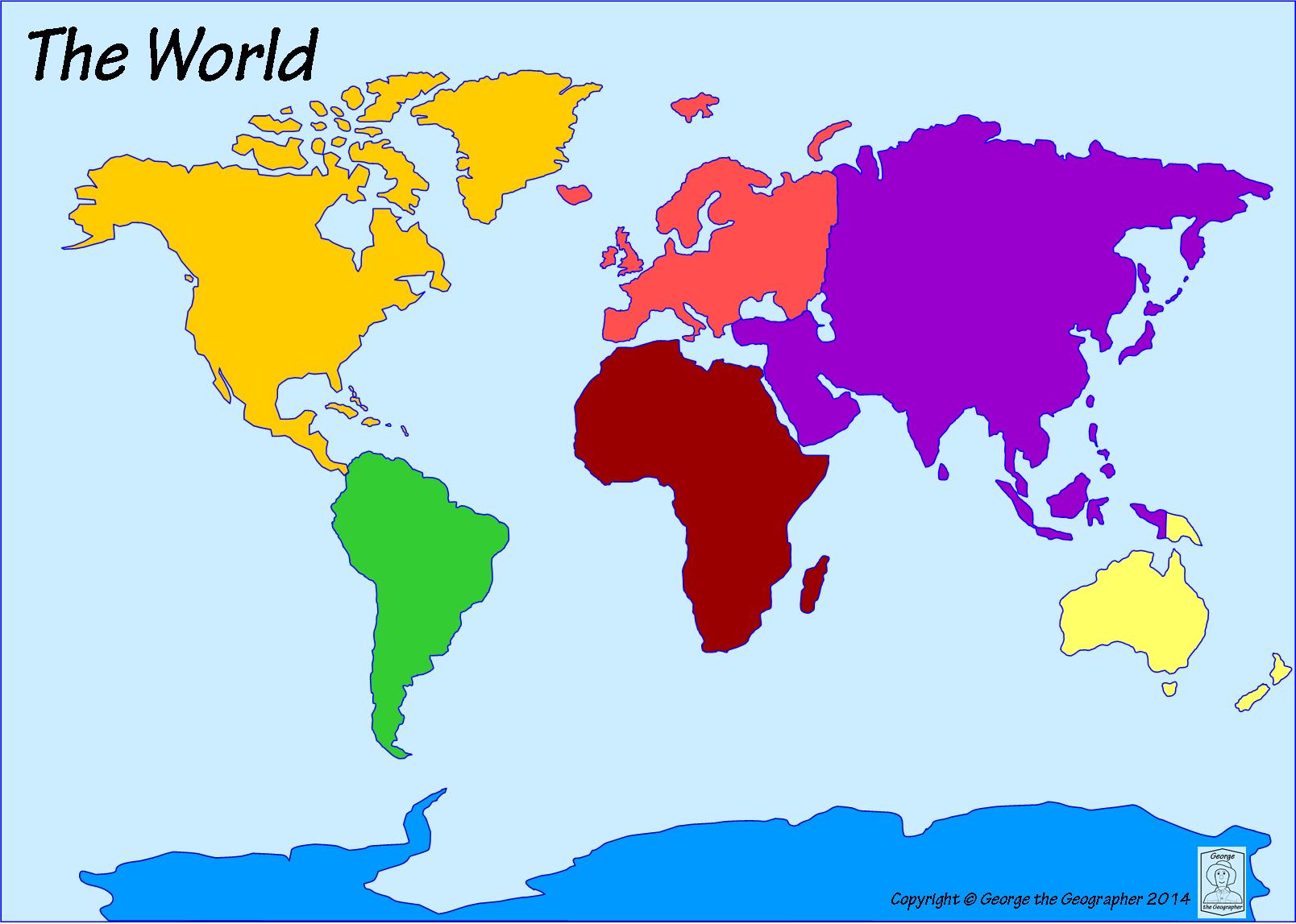
Which continent is located west of Asia?
Europe
Antarctica
Australia
South America
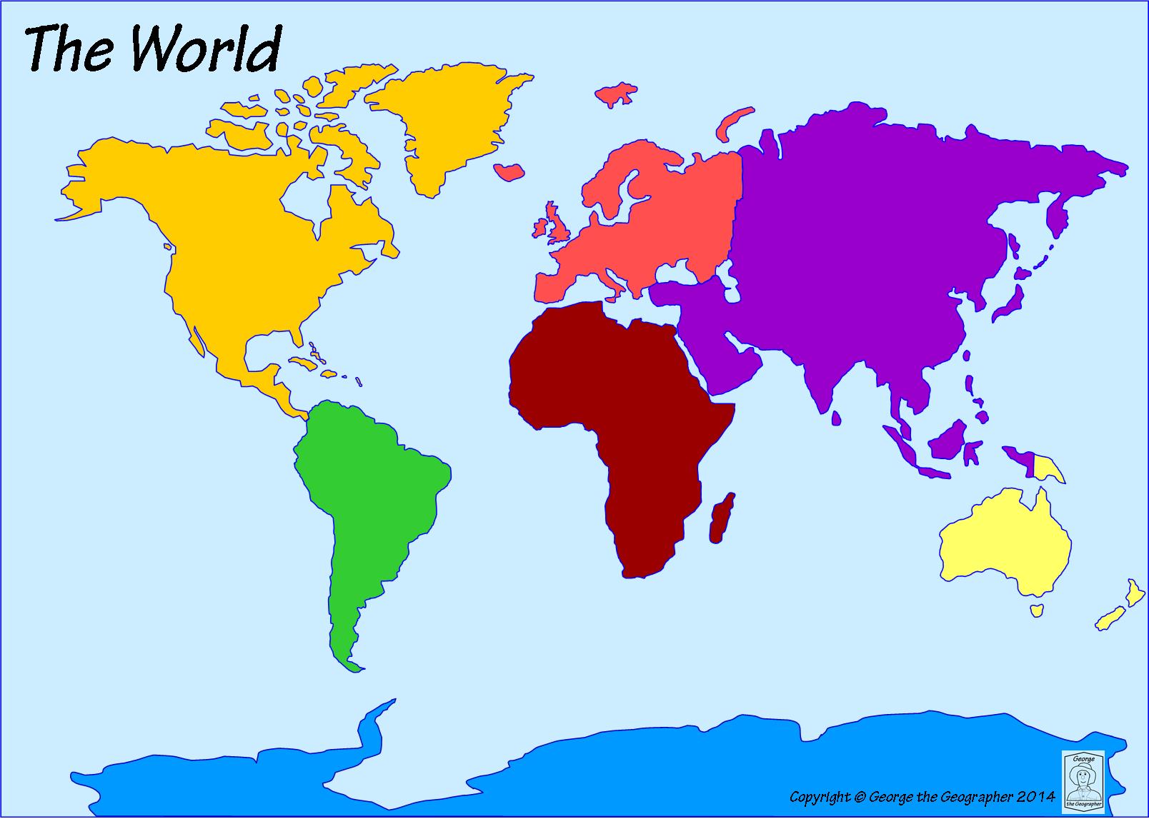
Which ocean is the farthest north?
Indian Ocean
Southern Ocean
Arctic Ocean
Atlantic Ocean
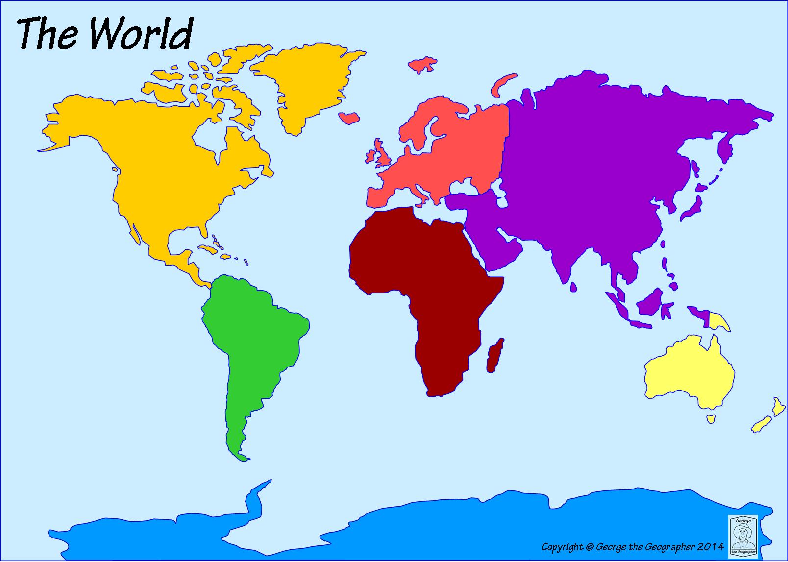
What is the name of the most southern continent?
Australia
Africa
Asia
Antarctica
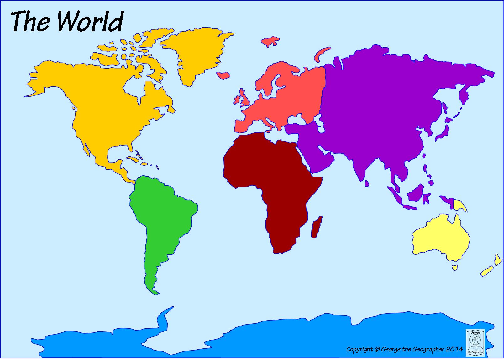
Which ocean is located to the east of Africa and to the west of Australia?
Atlantic Ocean
Indian Ocean
Pacific Ocean
Arctic Ocean
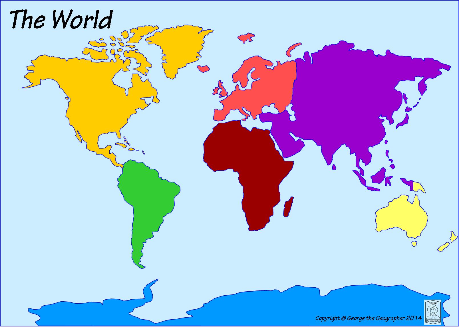
Which continent is to the east of the Indian Ocean and to the west of the Atlantic Ocean?
Africa
Europe
North America
Asia
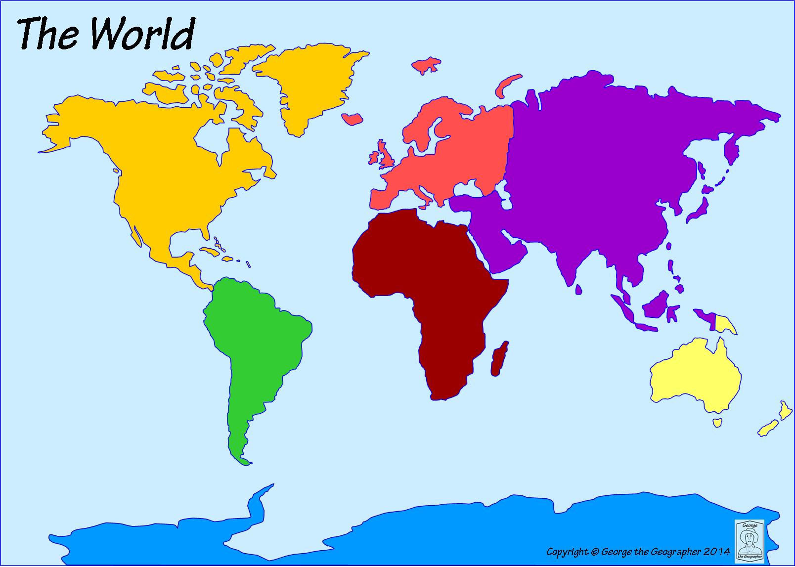
Which ocean is located off the west coast of North America. It is the LARGEST ocean.
Atlantic Ocean
Pacific Ocean
Arctic Ocean
Southern Ocean
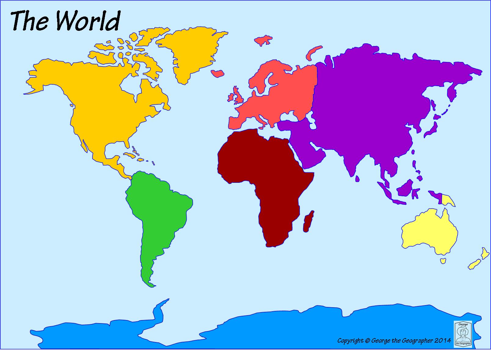
Which continent is an island continent?
Europe
North America
Antarctica
Australia
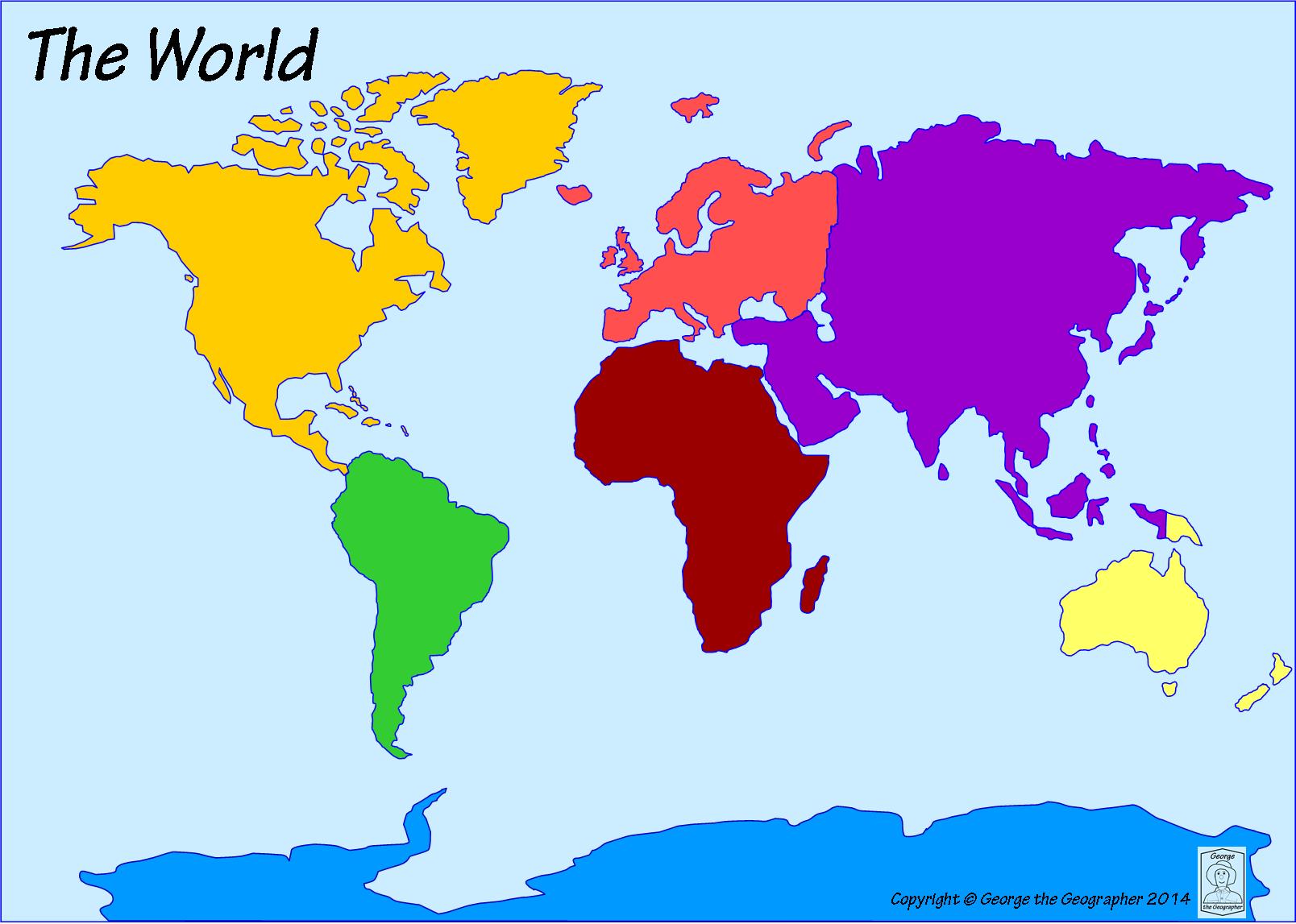
The United States of America is a country located on which continent?
South America
Europe
Africa
North America

