
 Worksheets
Europe Physical and Political Map Quiz
Total questions: 15
Worksheet time: 6mins
Name
Class
Date
1.

What country is this?
a)
Germany
b)
France
c)
Hungary
d)
Italy
2.

What country is this?
a)
Spain
b)
Sweden
c)
Finland
d)
Germany
3.

What country is this?
a)
France
b)
Italy
c)
Ukraine
d)
United Kingdom
4.

What country is this?
a)
France
b)
Poland
c)
Sweden
d)
Iceland
5.

What country is this?
a)
Sweden
b)
Norway
c)
Ukraine
d)
Czech Republic
6.

Which body of water is circled?
a)
North Sea
b)
Black Sea
c)
Mediterranean Sea
d)
Atlantic Ocean
7.

The purple arrow points at the
a)
Adriatic Sea
b)
English Channel
c)
The Mediterranean Sea
d)
The Baltic Sea
8.

The mountains in Red are
a)
The Apennines
b)
The Alps
c)
The Carpathian Mountains
d)
The Pyranees
9.
The mountains in Blue are
a)
The Apennines
b)
The Alps
c)
The Carpathian Mountains
d)
The Pyranees
10.

Which landform is A?
a)
Alps (Mountains)
b)
Scandinavia (Peninsula)
c)
Mediterannean Sea
d)
Apennines (Mountains)
11.

Which body of water is circled?
a)
North Sea
b)
Atlantic Ocean
c)
Mediterranean Sea
d)
Black Sea
12.
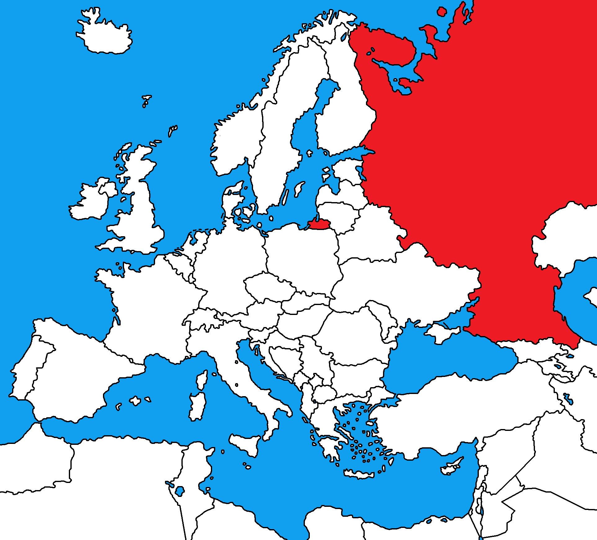
Bonus Question: What country is this?
a)
Belarus
b)
Canada
c)
China
d)
Russia
13.

The physical feature circled in RED is the
a)
Northern European Plain
b)
Hungarian Plain
c)
Scandinavian Plain
d)
Jutland Plain
14.
The Ural Mountains separate which two continents?
a)
Europe and Asia
b)
Europe and Africa
c)
Europe and Russia
d)
Europe and North America
15.

What country is this?
a)
France
b)
Iceland
c)
Denmark
d)
United Kingdom
100 %

