wayground logo

Free Printable Worksheets

NEW

Font size

S
M
L
XL
Worksheets

AP Human Geography Unit 1 Practice

Total questions: 42

Worksheet time: 24mins

Name
Class
Date
1.
The location of a place using the latitude-longitude grid is called: 
a)
A.  referenced location 
b)
A.  central location
c)
A.  relative location
d)
A.  absolute location 
2.
The location of a place in relationship to other places or features around it is called: 
a)
absolute location
b)
relative location
c)
site
d)
situation
3.
Scale is…                                     
a)
the system used by geographers to transfer locations  from a globe to a map
b)
the extent of spread of a phenomenon over a given area
c)
 the difference in elevation between two points in an area
d)
 the relationship between the length of an object on a map and that feature on the landscape
4.
The process of the spread of an idea and/or dissemination of an innovation from its source area to other cultures, is the process of cultural: 
a)
diffusion
b)
simultaion
c)
adaptation
d)
movement
5.
The physical qualities of the original location for a city is referred to as the
a)
site
b)
situation
c)
relative location
d)
absolute location
6.
The layering of geographic data by computers into data sets is known as: 
a)
GPS
b)
GIS
c)
ENSO
d)
OPEC
7.
Geographers usually categorize cultural diffusion into the two broad categories of 
a)
 Expansion and hierarchical
b)
Contagious and stimulus
c)
 Expansion and relocation
d)
 Migrant and hierarchical
8.
The visible imprint put on the environment by people is called?
a)
Cultural Landscape
b)
Place
c)
Location
d)
Human Environment Interaction
9.
What is it called when you take a 3D image and put it onto a 2D surface?
a)
Cartogram
b)
Projection
c)
Globe
d)
Instagram
10.
Which type of location does not change?
a)
Absolute
b)
Relative
c)
Positive
d)
Negative
11.
Geographers group like things together into regions in order to make them easier to study.  What type of region would a corn field be?
a)
Perceptual
b)
Formal
c)
Functional
d)
Vernacular
12.
Measuring the distance people are willing to travel to shop at a store would be creating what type of region for that store?
a)
Formal
b)
Perceptual
c)
Functional
d)
Uniform
13.
The imprint that humans leave, such as buildings, roads, cemeteries, etc. are all considered to be part of the:
a)
Location
b)
Region
c)
Cultural Landscape
d)
Move
14.
Billy thinks that in the south, everyone eats grits, eats fried chicken and watches football.  He would be creating what type of region of the south with these ideas?
a)
Formal
b)
Functional
c)
Perceptual
d)
Uniform
15.
Telecommunication networks, whose areas of service radiate outward from central nodes best represent which of the following types of culture?
a)
Vernacular
b)
Formal
c)
Folk
d)
Functional
16.
The spread of ideas, inventions, or patterns of behavior is called ____.
a)
acculturation
b)
innovation
c)
cultural hearth
d)
diffusion
17.
Which of the following divides Earth into Eastern and Western Hemispheres?
a)
Prime Meridian
b)
Hemisphere Line
c)
Equator
d)
Tropic of Capricorn
18.
Which type of map would show the boundaries of countries?
a)
vegetation map
b)
political map
c)
land-use map
d)
elevation map
19.
Places that share similar characteristics are called 
a)
human systems
b)
environments
c)
regions
d)
physical systems
20.
Which of the following is not a use of GPS?
a)
tracking airplanes
b)
determine when a volcano will erupt
c)
help farmers in their fields
d)
provide driving directions to a destination
21.
Which of the following shows places on the Earth's surface the most accurately?
a)
thematic maps
b)
globes
c)
general-purpose maps
d)
physical maps
22.
Imaginary North-South line that passes through Greenwich, England, and has a value of 0 degrees
a)
latitude
b)
longitude
c)
relief
d)
scale
23.
What is one or more features that make an area different from those around it?
a)
formal region
b)
perceptual region
c)
functional region
d)
region
24.
What are lines on a globe drawn in an east-west direction and measured in degrees?
a)
longitude
b)
latitude
c)
grid
d)
equator
25.
Environment influences, but does not strictly determine, how a culture interacts with the environment.
a)
Environmental Determinism
b)
Environmental Possibilism
c)
Cultural Determinism
d)
Cultural Environmentalism
26.
The physical environment causes social and cultural development.
a)
Cultural Environmentalism
b)
Environmental Possibilism
c)
Environmental Determinism
d)
Cultural Possibilism
27.
Culture is spread by...
a)
Movement of people
b)
TV and Internet
c)
War and conquest
d)
All are correct
28.
defined formally by government or other structures, such as cities, states, and mountain ranges
a)
Location
b)
Place
c)
region
d)
formal region
29.
made up of a central place and surrounding areas affected by it. Often, this is a metropolitan area that consists of a major city and lots of smaller towns or cities that surround it.
a)
functional region
b)
perceptual region
c)
cultural landscape
d)
free enterprise
30.

(Unit 1) Diffusion which moves from large cities to smaller cities to towns, skipping over rural areas between is

a)

Expansion Diffusion

b)

Stimulus Diffusion

c)

Relocation Diffusion

d)

Hierarchical Diffusion

31.

(Unit 1) The spread of specialty coffee shops across the United States in the 1990's is an example of

a)

Hierarchical diffusion

b)

Contagious diffusion

c)

Stimulus diffusion

d)

Relocation diffusion

32.

Which map scale shows the most detail?

a)

1:10,000

b)

1:62,500

c)

1:100,000

d)

1:250,000

e)

1:2,500,000

33.
Scale is
a)
the system used by geographers to transfer locations from a globe to a map
b)
the spread of a phenomenon over a given area.
c)
the difference in elevation between two points in an area.
d)
the relationship between the length of an object on a map and that feature on the landscape.
34.
All maps have
a)
distortion
b)
graduated circles.
c)
bar scale.
d)
multiple colors
35.

Success in AP Human Geo takes time, effort, and determination. What is NOT a good strategy for growth and achievement?

a)

Build a study group and work together as a team.

b)

Do "a little, a lot" so that information builds and deadlines do not sneak up on you.

c)

Ask for help as you go through the chapter.

d)

Say the course is too hard, and pull the covers over your head.
36.

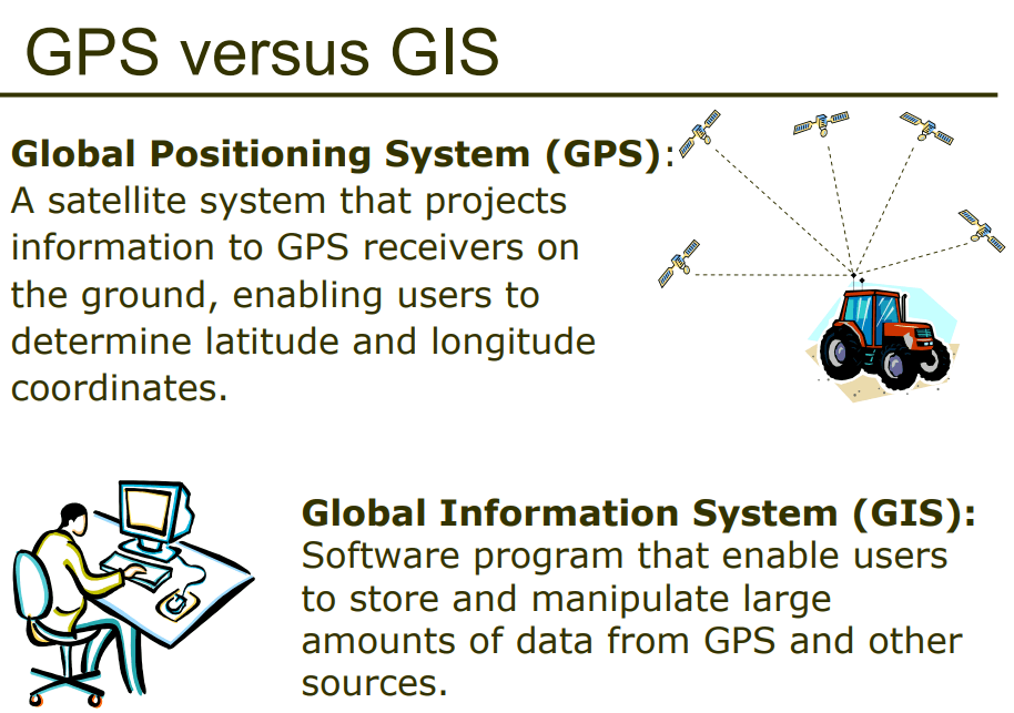
GPS and GIS are examples of contemporary mapping tools that rely on ______ technology.

a)

remote sensing/satellite

b)

computer

c)

smart phone/satellite

d)

International Space Station

37.

Why is the mercator map projection useful.

a)

The distortion is minimized

b)

Directions is constent across the map

c)

Distances are correctly protrayed

d)

Area of the land masses is shown accurately.

38.

Cartography is the science of

a)

Map making

b)

Spatial Topography

c)

demographics

d)

Cognitive Imaginary

39.

Which geographical theme would involve the study of the impact drainage of part of the Florida, Everglades?

a)

Movement

b)

Location

c)

Place

d)

Human Environment Interaction

40.

The greater the distance from the hearth, the less likely the interaction would be referred to as,

a)

Distance Decay

b)

Acculturation

c)

Time-Space Compression

d)

Sequent occupance

41.

Which form of diffusion cannot be transmitted by media (television, internet, radio)?

a)

Relocation Diffusion

b)

Stimulus Diffusion

c)

Contagious Diffusion

d)

Hierarchical diffusion

42.

The location of a place in relationship to other places or features around it is called:

a)

Situation

b)

Relative Location

c)

Absolute Location

d)

Site