
 Worksheets
geography fall semster
Total questions: 115
Worksheet time: 2hrs 39mins


Which of the following explains why the Suez Canal is important?
It is a vital transportation link for trade and military purposed
It promotes cultural divergence
It results in less oil exportation
It leads to an increase of agricultural products
Water carrying sediment down a hill is an example of...
weathering
erosion
deposition
15.Which is the best summary of this selection?
A Hurricanes are storms with winds over 75 miles per hour. They form over the Atlantic Ocean near the equator and move west. Storm surges and winds can cause great damage.
B A hurricane is a huge storm that can cause much destruction. Rain pours down and winds blow fiercely. Ocean waves are higher than normal and flooding occurs.
C Hurricanes are wind storm that start over the Atlantic Ocean. They are called cyclones, typhoons, or willy-waves when they start in other places.
D Hurricanes are violent storms that cause a lot of damage. Trees and buildings are destroyed. Sometimes people are hurt by flying objects.
Why is water important in the formation of hurricanes?
water produces the winds that move the hurricanes
warm water allows for evaporation which produces the winds to fuel the hurricanes
cold water produces the moisture that creates water vapor and energy to fuel the hurricane
warm water produces the moisture that produces water vapor which in turn releases heat energy to fuel the hurricane
Why do hurricanes form more often at the end of summer?
The ocean water is cooling off and creating more moisture in the air.
The ocean water is cooling off and creating less water vapor in the ocean.
The ocean water is much warmer which fuels the water cycle and creates lower air pressure.
The ocean water is much warmer which fuels an increase in water vapor on the ocean's surface.
What must be present for a hurricane to form. Check all that apply.
Water temperatures over 80 degrees
Great amounts of rainfall
High humidity
High pressure
Low pressure
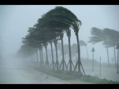
A hurricane is a very powerful storm.
false
true
The Panama Canal is a man-made waterway. Which two oceans does it connect?
the Atlantic and Pacific Oceans
the Pacific and Indian Oceans
the Atlantic and Arctic Oceans
the Southern and Pacific Oceans
The text describes some effects of the construction of the Panama Canal. What is one of these effects?
It increased the travel time of cargo ships moving between the Atlantic and Pacific Oceans.
It increased the expenses involved with moving cargo ships between the Atlantic and Pacific Oceans.
It cut down the travel time of cargo ships moving between the Atlantic and Pacific Oceans.
It decreased the number of people who moved from North America to South America.


What causes earthquakes?
Millions of people jumping at once
The earth rotating
The movement of plate tectonics
Gravity

A large part of a command economic system is controlled by:
a centralized power; federal government
No one. It's an economy based off of individual freedom
Define the word
“ Command Economy “
It is the fifth-largest national economy in the world measured by nominal gross domestic product, ninth-largest by purchasing power parity.
a system where the government, rather than the free market, determines what goods should be produced.
job opportunities by promoting conditions that enable economic growth and stability at home and abroad, strengthen national security.
combating threats and protecting the integrity of the financial system, and manage the U.S. Government's finances and resources.

What is a Command (Communist) Economy?
Central government makes most economic decisions
Government play no role
Government and individuals share the decision making process

What is Free Enterprise (Capitalist) Economy?
Individuals and businesses are allowed to compete for profit with a minimum of government interference
The government controls the economy
All personal needs, such as health care and education, are provided by the government.
Traditional Economy
Free enterprise (Capitalist) Economy
Communist (Command) Economy
Socialist Economy
Entrepreneurs bear their own risks but reap ALL their own PROFITS!
Traditional Economy
Communist (Command) Economy
Socialist Economy
Free Enterprise (Capitalist) Economy
North Korea is a communist Country.
A person who chooses to, and is free to, open a grocery store is participating in a
command economy
centrally-planned economy
free enterprise economy
traditional economy
Open opportunity helps to ensure that everyone is free to
be efficient
invest in stocks
start businesses
maximize production
People can own property and choose their occupations. The production is OWNED by the GOVERNMENT. Wages are set by the Government.
Traditional Economy
Free Enterprise
Communist Economy
Socialist Economy
Buyers and sellers make the decisions.
Traditional
Communist
Free Enterprise System
Socialist
Dairy cattle, wheat production, and forestry are examples of which type of economic activity?
Primary
Secondary
Tertiary
Which type of economic activity provides services to people and businesses?
Primary
Secondary
Tertiary
Which type of economic activity uses raw materials to produce or manufacture something else?
Primary
Secondary
Tertiary
Teachers and doctors are examples of which type of industry?
Primary
Secondary
Tertiary
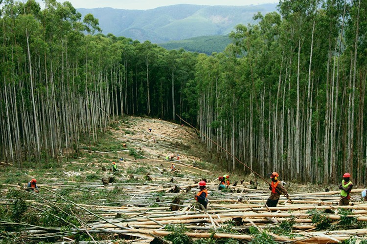
This image represents which economic sector?
Tertiary Sector
Secondary Sector
Primary Sector
Quaternary Sector
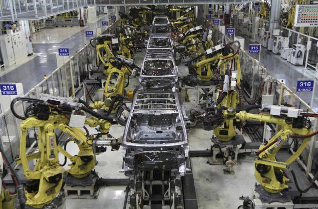

This image represents which economic sector?
Primary Sector
Quinary Sector
Secondary Sector
Tertiary Sector
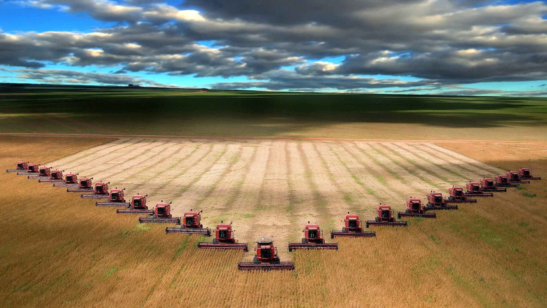


Workers overthrow the rich, and the government has complete control. What type of government would this be?
Oligarchy
Socialism
Communism
Anarchy
Identify the factors that influence an areas temperature
Mountain Ranges
Latitude
Altitude
Distance from Large Bodies of Water
Prevailing Winds

Identify the factor that influence the temperature of these two areas
Latitude
Altitude
Distance from Large Bodies of Water
Ocean Currents

What factor is influencing the temperature of these two cities
Latitude
Altitude
Distance from Large Body of Water
Ocean Currents

Quito, the capital of Ecuador, is located at 9,250 feet above sea level. According to the diagram Quito is in which elevation zone?
tierra fria
tierra helada
tierra caliente
tierra templada
At which elevation zone is the tree line found in the Andes?
tierra fria
tierra helada
tierra caliente
tierra templada
Terracing is a farming method that makes it possible to raise crops
above the snow line
on steep hillsides
in tropical lowlands
below forest canopies
2. Tierra Fria
3. Tierra Templada
4. Tierra Caliente
5. Tierra Nevada
2.Tierra Helada
3. Tierra Fria
4. Tierra Templada
5. Tierra Caliente
4. Tierra Helada
3.Tierra Templada
2. Tierra Templada
1. Tierra Caliente


What is the definition of perceptual region?
How we imagine a place to be based on the connections we have made.
Central places and the areas surrounding it.
Defined by a limited number of characteristics.
The subway and train system that connects the suburbs of Tokyo, Japan can be considered....
functional region
formal region
perceptual region

An area of the Earth's surface with similar characteristics.
Region
Place
Location
Religion

Whether formal, functional, or perceptual, all regions have this in common:
They all have well defined and distinct boundaries.
There is at least one characteristic that defines the region.
There is a function happening in each of the regions.
They all are based on how people see the area.

Which is not true of Formal regions:
They have at least one related characteristic.
They usually have clear, distinct boundaries.
They are usually related to how people see that area.
They can be defined by any P.E.G.S. characteristic.

Which would be a good example of a FORMAL region?
Tarrant County
Cajun Country
Interstate 35
The Port of San Francisco

An example of a functional region might be
a cell tower
The Corn Belt
Latin America
Texas

A region that is organized around a set of interactions or connections between places is a:
formal region
perceptual region
functional region
governmental region
Which is false about a perceptual region?
They are defined by at least one related characteristic.
They are based on how people see an area.
People can see the same region in different ways, depending on their beliefs.
They always have well defined, distinct boundaries.

WHat kind of regions does this map show?
Formal
Functional
Perceptual

What kind of regions does this map show?
Formal
Functional
Perceptual

On this map, Interstate 35 is an example of which kind of region?
Formal
Functional
Perceptual

This map of food regions in the United States shows what kinds of regions?
Formal
Functional
Perceptual


How much of Europe's population was killed by the Black Death?
1/4
1/2
1/3
1/5
Where were the Incas located?
Colombia
Guyana
Peru
Paraguay

