
 Worksheets
6th Grade European Maps (GSE)
Total questions: 13
Worksheet time: 7mins
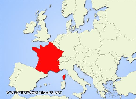
What country is in red on the map of Europe?
The United Kingdom
Germany
Spain
France
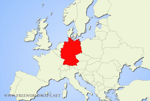
What country is in red on the map of Europe?
Germany
Spain
France
Russia
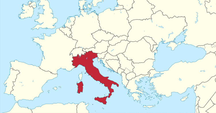
What country is in red on the map of Europe?
Germany
Spain
Italy
Russia
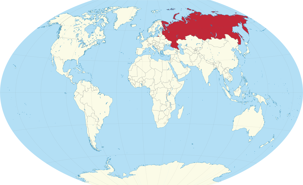
What country is in red on the map of the World?
The United Kingdom
Russia
Turkey
Ukraine
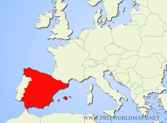
What country is in red on the map of Europe?
Spain
France
Germany
Ukraine
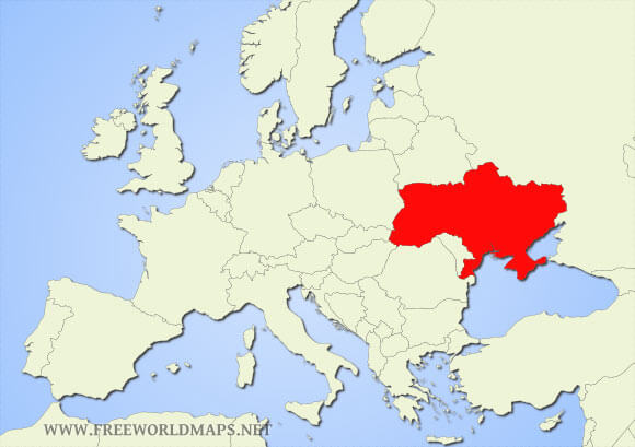
What country is in red on the map of Europe?
Ukraine
The United Kingdom
Italy
Spain
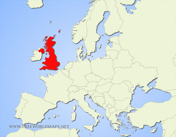
What country is in red on the map of Europe?
Germany
The United Kingdom
Russia
Portugal
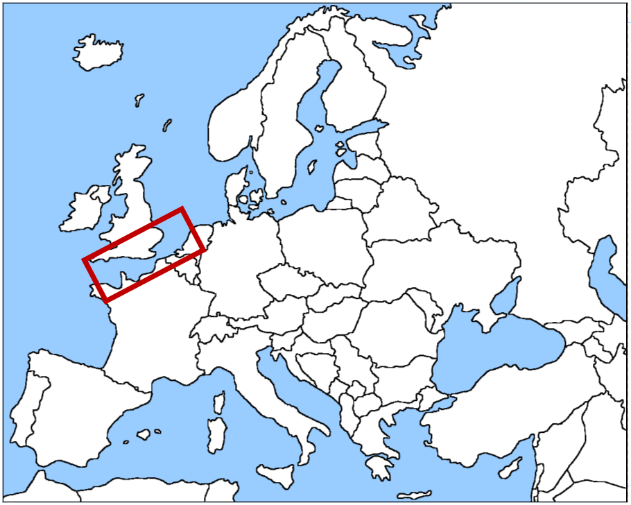
What physical feature of Europe is in the red box?
Rhine River
Atlantic Ocean
Danube River
English Channel
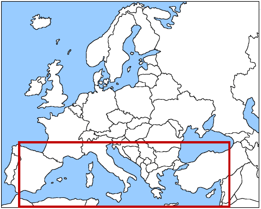
What physical feature of Europe is in the red box at the bottom of the map?
Mediterranean Sea
English Channel
Atlantic Ocean
Danube River
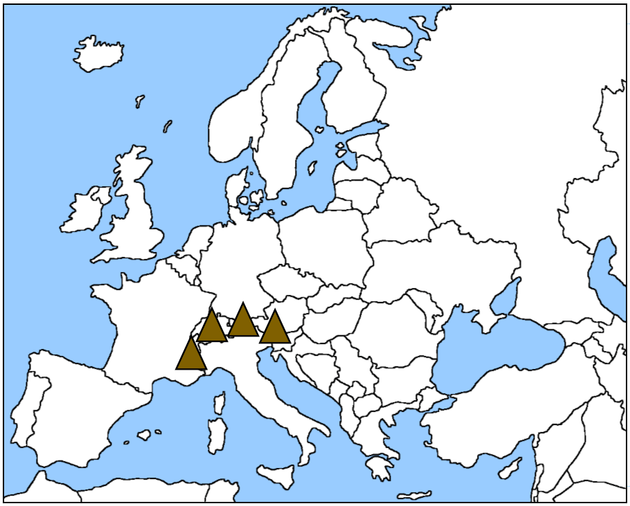
What physical feature of Europe do the brown triangles represent?
Pyrenees Mountains
Alps Mountains
Ural Mountains
Italian Mountains
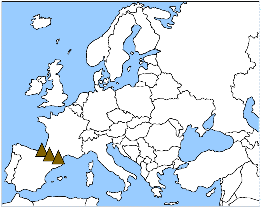
What physical feature of Europe is represented by the brown triangles?
Alps Mountains
Spanish Mountains
Pyrenees Mountains
Ural Mountains
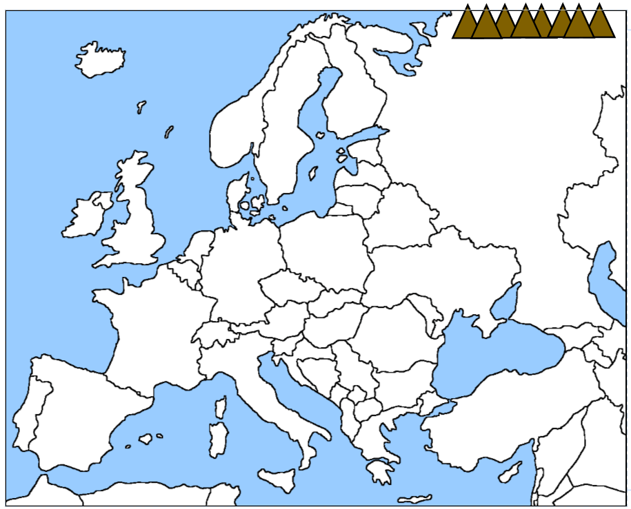
What physical feature of Europe do the brown triangles at the top of the map represent?
Ural Mountains
Alps Mountains
Russian Mountains
Pyrenees Mountains
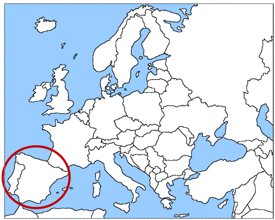
What physical feature of Europe is in the red circle at the bottom of the map?
Danube River
European Plain
Mediterranean Sea
Iberian Peninsula

