wayground logo

Free Printable Worksheets

NEW

Font size

S
M
L
XL
Worksheets

Ordnance Survey- Altitude

Total questions: 23

Worksheet time: 14mins

Name
Class
Date
1.
__________ identifies distances on a map.  It refers to the relationship (or ratio) between distance on a map and the matching distance on the earth.
a)
Map Scale
b)
Cardinal Directions
c)
Intermediate Directions
d)
Symbols
2.
A _________ is used to represent real objects on the map such as a building, road, lake, tree, mountain, etc.
a)
Symbol
b)
Compass Rose
c)
Map Scale
d)
Merdian
3.
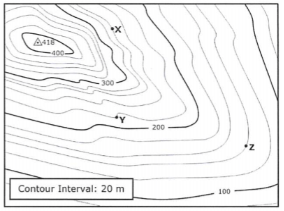
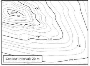
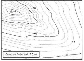
Determine the contour interval
a)
10 m
b)
20 m
c)
50 m
d)
100 m
4.
What do close contour lines represent on a map?
a)
waterfall
b)
steep area
c)
gradual area
d)
river
5.
What do contour lines that are farther apart represent?
a)
waterfall
b)
steep area
c)
gentle slope
d)
river
6.

Which map shows a 'topographic map'?

a)
b)
c)
d)
7.

Which map shows a 'weather satellite map'?

a)
b)
c)
d)
8.
Line drawn on a map that connects all points with the same elevation
a)
contour line
b)
contour interval
c)
sea level
9.
Used to determine the height of geographical features
a)
topography
b)
isoline
c)
sea level
10.
Difference in elevation between contour lines
a)
isoline
b)
contour line
c)
elevation
d)
contour interval
11.
When you move from one contour line to another, the elevation
a)
stays the same
b)
goes up or down
c)
disappears
d)
is below sea level
12.
Topographic maps provide information about the size, shape, and 
a)
elevation
b)
dimension 
c)
average 
13.

What part of a map explains symbols and colors used on the map?

a)

map key

b)

scale bar

c)

compass rose

d)

map grid

14.

What part of a map identifies what the map shows?

a)

map key

b)

scale bar

c)

map title

d)

compass rose

15.

______________________ is the study of Earth's shapes and features.

a)

interval

b)

topography

c)

elevation

d)

contour

16.

______________________ are lines that connect areas of the same elevation and eventually form a closed loop.

a)

contour lines

b)

parallel lines

c)

intersecting lines

d)

relief lines

17.

________________ is the difference between the highest elevation point and the lowest elevation point.

a)

contour lines

b)

relief

c)

contour intervals

d)

elevation

18.

_____________ is the height above sea level.

a)

elevation

b)

relief

c)

contour

d)

topography

19.

The closer the contour lines are together, the ______________ the slope.

a)

thinner

b)

wider

c)

flatter

d)

steeper

20.

What is the elevation of point X?

a)

240 meters

b)

250 meters

c)

260 meters

d)

270 meters

21.

What is the elevation of point Y?

a)

220 meters

b)

210 meters

c)

200 meters

d)

215 meters

22.

What is the elevation of point Z?

a)

130 meters

b)

135 meters

c)

140 meters

d)

150 meters

23.

What is the difference in elevation between points X and Y?

a)

30 meters

b)

20 meters

c)

40 meters

d)

10 meters