
 Worksheets
7.1.1 Geography Baseline Assessment
Total questions: 30
Worksheet time: 15mins

Which continent is shaded in yellow? (number 1)
North America
South America
Europe
Asia
Which continent is shaded in green? (number 2)
Oceania
South America
Europe
Asia
Which continent is shaded in brown? (number 3)
Oceania
South America
Africa
Asia
Which continent is shaded in purple? (number 4)
Oceania
South America
Africa
North America
Which continent is shaded in orange? (number 5)
Oceania
South America
Africa
Antarctica
Which continent is shaded in pink? (number 6)
Oceania
South America
Africa
Antarctica
Which continent is shaded in white? (number 7)
Oceania
South America
Africa
Antarctica

Which continent is this?
Oceania
North America
South America
Antarctica

Which continent is this?
North America
South America
Europe
Antarctica
Africa

Which ocean is this?
Atlantic Ocean
Southern Ocean
Indian Ocean
Pacific Ocean
Arctic Ocean

Which ocean is this?
Atlantic Ocean
Southern Ocean
Indian Ocean
Pacific Ocean
Arctic Ocean

Which ocean is this?
Atlantic Ocean
Southern Ocean
Indian Ocean
Pacific Ocean
Arctic Ocean

Which ocean is this in the centre of the map?
Atlantic Ocean
Southern Ocean
Indian Ocean
Pacific Ocean
Arctic Ocean

Which ocean is shown in the darker shade of blue?
Atlantic Ocean
Southern Ocean
Indian Ocean
Pacific Ocean
Arctic Ocean

What does this symbol represent?
Telephone
School
Motorway
Picnic area

What does this OS map symbol represent?
B Road
A Road
Railway line
Hospital

What does this OS map symbol represent?
View point
Picnic area
Parking
County park

6 figure grid reference for summit of Blencathra (Hallsfell Top)
323 277
277 323
283 337

4 figure reference for Scales Tarn
32 28
28 32
29 33

If you stood at Location 4 you would be..
at the bottom of a valley
on the top of a ridge

This photo shows a .................
ridge
valley


Which direction is missing?
North
East
Southeast
South
Northeast

Erosion is
the wearing away of the land.
the break down of rocks
the movement of sediment downslope due to gravity.
A beach is created by
erosion.
transport.
deposition.
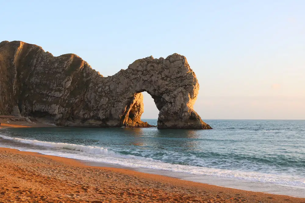
This feature in the cliffs in known as
a cave.
an arch.
a stack.
a stump.

This sea wall is designed to stop: (choose 2 answers)
flooding.
long-shore drift.
erosion.
deposition.
Which of these is not a factor that affects the size of the waves?
Strength of the wind.
The distance over which the wind is blowing across the sea.
The moon.
The length of time the wind has been blowing in the same direction.

