
 Worksheets
Erosion and Deposition
Total questions: 15
Worksheet time: 8mins
Name
Class
Date
1.
Ox-bow lakes are features found along rivers and are formed by a combination of ________________ and _____________
a)
erosion; deposition
b)
weathering; erosion
c)
weathering; deposition
2.
Sediments are -
a)
large rocks
b)
very small rocks and dirt
c)
crystals
d)
water
3.
Deposition occurs when a river...
a)
...begins to flow faster.
b)
...begins to flow slower.
c)
...carries sediment down stream.
d)
...flows around a meander.
4.

What is this landform?
a)
Spit
b)
Sand dune
c)
Stack
d)
Stump
5.
What is the first stage in a stack formation?
a)
Arch is formed
b)
Cave is formed
c)
Line of weakness in rock
d)
Stump is formed
6.
Which of these is created by deposition?
a)
cave
b)
Sea stack
c)
bay
d)
beach
7.
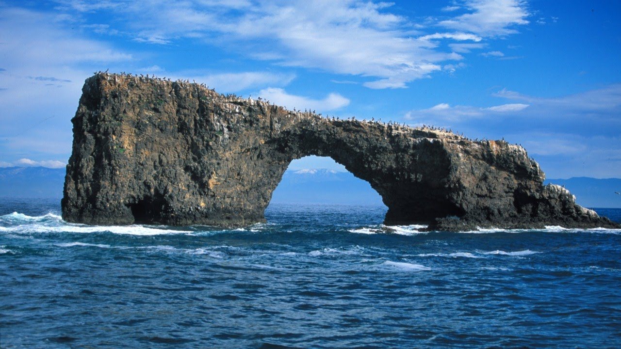
Identify the landform.
a)
Arch
b)
Tombolo
c)
Stack
d)
Cave
8.

This diagrams shows the movement of material along a coast by waves that approach at an angle to the shore but recede straight down the beach is called...
a)
Longshore Drift
b)
Wave currents
c)
Prevailing drift
d)
Longshore currents
9.
What ecosystem forms behind a spit?
a)
Sand Dune
b)
Salt Marsh
c)
Coral Reef
d)
Mangrove
10.

Water gets into cracks of a rock, when the water freezes it breaks up the rock
a)
Mechanical Weathering
b)
Chemical Weathering
c)
Erosion
d)
Deposition
11.

Waves wash sand onto land until a beach is formed
a)
Mechanical Weathering
b)
Chemical Weathering
c)
Erosion
d)
Deposition
12.
A waterfall is created because of ...
a)
the types of layers of rock
b)
the force of gravity
c)
deforestation
d)
deposition
13.

A meander is best described as ...
a)
A straight section of the river.
b)
A winding section of a lake.
c)
A section of the river that joins another river.
d)
A winding section of a river.
14.

When the bends of a Meander get close enough they can join, creating a new river path. What is left is called ...
a)
An oxback lake
b)
An oxen lake
c)
An oxcart lake
d)
An oxbow lake
15.
What river features and landforms are associated with a cross section or profile of a river valley in its upper course.
a)
A. river source, V-shape, interlocking spurs, narrow and shallow river channel
b)
B. delta, flood plain, river mouth, levees, wide and deep river channel
c)
C. sheep farming, wind turbines, HEP (hydro-electric power) stations and dams and reservoirs
100 %

