
 Worksheets
Thinking Like a Geographer
Total questions: 56
Worksheet time: 38mins

Which of the following is an example of a PRIMARY SOURCE?
Titanic directed by James Cameron
a letter written by a Civil War Soldier to his Wife
Wikipedia
Hamilton written by Lin Manuel Miranda


What continent is located 40 degrees North and 100 degrees West? It is labeled "G" on the map
South America
Australia
North America
Antarctica

Invisible line at 0o latitude; divides the Earth into the Northern and Southern hemispheres
Tropic of Cancer
Prime Meridian
Equator
International Date Line

Invisible line at 0o longitude; it divides the Earth into the Western and Eastern hemispheres
Equator
Coordinate
International Date Line
Prime Meridian

Which of these gives the best definition of "relative location"?
location of a place compared to another place
exact position of a place on the earth's surface
place where your relatives [aunts, uncles, cousins] live
where a place is using Latitude and longitude

What is the purpose of a map scale?
To show the direction
To explain the symbols on the map
Compare the distance measured on the map to the actual distance on Earth
To show how old the map is


What is the TITLE of this map?
Major Rivers of Texas
Gulf of Mexico
Main Cities Found in Texas
Corpus Christi

Which area of Texas has more people?
East
West
North
South

the conditions of how a country or area produces and uses its resources and/or money
economy
politics
social
geographic

Political
Economic
Geographical
Social
The "P" in PEGS stand for ...
Practice
Political
Primary
Perfect
The "E" in PEGS stand for ...
Ethernet
Environment
Equator
Economic
The "G" in PEGS stands for ...
Geography
Global
Gravity
Grades
The "S" in PEGS stands for ...
Slavery
Social
San Antonio
Splendid

Senate
Political
Economic
Geographic
Social

Language
Political
Economic
Geographic
Social

Trade
Political
Economic
Geographic
Social

King
Political
Economic
Geographic
Social

Food
Political
Economic
Geographic
Social

Military
Political
Economic
Geographic
Social

Prime Minister of New Zealand (Jacinda Ardern)
Political
Economic
Geographic
Social

Celebrations
Political
Economic
Geographic
Social


Australia is located in the Southern and Eastern Hemispheres
Asia is located in the Southern and Eastern Hemispheres
North America is located in the Southern and Eastern Hemispheres
South America is located in the Southern and Eastern Hemispheres.


What is located at 40*N, 105*W
Fargo
Denver
Boston
Niagara Falls


Identify the name of the city or state at the given latitude and longitude coordinates.
25 degrees North latitude, 80 degrees West longitude
Niagara Falls
Miami
Raleigh
Houston
Identify the name of the city or state at the given latitude and longitude coordinates.
43 degrees North latitude, 79 degrees West longitude
Niagara Falls
Portland
Raleigh
Houston
Identify the name of the city or state at the given latitude and longitude coordinates.
29 degrees North latitude, 95 degrees West longitude
Niagara Falls
Houston
Fargo
Portland
Identify the name of the city or state at the given latitude and longitude coordinates.
45 degrees North latitude, 122 degrees West longitude
Phoenix
Portland
Raleigh
Houston

The Prime Meridian divides the Earth into what two hemispheres ?
East and West
East and North
South and North
West and South

What is the job of a compass rose?
to tell direction
to explain the symbols
tell you how old the map is
to tell what the map is about

30°N, 100°W

What are the parallel lines going around planet Earth called?
Latitude
Longitude

What are the lines going from the top to the bottom of planet Earth?
Latitude
Longitude

The scale bar of the map explains...?
What the map is about
Tells the relative size of the map
Explains the symbols and colors on the map
Explains the cardinal directions on the map

A title of a map explains...?
The subject of a map
Tells the relative size of the map
Explains the symbols and colors of the map
Explains the cardinal directions of the map

What does a map key show?
it shows directions.
its lets you unlock a map.
it shows where things are located on a map, represented by symbols.
It shows you how far places are from one another.

If you wanted to know the symbol for “river,” where on the map would you look?
The scale
The compass rose
The borders
The legend
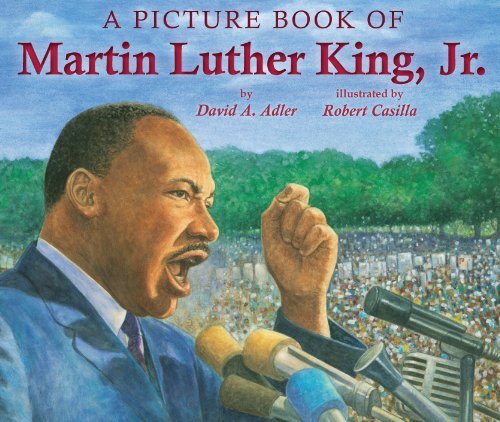
A Picture Book of Martin Luther King Jr by Adler and Casilla
Primary Source
Secondary Source

The Declaration of Independence
Primary Source
Secondary Source

Which of these is a secondary source?
I Am Malala by Malala Yousafzai
The Story of My Life by Helen Keller
John Adams by David McCullough
The Autobiography of Malcolm X by Malcolm X

Which of these is a primary source?
a rap song about Harriet Tubman
a photograph of Harriet Tubman
an essay about Harriet Tubman
a movie about Harriet Tubman

A textbook is a
Primary Source
Secondary Source

A letter written by a soldier is a
Primary Source
Secondary Source

An essay about mummies written in 2019 is a
Primary Source
Secondary Source

Cave art from the Old Stone Age is a
Primary Source
Secondary Source

a movie about the American Revolution
primary
secondary

an interview with Mae Jemison
primary
secondary

