
NEW
Font size
S
M
L
XL
 Worksheets
Understanding maps
Total questions: 13
Worksheet time: 4mins
Name
Class
Date
1.

__________ maps show landforms.
a)
Special Purpose or Thematic
b)
political
c)
physical
2.

_______________ map shows boundaries of countries.
a)
Special purpose or thematic
b)
physical
c)
political
3.

This map shows population. what type of map is this?
a)
Physical map
b)
Political map
c)
Special Purpose or Thematic map
4.

How many groups of islands are shown on this map
a)
4
b)
3
c)
2
5.

The part of the map that would help you measure distance between two cities
a)
key.
b)
title.
c)
scale bar.
d)
compass rose.
6.

The part of the map that would help you identify what a particular color or symbol means is the
a)
key.
b)
title.
c)
scale bar.
d)
compass rose.
7.

Which part of the map that tells you where North, South, East, and West are?
a)
The key.
b)
The title.
c)
The compass rose.
d)
The label
8.
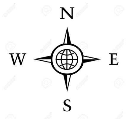
What is this called?
a)
North, South, East, West
b)
Compass Rose
c)
A map
d)
A map key
9.

A _______________ shows what distances on the map represent.
a)
Scale
b)
Legend
c)
Compass
d)
Title
10.

A _________________ identifies what any symbols on the map represent.
a)
Scale
b)
Legend or Key
c)
Compass
d)
Title
11.
Section of a map that shows a larger area than the main map
a)
key
b)
locator map
c)
scale bar
d)
compass rose
12.
What shows what a map is all about?
a)
Map title
b)
Map scale
c)
Legend or key
d)
Compass rose
13.

India shares its border with __________ on the west.
a)
Pakistan
b)
Bangladesh
c)
China
Reset

