
 Worksheets
Africa Political/Physical Review
Total questions: 48
Worksheet time: 25mins

Using the map, what country is identified with the letter "A"?
Egypt
Sudan
Kenya
Nigeria
Democratic Republic of the Congo
Using the map, what country is identified with the letter "B"?
Egypt
Sudan
Kenya
Nigeria
Democratic Republic of the Congo
Using the map, what country is identified with the letter "C"?
Egypt
Sudan
Kenya
Nigeria
Democratic Republic of the Congo
Using the map, what country is identified with the letter "D"?
Egypt
Sudan
Kenya
Nigeria
Democratic Republic of the Congo
Using the map, what country is identified with the letter "E"?
Egypt
Sudan
Kenya
Nigeria
South Africa
Using the map, what country is identified with the letter "F"?
Egypt
Sudan
Kenya
Nigeria
South Africa

Using the map, what physical feature is identified with the letter "R"?
Congo River
Niger River
Nile River
Lake Victoria
Using the map, what physical feature is identified with the letter "Q"?
Congo River
Niger River
Nile River
Lake Victoria
Using the map, what physical feature is identified with the letter "P"?
Congo River
Niger River
Nile River
Lake Victoria
Using the map, what physical feature is identified with the letter "O"?
Congo River
Niger River
Nile River
Lake Victoria

What is location 2?
Ahaggar Mountains
Atlas Mountains
Drakensberg Mountains
Mt. Kilimanjaro

What is location 5?
Kalahari Desert
Namib Desert
Sahara Desert
Wutsfir Dessert?

What is location 22?
Lake Chad
Lake Nyasa
Lake Tanganyika
Lake Victoria

What is location 23?
Lake Chad
Lake Nyasa
Lake Tanganyika
Lake Victoria

What is location 4?
Ahaggar Mountains
Atlas Mountains
Drakensberg Mountains
Mt. Kilimanjaro

What is location 6?
Kalahari Desert
Namib Desert
Sahara Desert
Wudyulyke Dessert?

What is location 7?
Kalahari Desert
Namib Desert
Sahara Desert
Wiltherbee Dessert?

What is location 15?
Congo Basin
Ethiopian Highlands
Madagascar
Serengeti Plains
What is a border?
An line that separates two political countries
A physical line that is drawn in the ground
The center of a country
Where two oceans meet
Africa is the world's _______ largest continent
1st
2nd
3rd
4th
Africa contains ______ independent nations
54
55
64
65
The largest desert in the world is the
Gobi
Namib
Kalahari
Sahara
The longest river in the world is the
Zambezi
Congo
Nile
Amazon

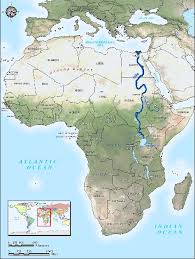

The Sahara Desert can be found in each of the regions shown on this map EXCEPT for one. Which region is NOT touched by the Sahara Desert?
2
3
4
5

Which number is CLOSEST to the Lake Victoria?
1
2
3
4

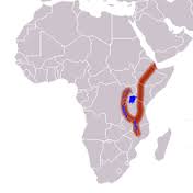
Africa's "Great Rift Valley" is found in which of the labeled areas?
1
2
3
4

Given that the Nile generally flows in a northward direction, which statement is MOST accurate?
The Nile flows into the Mediterranean Sea.
The Nile flows into the Suez Canal.
The Nile flows into Lake Victoria.
The Nile flows into the Red Sea.
Which river is being described by these statements?
· Generally considered the longest river in the world.
· Flows north and discharges into the Mediterranean Sea.
· Flows through ten different countries.
· Is made up of two main tributaries that converge near Khartoum.
Nile
Niger
Congo
Zambezi

What African river- so vital to west African states of past and present- is being shown on the map?
Nile
Niger
Congo
Zambezi

Which river is labeled on this map?
Nile
Niger
Congo
Zambezi

Which feature is the arrow pointing to?
Kalahari Desert
Tropical Rainforest
Sahara Desert
Gobi Desert

Which country would be MOST likely to be found in the area circled on the map?
Egypt
Kenya
Sudan
Nigeria

What country is labeled on the map?
- A former French colony
- Second-largest country Africa
- Home to a river with a similar name
Sudan
Democratic Republic of the Congo
Central African Republic
South Africa

In which region on the map would you find the country of Kenya?
1
2
4
5

In which region on the map would you find the country of South Africa?
2
3
4
5

Which number represents the modern day country of Sudan?
1
2
3
4

Name the country shown in red.
South Africa
Kenya
Liberia
Ethiopia

Name the country highlighted in red.
Sudan
Morocco
Kenya
Nigeria

Using the map, what physical feature is identified with the letter "I"?
Sahara
Sahel
Savanna
Tropical Rainforest

Name the country highlighted in red.
Liberia
Mali
Egypt
Ethiopia

