
 Worksheets
Maps and Directions
Total questions: 26
Worksheet time: 14mins
Which directions are North, South, East, and West?
cardinal directions
intermediate or ordinal directions
Which map shows landforms such as mountains, rivers, forests, and oceans?
political map
road map
climate map
physical map


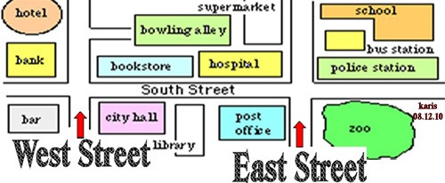
In which direction would you have to travel to go from the bank to the hospital?
North
South
East
West
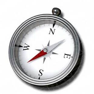
Which picture represents a globe?


What is used on a map to show cardinal directions and intermediate or ordinal directions?
map
globe
The Rocky Mountains
compass rose
A model of the Earth that is round like a ball
sphere
globe
map
orbit


What does this map symbol mean?
Hotel
Gas station
Airport
Hospital
Car park

Google Maps helps us with ____________________.
directions
dancing
doing homework

Identify the given map symbol
Railway Line
Bridge
Building

___________ is a bound collection of maps.
globe
atlas
map

The Sun rises in the ___ and sets in the ___.
East, West
West, East
North, East
North, South

____ is an imaginary line that divides the Earth into 2 parts.
Longitude
Equator
Latitude
Prime Meridian

Did you like the quiz ?
Yes
No
The different known places used for finding locations like schools, hospitals and temples are called ___________
landforms
landmines
landmarks
landfills
The opposite direction to East is ____________
North
South
West
East

Identify this type of Map
Physical Map
Political Map
Road Map
Sign Map

This symbol on Map is used to show a ___________
House
Temple
Hospital
Dam
The relation between the distance on the map and the actual distance on the earth is called the ____________
Size of map
Scale of map
Side of map
The distance between two places on the ground is measured in _______________
Kilometers
Centimeters
Inches
Hands
People who draw maps are called (a) .

