
 Worksheets
Map South America Europe Physical Political Human
Total questions: 24
Worksheet time: 11mins

16
Atlantic Ocean
Pacific Ocean
Panama Canal
Amazon River
12
Atlantic Ocean
Pacific Ocean
Panama Canal
Amazon River
6
Atlantic Ocean
Pacific Ocean
Panama Canal
Amazon River
10
Andes Mountains
Atacama Desert
Iguazu Falls
Angel Falls
9
Andes Mountains
Atacama Desert
Iguazu Falls
Angel Falls
7
Brazil
Colombia
Panama
Venezuela
11
Brazil
Colombia
Panama
Venezuela


What country is this?
Germany
France
Hungary
Italy

What country is this?
Spain
Sweden
Finland
Germany

What country is this?
France
Italy
Ukraine
United Kingdom

Which body of water is circled?
North Sea
Black Sea
Mediterranean Sea
Atlantic Ocean


Which body of water is circled?
North Sea
Atlantic Ocean
Mediterranean Sea
Black Sea
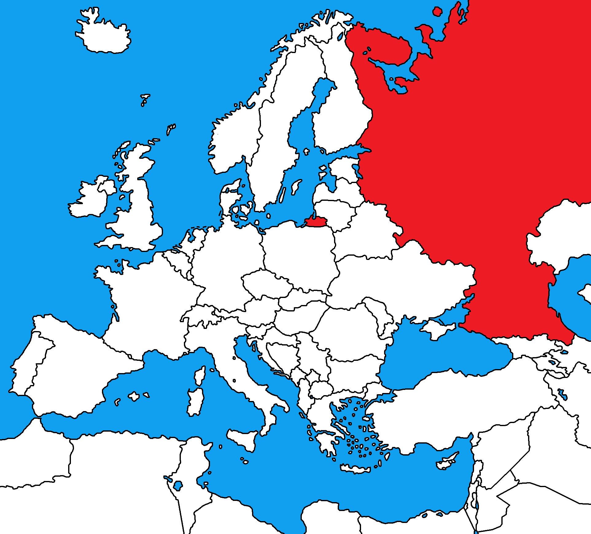
Bonus Question: What country is this?
Belarus
Canada
China
Russia


Name this country.
Iceland
Ireland
Great Britain
Denmark

How have the land & water forms in the map above affected the way humans have behaved in the region over time?
Humans have used the area for tourism & agriculture
Humans have used it as a strategic area to transport people & goods from Asia to the Mediterranean Sea & Atlantic Ocean
Humans have created man-made canals to they could pass through the area in ships
Humans have made dams in these areas creating hydroelectricity which powers the entire region
What factor best explains why Europe is home to many
manufacturing industries?
Cold climate conditions make it necessary to work indoors.
Tourists who visit the region want to stop for European products.
Many immigrants to the region provide labor for work in factories.
Access to ports and navigable river facilitates the distribution of goods.

What effect has the Pyrenees Mountains had on the population of the Iberian Peninsula?
The Pyrenees Mountains have isolated the population of the Iberian Peninsula from the rest of Europe.
The Pyrenees Mountains have cause problems with water usage in major cities
The Pyrenees Mountains were densely populated
Many ideas and languages were exchanged between the Iberian peninsula and the Italian peninsula

How do the Alps Mountains affect the climate of Southern Europe?
The Alps Mountains lower the temperature of Southern Europe due to high elevation
The Alps Mountains slow the winds down causing little winds in Southern Europe
The Alps Mountains block winds from the north causing mild winters of the Mediterranean climate
The Alps Mountains cause more precipitation during the winter because of a higher elevation.

Using the population map above, what can be determined about the population density of Europe?
The population is sparse around the pyrenees and Alps Mountains and is dense around major water sources where the climate is mild.
The Iberian peninsula is densely populated while the Northern European Plain is sparsely populated
More people live in Southern Europe than in Northern Europe
Archipelagos are densely populated landforms

