
 Worksheets
Geography
Total questions: 31
Worksheet time: 18mins

Which continent do we live on?
North America
South America
Europe
Asia


What is the continent that is dark red?
North America
Europe
Africa
Australia

A "half sphere," used to refer to one-half of the globe when divided into North, South, East, and West.
Scale
Latitude
Longitude
Hemisphere

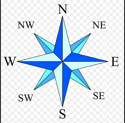
What is the object shown in the image?
compass rose
legend
map title
scale


How many oceans are there?
4
5
6
7

Which ocean is labeled with the number 1?
Atlantic
Indian
Pacific
Southern

Which ocean is labeled with the number 2?
Atlantic
Indian
Southern
Arctic

Which ocean is labeled with the number 3?
Atlantic
Indian
Arctic
Southern

Which ocean is labeled with the number 4?
Pacific
Indian
Southern
Arctic

Which ocean is labeled with the number 5?
Arctic
Southern
Indian
Atlantic

What is the name of the imaginary line that circles the Earth from east to west at 0 degrees latitude? (It divides the Earth into the northern and southern hemispheres)
Prime Meridian
Equator

What is the name of the imaginary line that runs from the north pole to the south pole at 0 degrees longitude? (It divides the Earth into the Eastern and Western hemispheres)
Prime Meridian
Equator

What river is found in Virginia (at #6 on the map)?
The James River
The Atlantic Ocean
The Pacific Ocean
The Mississippi River

What river is found at #3 on the U.S. map?
James River
Mississippi River
Rio Grande River
The Great Lakes

What is located at #4 on the U.S. map?
James River
Rio Grande River
Mississippi River
The Great Lakes

What river is located at #2 on the U.S. map?
James River
Mississippi River
Rio Grande River
The Great Lakes

What mountain range is located at #1 on the U.S. map?
The Appalachian Mountains
The Rocky Mountains

What mountain range is located at #5 on the U.S. map?
The Appalachian Mountains
The Rocky Mountains
The solid surface of Earth is called _____.
land
oceans
lakes
rivers
A large body of land on Earth is called ___________.
an ocean
a continent
the equator
the prime meridian

