
Font size
 Worksheets
Maps and Globes Study Practice
Total questions: 21
Worksheet time: 1hrs 3mins
__________is the perfect model of the Earth
Map
Globe
Equator
None of these
______________ show countries, states, capitals and important cities.
Physical Map
Political Map
Thematic map
None of these
Physical map shows the various land forms like mountains, valleys, plains, rivers,
plateaus and oceans.
True
False
A model of the Earth that is round like a ball
sphere
globe
map
orbit
A large body of salt water
sea
lake
ocean
river
This tells what the symbols on a map stand for
map key
map scale
globe
title
North, South, East, and West
map
cardinal directions
location
intermediate directions
A type of map that includes boundaries, cities, and states
climate map
physical map
political map
population map

A type of map that includes the number of people who live in a certain region.
climate map
physical map
political map
population map
A type of map that shows what the temperature and weather are like for each region.
climate map
physical map
political map
population map
A type of map that shows what natural resources are available in each region.
climate map
physical map
resource map
population map
__________is the perfect model of the Earth
Map
Globe
Equator
None of these

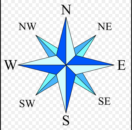
What is this?
This is a compass rose.
This is a map scale.
This is a map key.

_______ map shows where a nation’s natural resources are located
urban
resource
population density
climate
A(n) _____________ photograph is a picture taken from an airplane.
aerial
polaroid
digital
satellite
_____________ images are taken from space and can be used to study the earth's physical features.
Aerial
Polaroid
Digital
Satellite

