
 Worksheets
Map skills revision
Total questions: 66
Worksheet time: 23mins


What horizontal lines show the distance north or south of the equator?
prime meridian
tropics
latitude
longitude

What vertical lines show distance east or west of the prime meridian?
prime meridian
longitude
equator
Tropic of Cancer

What are the four main points of direction called?
cardinal directions
direction points
compass rose
ordinal or intermediate directions

What imaginary line divides the Earth into a northern and southern half?
prime meridian
longitude
equator
Tropic of Cancer

What imaginary line represents zero (0º) degrees longitude?
prime meridan
longitude
equator
Tropic of Cancer

What imaginary line marks the northern boundary of the tropics?
Tropic of Capricorn
Tropic of Cancer
Tropic of Aquarius
Tropic of Sagittarius

What part of a map explains the symbols that are used?
key
legend
key or legend
none of the above

What type of map shows landforms like mountains and deserts?
political map
physical map
resource map
climatic map

What type of map shows governmental boundaries such as countries, counties, and cities?
political map
physical map
resource map
climatic map

What is located at 30ºS, 60º W?
Buenos Aires
Chicago
Paris


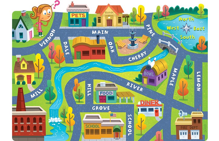
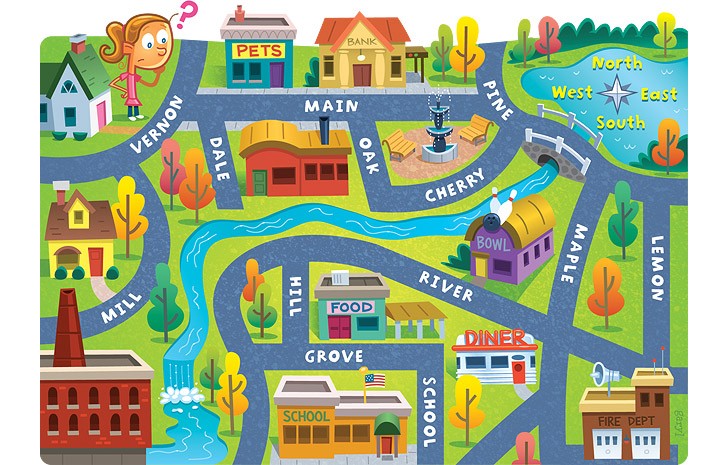
What is the Zero degree line of latitude called
Prime Meridian
Greenwich Meridian
Equator
Parallel Meridian

What are Contour Lines?
They are lines used to represent the distance between two points.
They are lines used to show you how big something is.
They are lines used to represent hills, slopes and mountains on a map.
They are lines used to show the fastest route.
Why are Contour Lines important?
You can work out lots about the surrounding terrain.
You can tell how far a point is from you.
You can work out where is the nearest car park.
You can find out the name of mountains.

The height values of contour lines are labelled in a way that moves ..... a slope. This helps us to see a picture of the group rising up a hill.
Up
Down

What is the height of the contour line at point C?
200m
250m
210m
200km

Which side is steeper?
The left side of the hill
The right side of the hill

Match the topographic map to its profile.


What is the contour interval?
10
20
50
100
How can you tell a map shows a steep slope?
The lines are far apart from each other
The lines are close to each other
The scale of a map is 1 cm to 2.5 m. Find the scale of the map.
1 : 250
1 : 2500
1 : 250000
1 cm : 250 cm
The scale of a map is 1 : 300. Calculate the distance on the map given that the actual distance is 9 m.
2 cm
3 cm
6 cm
0.2 cm
A map has a scale of 1cm : 3 miles.
On the map, the distance between two towns is 7cm. What is the actual distance between the two towns?
21cm
21km
21miles
2.1miles

What does the B in BOLTSS stand for?
Border
Banana
Background
Banner
What does the T in BOLTSS stand for?
Title
Trim
Tough
Tag

What type of map is shown?
Topographic
Physical
Political
Choropleth

Which element of BOLTSS is missing from this map?
Orientation
Border
Title
Scale

What is the golden rule for finding a Grid Reference?
Never eat soggy Weet-a-Bix.
Along the corridor, then up the stairs.
Along the pathway, and through the gate.
Eastings before bee-stings.


What is the grid reference of the snake?
(B,9)
(9,B)
(C,7)
(F,3)

What is at F2?
Mountains
River
Treasure
Lake

What is the grid reference for car park?

what is the four digit grid reference for the Hospital?
4319
1943
1843
4320

What is the six figure grid reference for the train station?
180 440
180 444
181 445
180 443

What is the location of blue lagoon lake?
D1
D3
A5
A1


Earth's plates meet at ____________.
plate tectonics
plate boundaries
continental drift
oceans


What type of plate boundary occurs between the Antarctic Plate and Indo-Australian Plate?
Convergent
Divergent
Transform
None of these

What type of plate boundary occurs between the Nazca Plate and South American Plate?
Convergent
Divergent
Transform
None of these

What is the correct order (starting from the surface) of Earth’s layers?
crust, outer core, inner core, mantle
mantle, outer core, inner core, crust
crust, mantle, outer core, inner core
outer core, inner core, crust, mantle

The process by which the ocean floor sinks beneath a deep-ocean trench and back into the mantle is known as _______
convection.
continental drift.
subduction.
conduction.

Most geologists think that the movement of Earth’s plates is caused by _______
convection.
continental drift.
subduction.
conduction.

Which description best describes the term 'landscape'
A specific shape or physical feature of the Earth’s surface which has been produced by a natural process
A part of the Earth’s surface that consists of a variety of geographical features that are characteristic of an area
Natural objects found on the earth's surface
Man made objects found on the earth's surface
Which description best describes a 'landform'
Natural object found on the earth's surface
A specific shape or physical feature of the Earth’s surface which has been produced by a natural process
Man made objects found on the earth's surface
A part of the Earth’s surface that consists of a variety of geographical features that are characteristic of an area.

Study the image and identify the landscape
Tropical rain forest
Coastal
Desert
Riverine

Study the image and identify the landform/s
Plains
Mountain range
Valleys
Cliffs

What are natural landscapes?
Natural landscapes (for example, mountains and deserts) are mainly unaffected by evasive species
Natural landscapes (for example, mountains and deserts) are mainly unaffected by human activity
Natural landscapes are made by humans but from natural materials mainly
Natural landscapes (for example, mountains and deserts) only exist in central Asia
Which description best describes a 'dune''?
Broad, curved indentation in the
Coastline
A piece of land surrounded by water
Deposited rock particles – such as sand, gravel or pebbles – along the coastline
Wind-blown particle formation
Which description best describes a 'oasis'?
Underwater ridge formed by the growth and deposit of coral
Wind-blown particle formation
Deposited rock particles – such as sand, gravel or pebbles – along the coastline
Desert area with a water supply provided by groundwater
What are the 4 geomorphic processes that can change landscapes?
erosion, deposition, weathering, tectonic activity
erosion, deposition, human activity, weathering
deposition, human activity, tectonic activity, earthquakes
flooding, erosion, volcanoes, acid rain
Which term describes a ridge of sand created by the wind; found in deserts or near lakes and oceans?
Sand dune
Sanddune
Beach
Beech

