
 Worksheets
Map Skills Quiz
Total questions: 38
Worksheet time: 24mins


What direction is missing?
north
south
east
west

A 3D sphere that shows a map of the earth is called a...
globe
continent
country
ball

What city is located closest to 70'W and 40'N?
Denver
Niagra Fallas
Boston
Houston
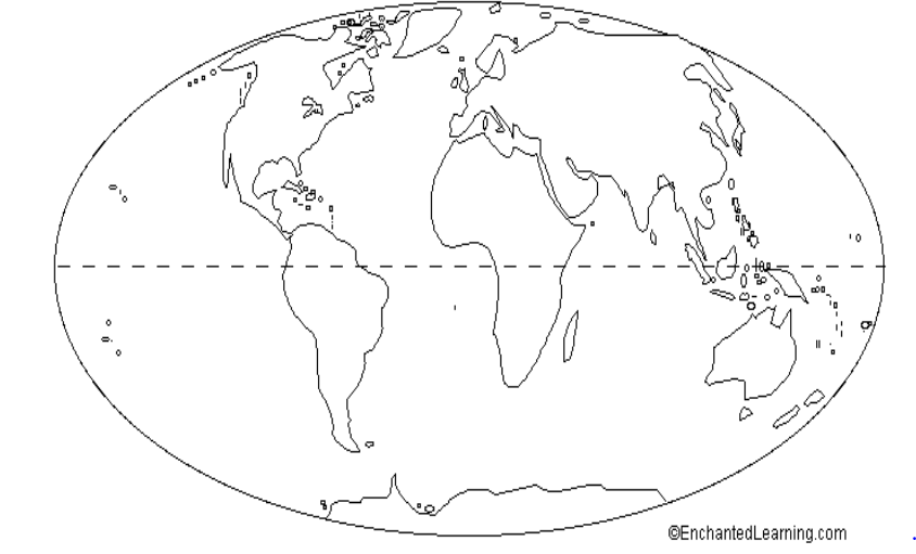
What is the name of the imaginary line that runs from east to west, and separates the Northern and Southern Hemispheres?
Equator
Prime Meridian
Longitude
Latitude

What is the name of the imaginary line on the globe that runs north to south, and separates the Eastern and Western Hemispheres?
Equator
Prime Meridian
Latitude
Longitude

Identify this map
Population map
Elevation Map
Physical Map
Political Map

This map is an example of a . . .
Political Map
Physical Map
A map showing cities, capitals, and states is which type of map?
Political
Physical
A map showing bodies of water, lakes, and islands is what type of map?
Political
Physical
Which of the following is NOT a cardinal direction?
north
south
southeast
west
Symbol means...
something people do year after year.
the direction that you will travel.
is an object or picture that stands for something else.
a tool on a map that shows distance.
half of the earth
degree
Mars
hemisphere
the ratio between the size of a thing and its representation
scale
continent
degree
A network of lines that cross each other to form a series of squares or rectangles
grid
phone lines
equator
0 degree longitude
hemisphere
Africa
Prime Meridian
A set of imaginary lines used to measure distances that run east to west.
equator
longitude
directions
latitude
A set of imaginary lines used to measure distances that run north and south.
North Pole
longitude
equator
latitude
The starting point for measuring longitude.
latitude
equator
prime meridian
longitude
Imaginary lines that run from side to side (east to west) around the globe are called lines of _________.
latitude
longitude
attitude
Imaginary lines that run from top to bottom (north to south) of the globe are called lines of _________.
latitude
longitude
altitude
The Equator is a line of __________.
longitude
latitude
meridian
The Prime Meridian is a line of longitude that divides the Earth into ____________ hemispheres.
Northern and Southern
Southern and Eastern
Eastern and Western
The Equator divides the Earth into ____________ hemispheres.
Northern and Southern
Southern and Eastern
Eastern and Western
The United States of America lies in BOTH the ________ and the __________ hemispheres.
Northern and Southern
Northern and Western
Eastern and Western
Lines of latitude are also called ________.
meridians
parallels
line
Lines of longitude are also called __________.
meridians
parallels
lines

Using the map, which state is EAST of Alabama?
Mississippi
Georgia
Tennessee
Atlantis

Using the map, which state is south of Kansas?
Mexico
Oklahoma
Nebraska
California

Which direction is found at number 6 on the compass?
Southeast
Southwest
North
Weast

Which direction is found at number 3 on the compass?
East
Northwest
Southeast
West
Which part of a map is used to compare the distance on a map to the distance in the real world?
map title
map scale
compass rose
map key

This map shows the United States. What type of map is it?
Physical map
Political map
Climate map
Annual rainfall map
What type of map shows the borders of states and countries?
Political map
Physical map
Population density map
Treasure map
This part of a map shows what the symbols on a map mean.
Map key (legend)
Map title
Map scale
Mappy map

