
 Worksheets
Unit 8 Quiz (Sub-Saharan Africa)
Total questions: 50
Worksheet time: 38mins

What country is this?
Algeria
Ghana
Liberia
Nigeria

What country is this?
Algeria
Angola
Mali
Tanzania

What country is this?
Angola
Cameroon
Nigeria
Republic of the Congo

What country is this?
Chad
Niger
South Sudan
Sudan

What country is this?
Democratic Republic of the Congo
Niger
Republic of the Congo
Zambia

What country is this?
Democratic Republic of the Congo
Egypt
Eritrea
Ethiopia

What country is this?
Democratic Republic of the Congo
Eritrea
Ethiopia
Kenya

What country is this?
Ethiopia
Kenya
South Sudan
Tanzania

What country is this?
Madagascar
Mali
Mauritania
Mozambique

What country is this?
Angola
Mozambique
Namibia
South Africa

What country is this?
Angola
Mozambique
Namibia
Zambia

What country is this?
Liberia
Mali
Niger
Nigeria

What country is this?
Mozambique
Namibia
South Africa
Tanzania

What country is this?
Kenya
Mozambique
South Sudan
Tanzania

Which number on the map is the Red Sea?
9
10
11
12


Identify the physical feature.
Cape of Good Hope
Kalahari Desert
Sahel
Congo Basin
Mount Kilimanjaro
What is the tallest mountain in Africa?
Mt. Kilimanjaro
Ethiopian Highlands
Atlas Mountains
Mt. Everest
What ocean lies in between the U.S. and Africa?
The Pacific Ocean
The North Sea
The Southern Ocean
The Atlantic Ocean


Which of the following physical environments can lions, giraffes, elephants and gazelles be found?
Sahara Desert
Sahel
Savanna
Tropics

Which region is marked by letter A?
Sahara
Sahel
Rainforest
Savanna

Which physical feature is number 6?
Atlas Mountains
Great Rift Valley
Mt. Kilimanjaro
Kalahari Desert
Which region is marked by letter B?
Sahara
Sahel
Rainforest
Savanna
Which physical feature is number 3?
Lake Victoria
Nile River
Niger River
Congo River
Which physical feature is number 5?
Lake Victoria
Nile River
Niger River
Congo River

What physical feature is this?
Horn of Africa
Lake Victoria
Great Rift Valley
Niger River
What is Africa's transition zone between desert and rain forest?
Shara
Atlas Mountains
Equator
Sahel
What is an area of relatively level high ground called?
chaparral
topography
plateau
climate
What is the name of the dip in the Earth's surface that was caused by separating tectonic plates?
Sahel
Mt. Kilimanjaro
Sahara
Great Rift Valley
Who was excluded (left out) from the Berlin Conference?
representatives for the US
representatives of European countries
representatives of African countries
representatives of the 3rd Estate

Based on this map (& the map in your notes), what two African countries remained free of European imperialism?
Liberia & Ethiopia (Abyssinia)
Kenya & Rhodesia
Somaliland & Egypt
Nigeria & Togoland

What was the motive for Belgium and King Leopold to take over the Congo?
Rubber
Oil
Cotton
Iron
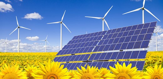
__________ is an energy resource that WILL NOT run out in the next several hundred years.
Renewable Energy Resource
Nonrenewable Energy Resource
Fossil fuels
biodegradable
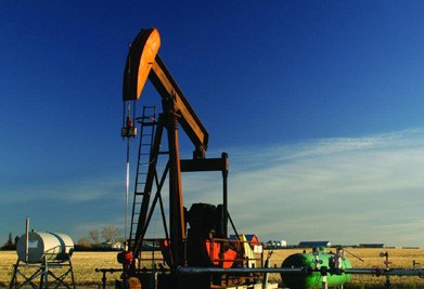
__________ is an energy resource that WILL run out in the next several hundred years.
Renewable Energy Resource
Nonrenewable Energy Resource
natural resources
pollution

Name the country with a big "X"
Madagascar
Botswana
Rwanda
Malawi

The Country Labeled with a big "X"
Gabon
Kenya
Angola
Mozambique

Name the country with a big "X"
Zambia
Zimbabwe
Uganda
Democratic Republic of Congo

Name the country with a big "X"
Kenya
Zambia
Malawi
Zimbabwe
Which physical feature is number 2?
Atlas Mountains
Great Rift Valley
Mt. Kilimanjaro
Kalahari Desert


What country is this?
Chad
Egypt
South Sudan
Sudan

