
 Worksheets
Do Now Session 11 - Landscapes and Topography
Total questions: 7
Worksheet time: 4mins
Name
Class
Date
1.
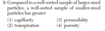
1.
a)
1
b)
2
c)
3
d)
4
2.
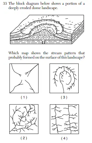
2.
a)
1
b)
2
c)
3
d)
4
3.
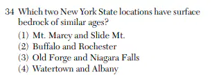
a)
1
b)
2
c)
3
d)
4
4.
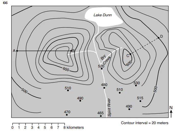
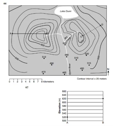
66 On the topographic map in your answer booklet, complete the 480-meter, 500-meter, and 520-meter contour lines on the southern portion of the map.
5.
67 On the grid in your answer booklet, construct a topographic profile along line AB by plotting the elevation of each contour line that crosses line AB. The elevations of points A and B have been plotted on the grid. Connect all nine plots with a line from A to B to complete the profile.
6.
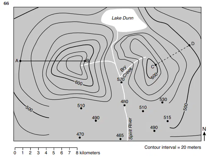
68 Calculate the gradient, in meters per kilometer, from point C to point D. (round to nearest tenth)
(a)
7.
69 Describe the evidence shown by the contour lines that indicates that Bry Creek flows downhill in a southwesterly direction.
(a)
100 %

