
NEW
Font size
 Worksheets
Floods
Total questions: 11
Worksheet time: 6mins
1. Floods usually occur when:
storage tanks fill up.
rivers overflow onto land.
heavy rain falls.
storm water drains flow.

2. A location in Australia that is least likely to flood is:
south-western Australia.
central-western Australia.
central-eastern Australia.
north-eastern Australia.
3. Floods affect people by:
providing free swimming zones for communities.
providing enough water for crops.
causing increases in water rates.
causing devastation to homes, crops and equipment.

4. What kind of map is shown here?
a flood map
a weather map
a rainfall map
a hurricane map
5. Which of the following is least likely to produce rain?
low pressure system
high pressure system
warm front
cold front
6. What are the two main ways in which floods occur?
fast inland floods from mountains, and slow coastal floods from rivers
fast inland floods from rivers, and slow coastal floods from mountains
slow inland floods from rivers, and fast coastal floods from mountains
slow inland floods from mountains, and fast coastal floods from rivers
7. Another term for heavy rain is:
temporary flooding.
torrential rain.
terrestrial rain.
tempestuous rain.

8. Which of the following towns or cities would experience long-duration slow-rise floods?
Birdsville
Cairns
Sydney
Geraldton
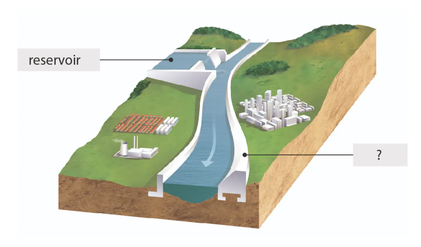
9. The flood management strategy in this image is:
a dam.
a gate.
a channel
a levee.
10. Two ways to prevent rivers from flooding are by using:
stopbanks and levees.
stopgaps and levees.
stopbacks and levies.
stoptanks and levies.

11. Examples of flood hotspots include:
two stream meeting points and mountain peaks.
narrow gorges and mountain peaks.
narrow gorges and the river mouth.
two stream meeting points and levees.

