
 Worksheets
Year 8 Geography
Total questions: 25
Worksheet time: 13mins
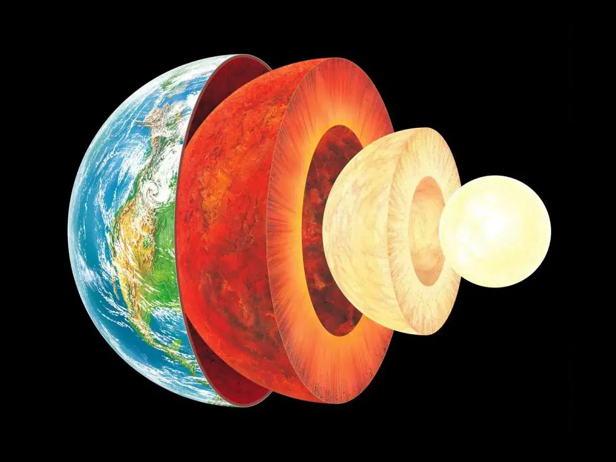
Tectonic plates make up pieces of the Earth's crust. Together with the upper-most layer, they form the what?
Asthenosphere
Exosphere
Lithosphere
Thermosphere
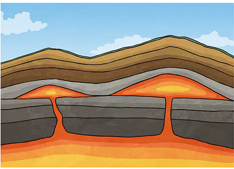
What is the name of this molten material that is found beneath the surface of the Earth?
Crust
Lava
Magma
Obsidian

300-200 million years ago, all the continents were one single continent. This was called what
Gondwanaland
Laurasia
Pangaea
Eurasia
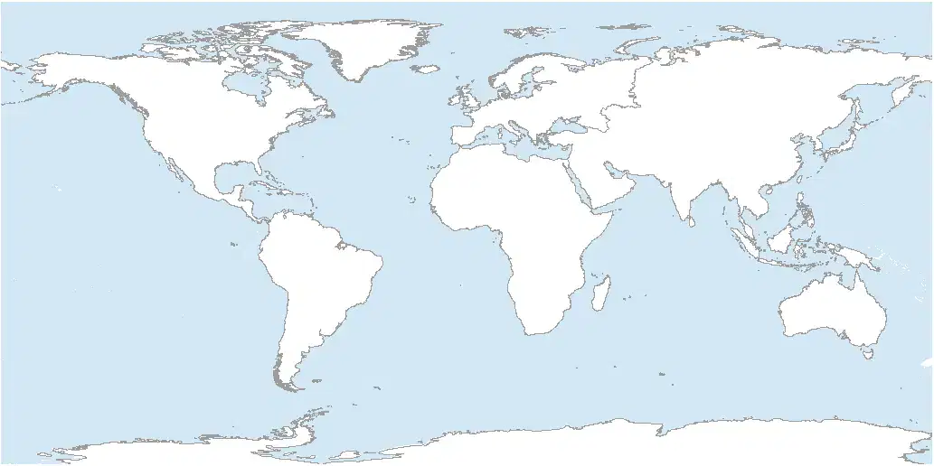
Which of the following is not considered a continent?
Asia
Africa
South America
South Africa

The largest country by area with 17,098,246 km2 is what?
Australia
Canada
Russia
United States

The largest country by population with 1.408 billion people is what?
China
India
Japan
Russia

The world's smallest country, with a population of 825 and an area of 0.49km2 is what?
Liechtenstein
Monaco
San Marino
Vatican City

Cause of the tectonic plates constantly moving, Mount Everest continues grow every year by how much?
2mm
4mm
8mm
16mm
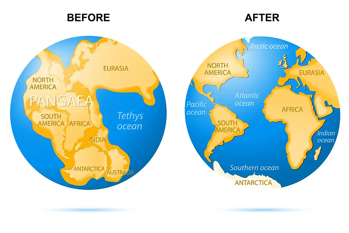
Because of continental drift, the continents are constantly moving closer and further way from each other. How many metres a century are the moving?
0.5 metres
1 metre
2 metres
2.5 metres

For a landscape to be constituted as a desert, it has to experience less than how many milimeters of rain per year.
20mm
25mm
30mm
35mm

The largest desert in the world is...
Antarctica
Arabian Desert
Great Victoria Desert
Sahara Desert
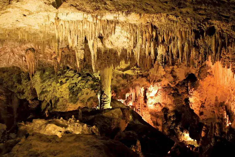
A common feature of karst landscapes are...
Stalagbites
Satalaclites
Stalackites
Stalactites
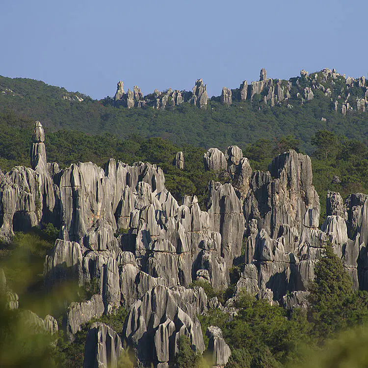
Karst landscapes are made by limestone being worn away by water and other natural forces. This called what?
Abrasion
Corrosion
Erosion
Weathering
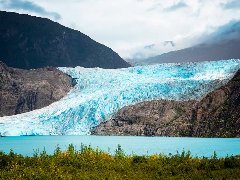
Glaciers are common parts of which landscape?
Deserts
Island
Karst
Tundra
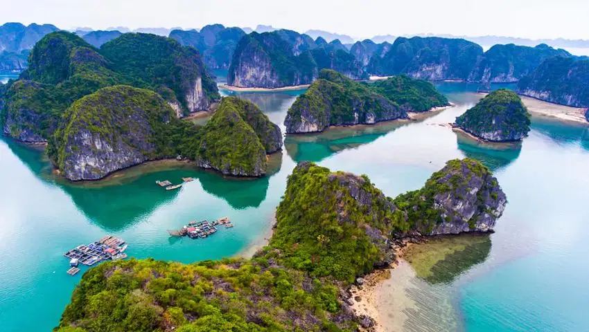
A chain of islands is referred to as what?
Archipelago
Delta
Fragments
Peninsula
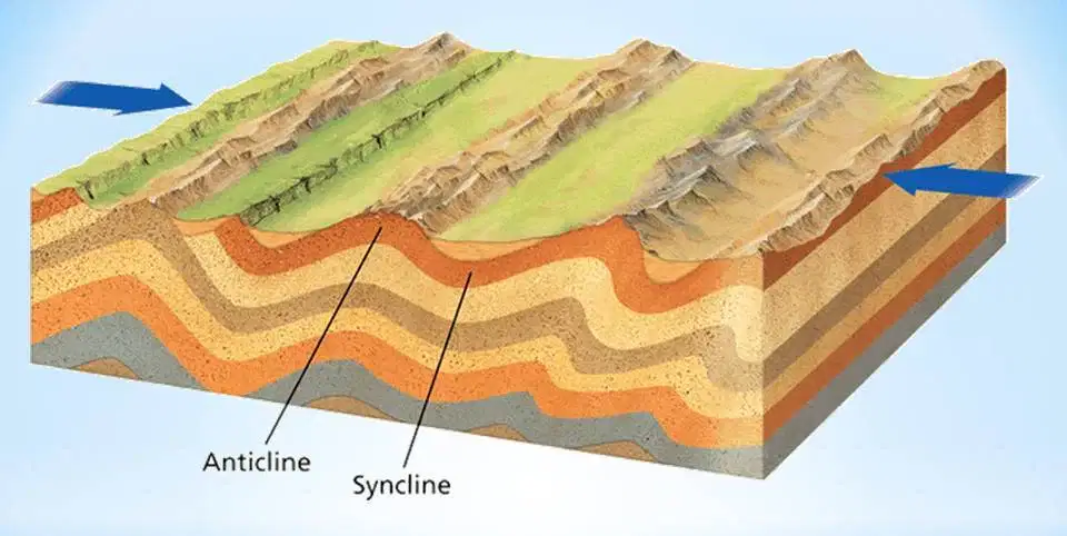
When two continental plates collide and the Earth's crust buckles up, this is known as a...
Fold mountain
Fault-block mountain
Dome Mountain
Plateau
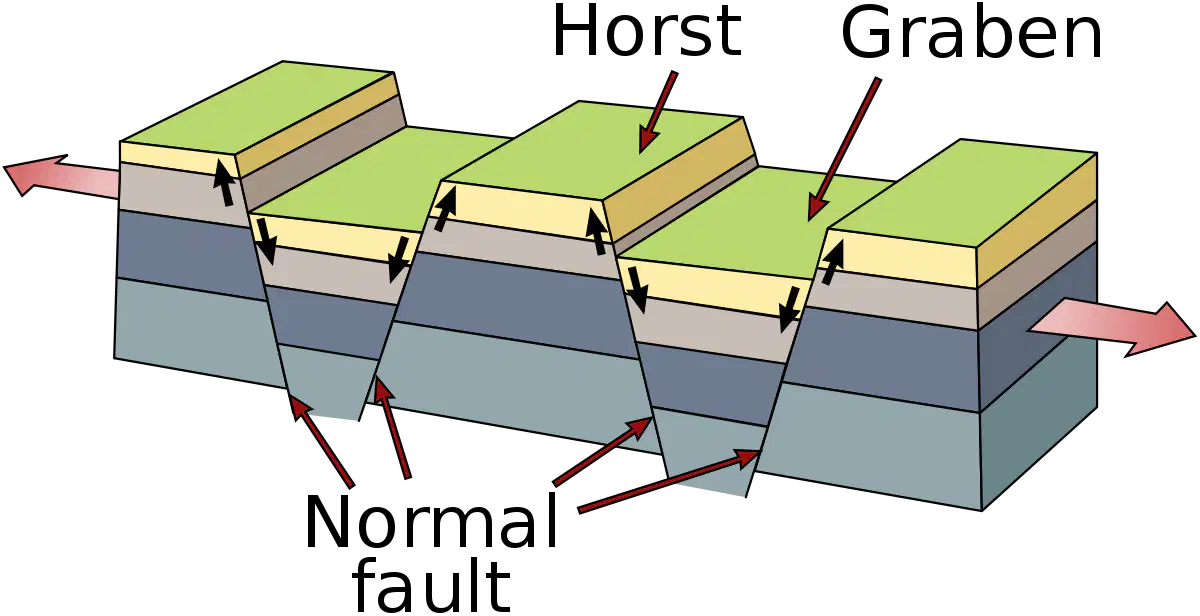
When cracks in the Earth's crust force parts of rock up and others to collapse, these called what
Fold mountains
Fault-block mountains
Dome mountains
Plateau mountains
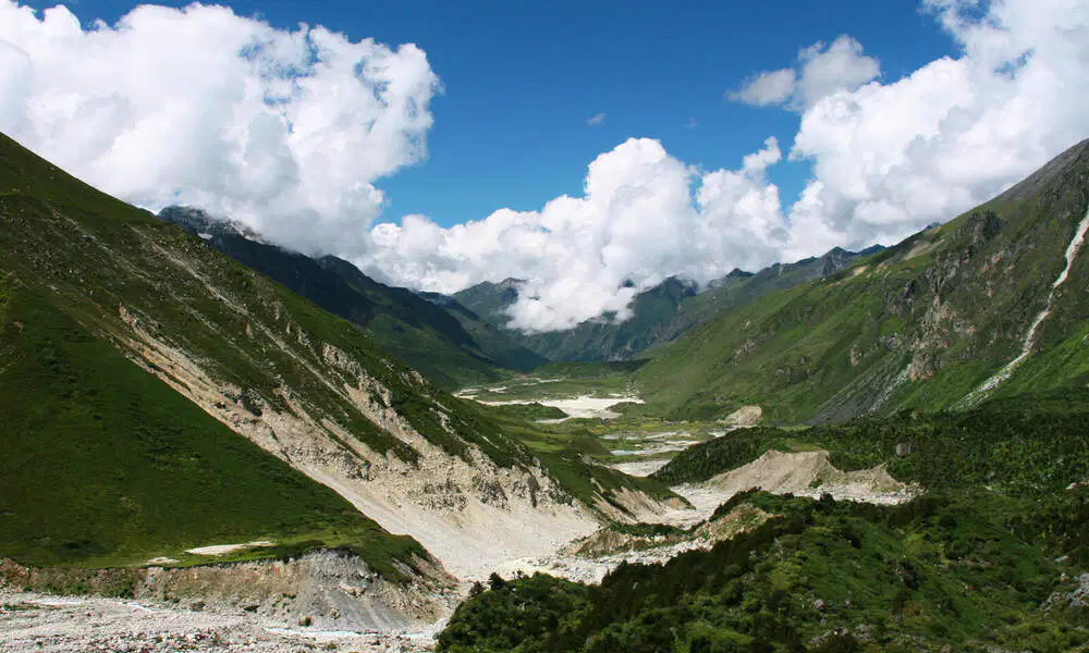
Mount Everest is located in which mountain range?
Atlas Mountains
Himalayan Mountains
Southern Alps
Ural Mountains

Spreading across Monaco, France, Switzerland, Italy, Liechtenstein, Germany, Slovenia and Austria is which mountain range?
The Alps
The Andes
The Great Dividing Range
Ural Mountains

Located in South America, what is the longest mountain range in the world?
The Andes
The Great Dividing Range
The Himalayas
The Rocky Mountains

Which of the following states does the Rocky Mountains not pass through?
British Columbia, Canada
Colorado, USA
New Mexico, USA
Coahuila, Mexico
This Ben Nevis in Scotland. Molten magma pushes the crust towards the Earth's surface. This makes the landform a what?
Fold Mountain
Fault-block Mountain
Dome Mountain
Plateau Mountain
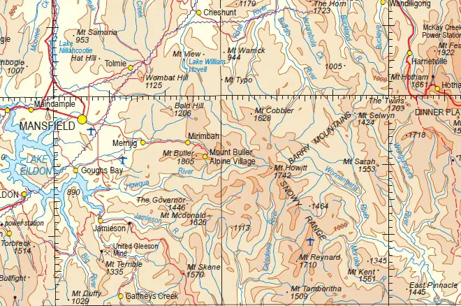
What type of map is this?
Climatic map
Nautical map
Physical Map
Topographical map
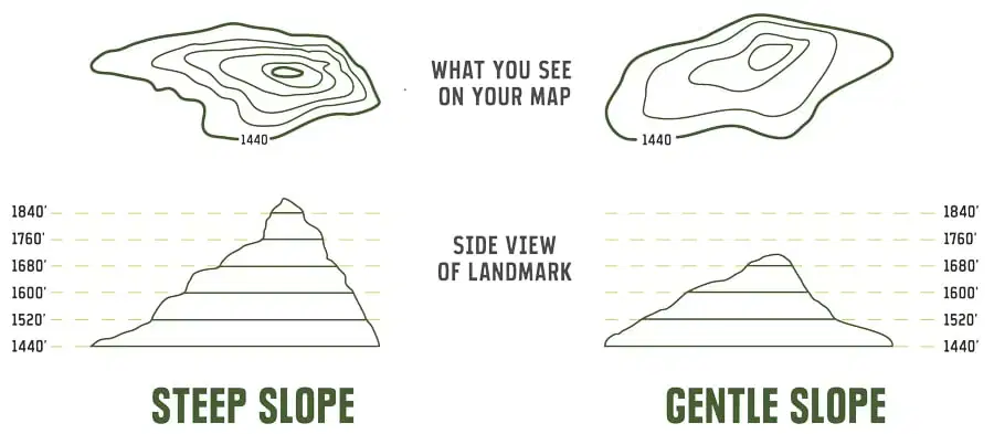
These lines show the elevation of the land and how steep peeks are. What are they called?
Contour lines
Lateral lines
Longitudinal lines
Supplementary lines
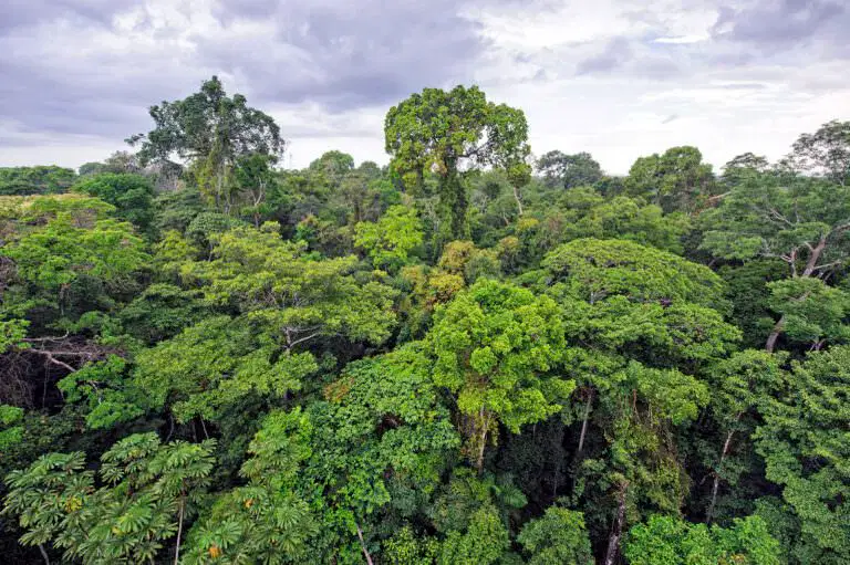
This landscape has high rainfall, wet tropics, and a diverse plant and animal life. What is this
Grassland
Karst
Rainforest
Tundra

