
 Worksheets
WS 2 (HW) Map - Social Studies Grade 4
Total questions: 20
Worksheet time: 10mins
Which lines run north and south along the earth’s surface?
It's latitude lines
It's equator lines
It's longitude lines
It's parallel lines

Look at the picture shown.
Where is the astronomic location of position B?
0o, 0o
0o, 800W
80oW, 0
0o, 800E
Look at the picture shown.
Where is the astronomic location of position A?
10oN, 90oW
90oW, 10oN
10oN, 90oE
90oW, 10oS
Look at the picture shown.
Where is the astronomic location of position D?
90oE, 10oS
10oN, 90oW
10oS, 90oW
90oW, 10oS
What is a book of maps called?
It is an Atlas
It is a Map
It is a Globe
It is a Planet
What is the name of the line at zero degrees longitude?
South Pole
North Pole
Equator
Prime Meridian
Which one of the following is NOT component of maps?
Scale
Legend
Size
Compass Rose
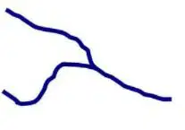
Look at the picture shown.
What is the meaning of the symbol shown?
It's lake
It's capital city
It's river
It's swamp
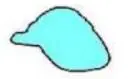
Look at the picture shown.
What is the meaning of the symbol shown?
It's lake
It's capital city
It's river
It's swamp
The Prime Meridian separates the Earth into what two hemispheres?
Southern and Western
Western and Eastern
Northern and Southern
Northern and Eastern
The equator breaks the Earth into what two hemispheres?
Southern and Western
Western and Eastern
Northern and Southern
Northern and Eastern
Lines of Latitude run from the _____ to the ______.
North, West
South, East
North, South
West, East
What is a map scale?
It is a component to tell direction, north. south, east and west
It is a component which shows the clear picture of the map’s content
It is a component to help us understand the symbols on map
It is a component to compare the distance of map and the actual distance
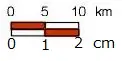
Look at the scale shown.
What is the type of that scale?
Flag scale
Graphic scale
Verbal scale
Numerical scale
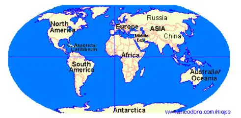
Look at the figure shown.
North and South America are in what hemisphere?
Eastern
Southern
Northern
Western
Look at the figure shown.
Europe, Asia and North America are in what hemisphere?
Eastern
Southern
Northern
Western
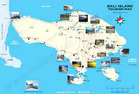
Look at the picture shown.
What is the type of map?
It's thematic map
It's world map
It's topographic map
It's general map
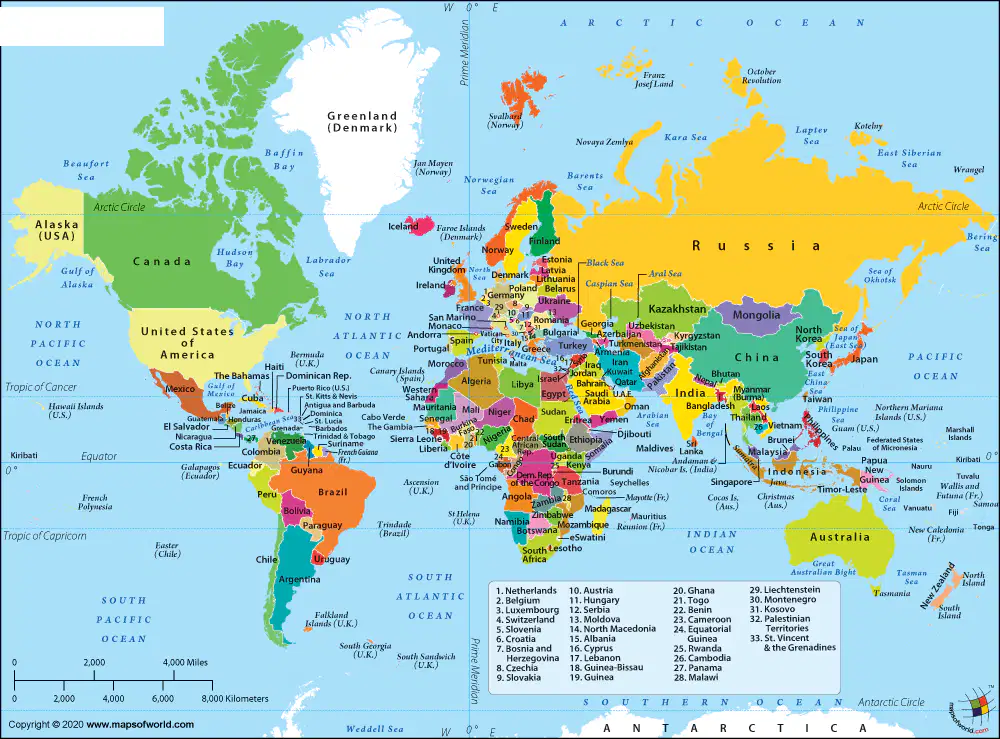
Look at the picture shown.
What is the type of map?
It's thematic map
It's world map
It's topographic map
It's tourism map
What is the name of the component that shows orientation of the cardinal directions?
It is scale
It is legend
It is compass rose
It is symbols
Scale of a map is known 1 : 500.000. It means 1 cm on map = ..... km on actual land.
500.000
5
50
500

