
 Worksheets
1.1 Types of Maps
Total questions: 21
Worksheet time: 11mins
What map would you use to answer the following question: "What countries border Brazil?"
Political map
Economic activity map
Aerial map
Road map
What map would you use to answer the following question: “Where is the Mississippi River?”
Political map
Topographic map
Cartogram
Physical map

Type of Map
Cartogram
Physical
Choropleth
Isoline
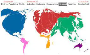
Type of Map
Isoline
Proportional symbol
Cartogram
Choropleth
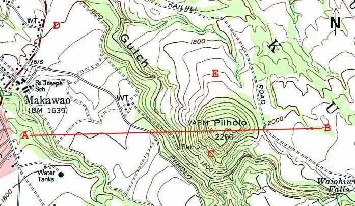
Type of Map
Cartogram
Physical
Isoline
Graduated symbol
Which of the following are the two types of reference maps
Physical
Political
GPS
Global
Which of the following is not a Thematic map?
cartogram
choropleth
isoline
dot
physical

type of map
Isoline
Physical
Cartogram
Choropleth
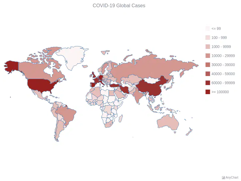
Type of Map
Choropleth
Cartogram
Isoline
Physical

type of map
Choropleth
Cartogram
Dot
Graduated symbol

type of map
Isoline
Cartogram
Choropleth
Dot

Type of map
dot
proportional symbol
isoline
choropleth

type of map
Graduated symbol
Cartogram
Choropleth
Dot

type of map
Graduated symbol
Dot
Choropleth
Poltical

A way of representing the spherical Earth on a flat surface is
a projection
a cartographer
distortion
The loss of accuracy in maps is a
projection
cartographer
distortion

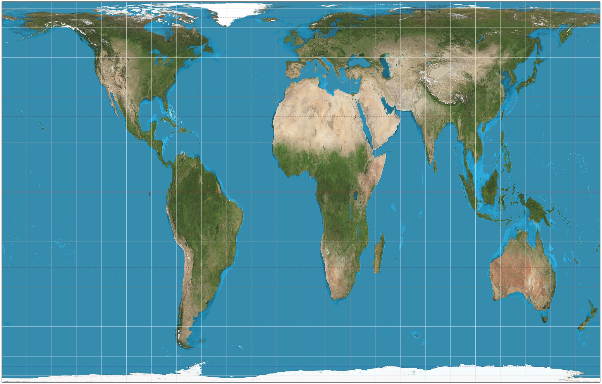

What type of map projection is shown here?
Robinson Projection
Mercator Projection
Goode Homolosine Projection

This map was a compromising map adopted in the 1990s
Robinson
Mercator
Gall-Peters
Winkle-Triple
The 4 types of distortion is
Area/Size
Shape
Distance
Direction
Maritime

