
 Worksheets
Unit 1 Map Test Study Guide
Total questions: 20
Worksheet time: 10mins
Name
Class
Date
1.

Continent 1 is named:
a)
North America
b)
South America
c)
Europe
2.

Continent 2 is named:
a)
North America
b)
Asia
c)
Australia
3.

Continent 4 is named:
a)
Europe
b)
Asia
c)
Antarctica
4.

Continent 5 is named:
a)
North America
b)
Antarctica
c)
Africa
5.

Ocean 1 is named:
a)
Pacific
b)
Arctic
c)
Indian
6.

Ocean 2 is named:
a)
Atlantic
b)
Pacific
c)
Indian
7.

Ocean 3 is named:
a)
Southern
b)
Arctic
c)
Indian
8.
What does a cartographer do?
a)
Plan events for towns and communities.
b)
Sell cars.
c)
Design and create maps of places.
9.

What is relative location?
a)
the exact place where something is located
b)
where a place is located, relative to other places
10.
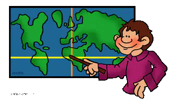
What is absolute location?
a)
the exact place where something is located
b)
where a place is located, relative to other places
11.

The Equator is an example of a line of....
a)
latitude
b)
longitude
12.

The prime meridian is an example of a line of...
a)
lattitude
b)
longitude
13.
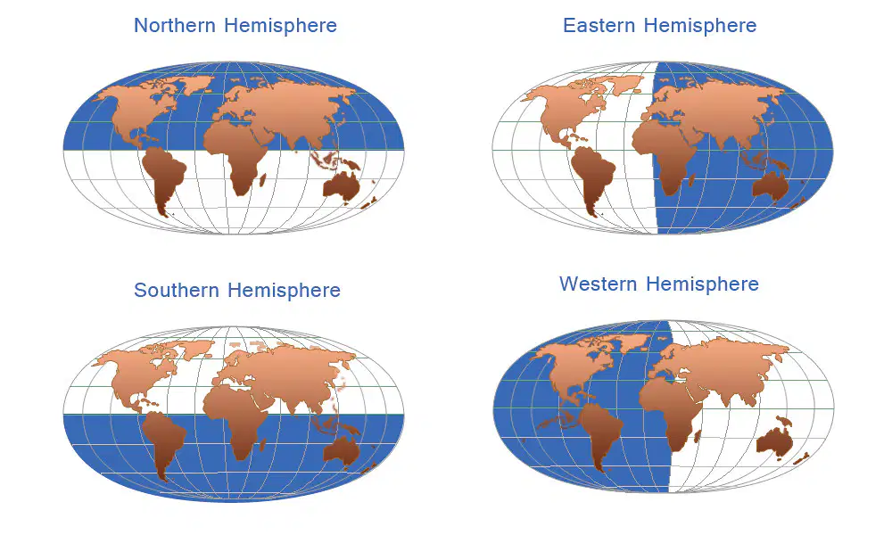
The lines of latitude and longitude segment the world map into hemispheres. South Carolina is located in which hemisphere? (highlighted in blue)
a)
Southern and Eastern Hemispheres
b)
Northern and Western Hemispheres
14.

What is this tool that cartographers use called?
a)
compass rose
b)
latitude
c)
camping compass
15.
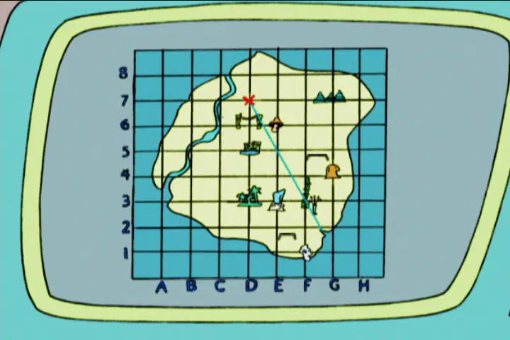
What is an Alphanumeric Grid?
a)
use letters to identify an absolute location
b)
use numbers to identify an absolute location
c)
use letters and numbers to identify an absolute location
16.
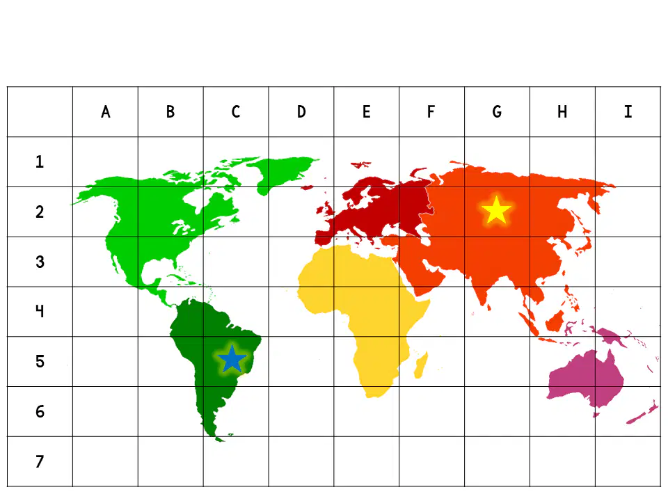
What are the alphanumeric grid coordinates for the yellow star?
a)
G3
b)
G6
c)
G2
d)
H2
17.
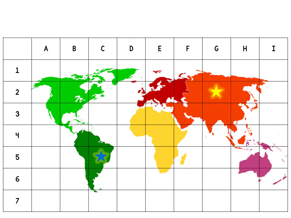
What are the alphanumeric grid coordinates for the BLUE star?
a)
C4
b)
C5
c)
C6
d)
B5
18.

What is a spatial hierarchy?
a)
A tool that cartographers use to create maps.
b)
A way to group things that are connected.
c)
The location of a place based on landmarks.
19.
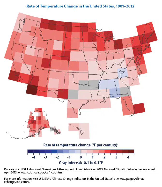
What type of map does the picture show?
a)
Political Map
b)
Resource Map
c)
Climate Map
20.

What type of map does this picture show?
a)
Physical Map
b)
Road Map
c)
Climate Map
100 %

