
 Worksheets
S.S. Topic 1 Geography: Vocabulary
Total questions: 13
Worksheet time: 7mins
Name
Class
Date
1.
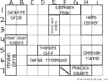
What is an alphanumeric grid on a map used for?
a)
Showing natural features
b)
Identifying communities and cultures
c)
Describing an absolute location
d)
Measuring distance
2.
Who is a cartographer?
a)
A person who studies climate
b)
A person who creates maps
c)
A navigator on a ship
d)
A weather forecaster
3.
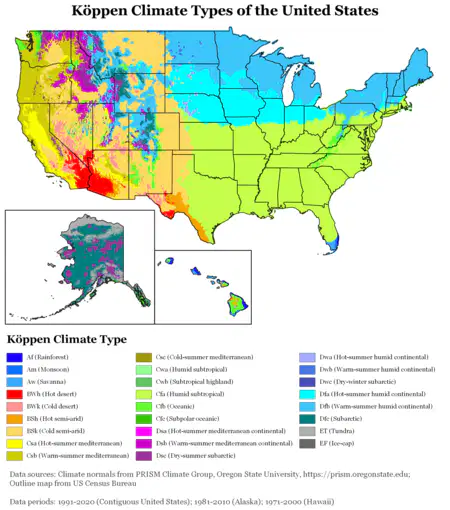
What do climate maps typically show?
a)
The borders of regions and cities
b)
Population distribution
c)
Whether a place is usually warm or cold and wet or dry
d)
Natural features of an area
4.

What does a compass rose on a map or globe symbolize?
a)
The number of continents
b)
The natural features of an area
c)
Cardinal and intermediate directions
d)
Cultural communities
5.

What is the main function of a legend or key on a map?
a)
Creating the map's title
b)
Explaining what the symbols and colors represent
c)
Determining scale
d)
Identifying the grid lines
6.
What is the Global Positioning System (GPS) used for?
a)
Creating physical maps
b)
Identifying cultural communities
c)
Taking specific measurements of locations on Earth
d)
Studying historical maps
7.
What is a physical map primarily used to display?
a)
Political borders
b)
Natural features of an area
c)
Population distribution
d)
Cultural communities
8.
What does a political map typically show?
a)
Climate patterns
b)
The natural environment
c)
Borders of regions, countries, and cities
d)
Historical landmarks
9.
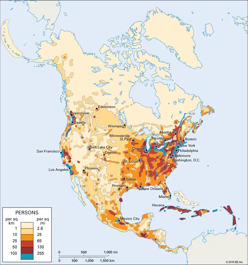
What is a population map used to illustrate?
a)
Climate patterns
b)
The distribution of communities and cultures
c)
The overall population within an area
d)
Historical events
10.
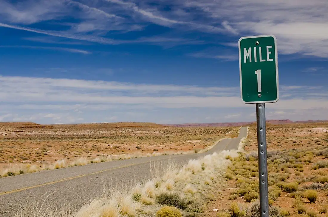
What is relative location in geography?
a)
Where a place is compared to something else
b)
The specific coordinates of a location
c)
The natural features of an area
d)
The study of geographic features
11.

What is the primary purpose of a scale on a map or globe?
a)
To identify cardinal directions
b)
To determine the elevation of a location
c)
To measure the distance between two places
d)
To describe the cultural communities in an area
12.
What does the term "spatial perspective" refer to in geography?
a)
The study of climate patterns in an area
b)
The analysis of historical maps and their accuracy
c)
The study of geographic features using various tools like maps, globes, and satellite images
d)
The examination of population distribution within a region
13.
Drawing of places around the world:
a)
alphanumeric grid
b)
gps
c)
cartographer
d)
map
100 %

