
 Worksheets
OSW 2 (Physical Characteristics of Ohio & US)
Total questions: 14
Worksheet time: 7mins
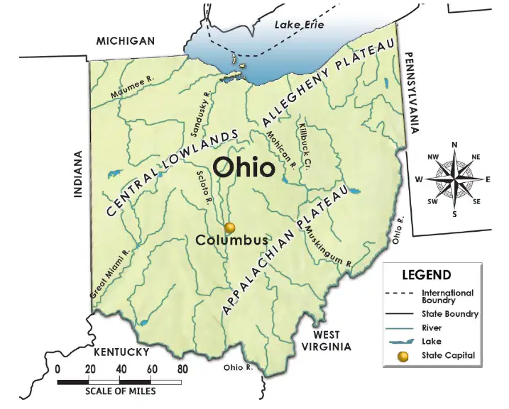
Lake Erie is located SOUTH of Ohio.
True
False

What is the RELATIVE LOCATION of the Mississippi River to the Rocky Mountains?
NORTH of the Rocky Mountains
SOUTH of the Rocky Mountains
EAST of the Rocky Mountains
What resource makes soil very good for growing crops?
plateaus
till
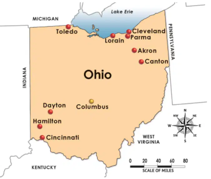
What is the RELATIVE LOCATION of Columbus?
SW of Cleveland
NE of Cleveland
N of Cleveland

This picture represents a ________.
river
mountain
rock arch
plateau

This picture represents a ________.
river
mountain
rock arch
plateau
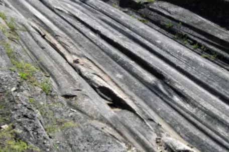
This picture represents ________.
river
mountain
glacial grooves
plateau
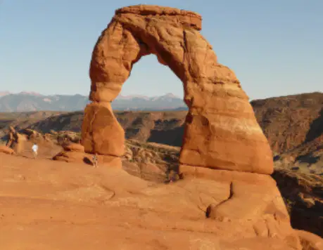
This picture represents a ________.
river
mountain
rock arch
plateau
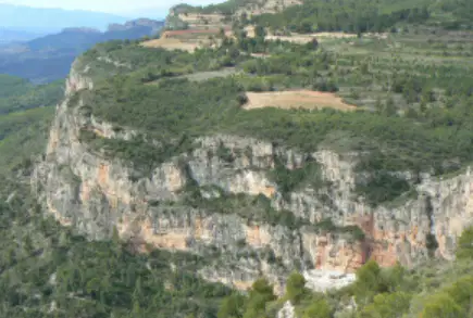
This picture represents a ________.
river
mountain
rock arch
plateau
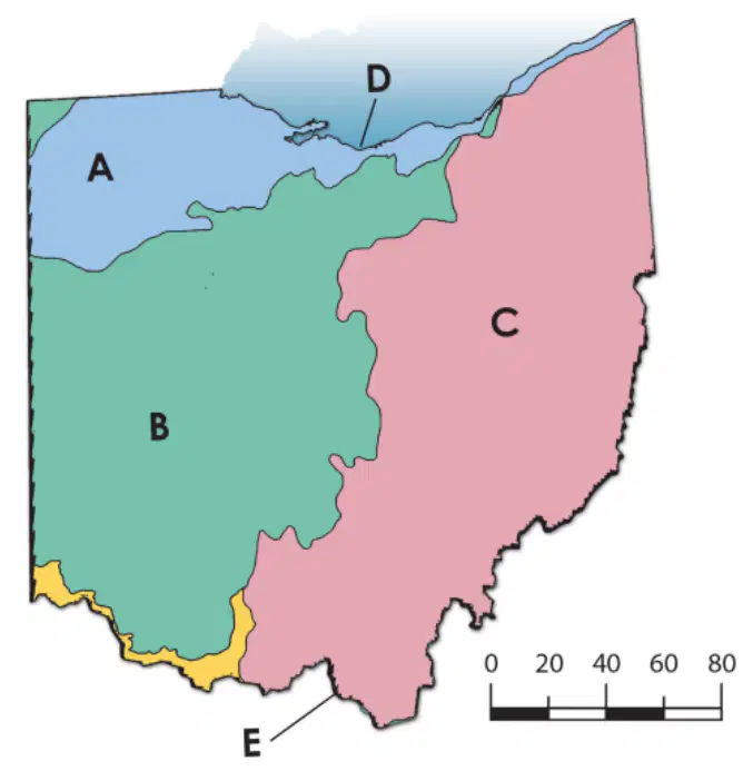
What is the the area labeled A in this map?
Ohio River
Lake Plains
Lake Erie Shoreline
Till Plains
What is the the area labeled B in this map?
Ohio River
Lake Plains
Lake Erie Shoreline
Till Plains
What is the the area labeled C in this map?
Ohio River
Appalachian Plateau
Lake Erie Shoreline
Till Plains
What is the the area labeled D in this map?
Ohio River
Appalachian Plateau
Lake Erie Shoreline
Till Plains
What is the the area labeled E in this map?
Ohio River
Appalachian Plateau
Lake Erie Shoreline
Till Plains

