
 Worksheets
Unit 1 Review
Total questions: 23
Worksheet time: 15mins
What is the cultural landscape?
The cultural practices and traditions of a particular group of people.
The combined works of nature and humans, representing the interaction between people and their environment.
The physical features of a region that have been shaped by human activity.
The study of how people interact with their environment.
What is the definition of region?
A region is a small town or village.
A region is a type of weather pattern.
A region is a specific time period in history.
A specific area or part of a larger area that is distinct from other areas.
What is the definition of globalization?
The definition of globalization is the increasing interconnectedness and interdependence among countries.
The definition of globalization is the promotion of nationalistic policies and self-sufficiency.
The definition of globalization is the process of isolating countries from each other.
The definition of globalization is the reduction of international trade and cultural exchange.
What is the definition of functional region?
A functional region is a geographic area that is defined by its physical characteristics.
A functional region is a geographic area that is defined by its political boundaries.
A functional region is a geographic area that is defined by a specific function or purpose.
A functional region is a geographic area that is defined by its population density.
What is the definition of formal region?
A formal region is a geographic area that is defined by a common characteristic.
A formal region is a geographic area that is defined by its physical features.
A formal region is a geographic area that is defined by its political boundaries.
A formal region is a geographic area that is defined by its climate.
What is the definition of vernacular (perceptual) region?
A vernacular (perceptual) region is a region that is defined by its physical characteristics and natural boundaries.
A vernacular (perceptual) region is a region that is defined by people's perception or subjective feelings about an area, rather than by objective data or boundaries.
A vernacular (perceptual) region is a region that is defined by its economic activities and industries.
A vernacular (perceptual) region is a region that is defined by its political boundaries and government structure.
What are the three types of regions?
Human, formal, and regional.
Absolute, relative, and functional.
Physical, human, and cultural.
Formal, functional, and perceptual.
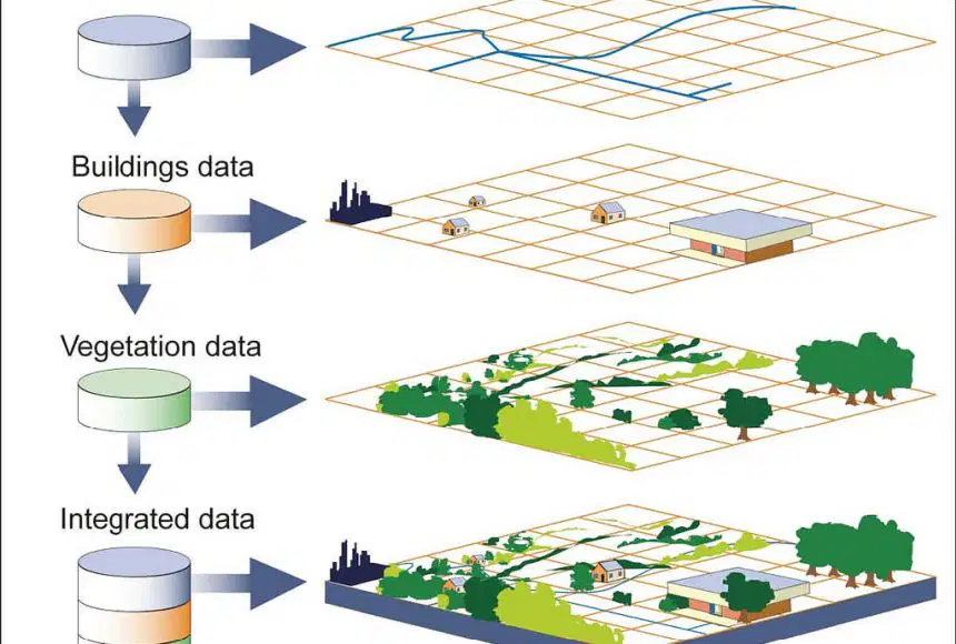
remote sensing
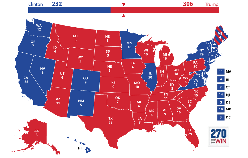
This is a thematic map. How can we tell?
It shows all of the states.
It shows elevation.
It shows specialized information like election results.
It does not show latitude and longitude.
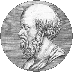
Known as the "father of geography", he was the first to calculate the circumference of the Earth nearly 2,000 years ago.
Strabo
Eratosthenes
Ptolemy
Herodutus
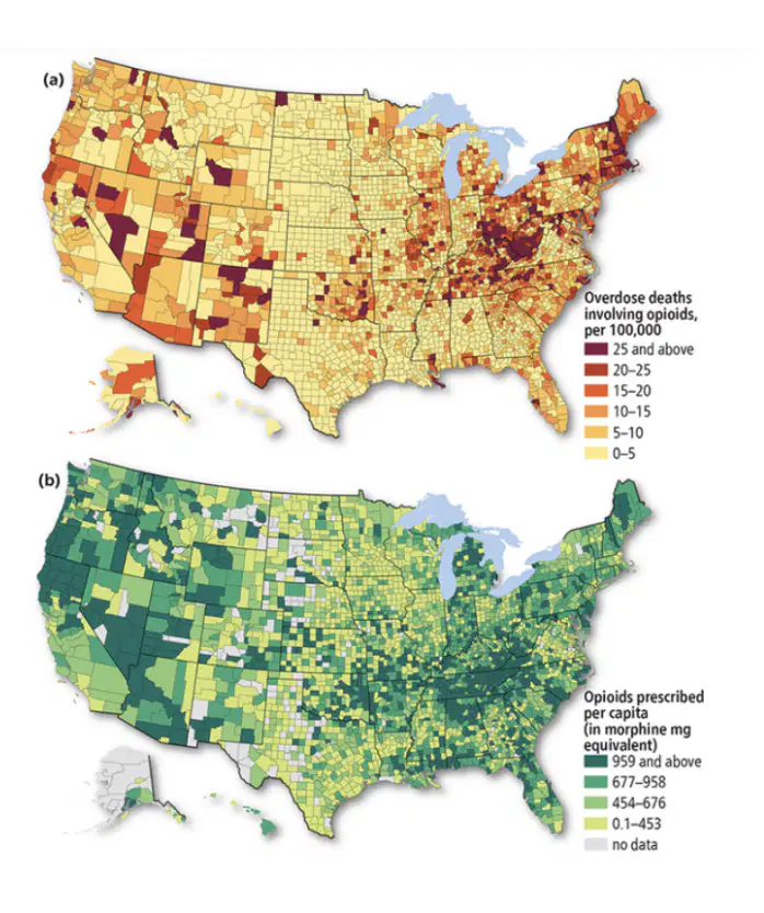
The image to the left shows number of opioid prescriptions written (green map) and the number of opioid deaths (red map) in the US. Using maps to identify this relationship of data is a __.
globalization example
perceptual region
relative scale
spatial association

Among the first uses of ___ was the mapping of the cholera epidemic of 1854 in London, England by Dr. John Snow. It helped determine the source and spread of the disease.
Snapmaps
GPS
GIS
Remote Sensing

The visual example and explanation here is of a ___.
Perceptual (vernacular) region
Formal region
Functional region
reference, or general purpose, map
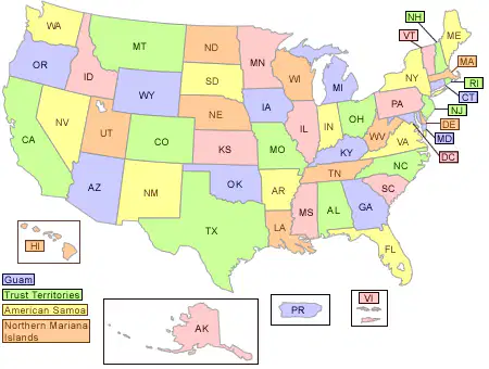
The image here best represents __.
Perceptual (vernacular) regions
Formal regions
Functional regions
Administrative regions

This image here of the primary airport hubs in the United States would be an example of __.
Perceptual (vernacular) regions
Formal regions
Functional regions
Administrative regions
Which of the following is correct about the concept of scale in geography?
Geographers understand how a characteristic is seen at a local, regional, national, and even global scale -- such as poverty.
The scale tool on a map can be shown in units, ratios, or fractions
Map scale is used to show distance on a map compared to distance on the Earth
All of these are correct about scale
Maps can be __ or __ depending on what cartographers are trying to show.
Thematic or Reference
Absolute or Relative
Formal or Functional
Remote Sensing or GIS

This type of map showing corn production in the US would be a __.
Isoline Map
Chloropleth Map
Cartogram
Dot Density Map
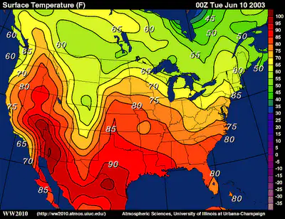
What is an Isoline map ? what does it show on map?
A map that shows various of data sets, such as elevation, temperature, or atmospheric pressure.
The isoline map helps readers to recognize geographical patterns and realtionships.
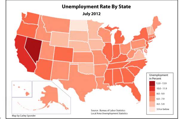
What a Choropleth map? what does it show on a map?
A Choropleth map uses different shading,cloring, or the placing of symbols within predefined areas to indicate the average values of a property or quantity in those areas.
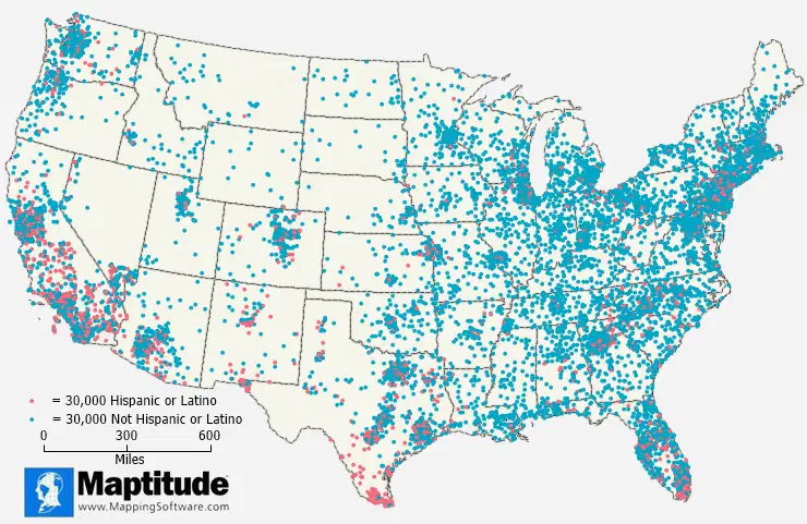
What a dot distribution Map ? What does it show on a map ?
A dot distribution map is a type of thematic map that uses dots to represent the density of a particular phenomenon or a variable across a geographic area.
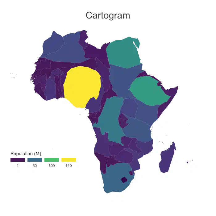
What a cartogram map? What does show on a map
a thematic map of a set of features (countries, provinces, etc.), in which their geographic size is altered to be directly proportional to a selected variable, such as travel time, population, or Gross National Product.
Locations compose of three characteristics ?
Situation - The location of a place relative to other places. Absolute Location describes the position of a place in a way that never changes, such as geographic coordinates.
Toponym(Place Names) A name given to a place on earth
Site Physical Character of a place, such as climate, water sources, topography, soil, vegetation, latitude, and elevation.

