
NEW
Font size
 Worksheets
Washington Geography Quiz
Total questions: 40
Worksheet time: 40mins

What was the name, of the water source, that created the mega floods?
Lake Missoula
Spokane River
Pacific Ocean
Columbia River

The ring of volcanoes around the Pacific Ocean are called what?
Pacific Circle
Ring of Fire
Volcano Alley
Pacific Tectonic Region

What causes earthquakes?
Too much greenhouse gas in the atmosphere
Ice dams and Megafloods
Movement of tectonic plates
I do. I cause earthquakes when I look at my Social Studies grade.

How were the Scablands created?
The Columbia River slowly carved out this unique landscape over several millennia of erosion
The area was hit by several meteors about 15,000 years ago
A giant ice dam burst, and let loose an enormous lake. The flood was so strong and so fast, it created the Scablands in a very short period
Prehistoric Native tribes placed the giant boulders. The Scablands is the Stonehenge of North America

Lava flowing out of fissures in the earth, and spreading out over 100 miles, created the. . .
Scablands
Columbia Plateau
Rocky Mountains
San Juan Islands

Forks, WA is very wet - averaging 78 inches of rain/year. Port Angeles (only 50 miles away) averages just 25 inches a year. What explains this difference?
The Rain Shadow Effect
Vampires and Werewolves must live in a rainy climate
The Umbrella Effect
Fissures in the Tectonic Plates

What is a strait?
a large body of water that connects two bodies of water
a large body of water that is surrounded by land
a small body of water that flows rapidly
a body of water where ships dock
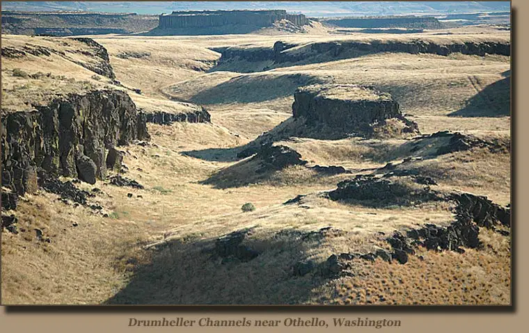
A plateau is...
a large valley
a large steep area of land
a large flat area of land that rises above other land
a mountainous area in Washington

Coastal Region
Puget Sound
Wenatchee
Blue Mountain Range

Western (Puget Sound) Lowlands
Columbia Plateau
Coastal Region
Cascade Region

Strait of Juan de Fuca
Cascade Mountain Range
Columbia Plateau
Rocky Mountain Region

Cascade Region
Yakima River
Olympic Mountain Range
Puget Sound Lowlands

Coastal Region
Columbia Plateau
Puget Sound
Okanogan Region

Columbia River
Yakima River
Snake River
Spokane River

Columbia River
Snake River
Yakima River
Spokane River

When one side of the mountain is dry and does not receive the rain and wind the ocean side gets, it is called the ______________________________
rainshadow effect
shadow box
wind shield
sheild effect

What does the star represent?
Seattle
Olympia
Tacoma
Pacific Ocean

Winds from the ocean give Western, Washington what type of climate?
Cold
snowy
temperate or mild
hot


Western (Puget Sound) Lowlands


This region is also sometimes called "The Rocky Mountain region"
Okanongan Region

Region in Eastern, Washington that is semi-arid climate and is known for its agriculture (apples, grapes, wheat, etc.)?
Western Lowlands Region

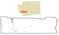
Which region do we live in?
Coast
Cascade Mountains
Western (Puget Sound) Lowlands
Columbia Plateau

An area of massive granite boulders, huge Dry Falls, and great potholes is called the
The Scablands
The Palouse
The Columbia River Gorge
The Scarlands
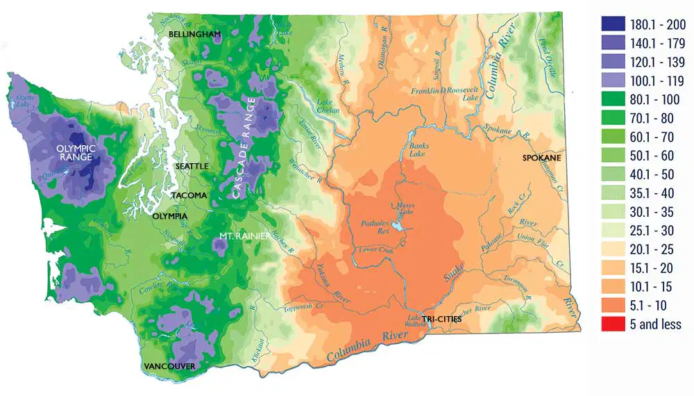
Which side of the Cascade Mountains gets the most rain?
west
north
east
south

_______________ is formed when molten lava, originating from the Earth's mantle, rapidly cools and solidifies on the Earth's surface. (You can find it in Eastern, Washington.)
Basalt
Limestone
Chalk
Marble
What is one reason why Washington State's geography is important?
It has the most rivers in the United States.
It shapes how people live and work.
It is the largest state in the United States.
It has the most wildlife in the United States.

Which region in Washington is known for its flat land, mild climate, and access to water, making it home to the state's largest cities?
Cascade Mountains
Western (Puget Sound) Lowlands
Columbia Plateau
Okanogan Highlands
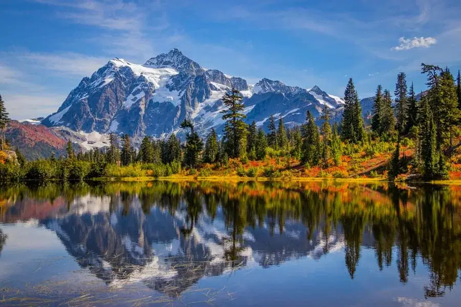
What activities are popular in the Cascade Mountains due to their tall, snow-covered peaks?
Fishing and boating
Hiking, skiing, and climbing
Farming and ranching
Shopping and dining
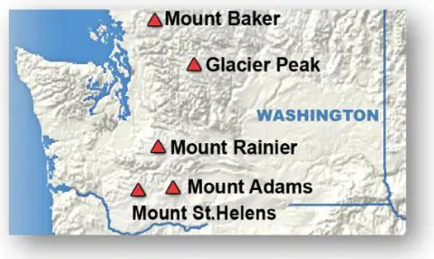
What is the significance of the Cascade Mountains in terms of weather and recreational activities?
They provide opportunities for fishing and boating.
They influence the weather and offer hiking, skiing, and exploring volcanoes.
They are known for farming and agriculture.
They are a hub for technology and trade.
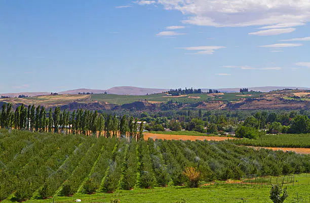
What is one of the main benefits of the Columbia River in Washington State?
It provides a natural border with Canada.
It supports industries such as fishing, irrigation, and energy.
It is the longest river in the United States.
It is a major tourist attraction for its beaches.

How do the Cascade Mountains affect the climate in Washington State?
They create a "rain shadow" effect, making the west side wetter.
They block all precipitation from reaching the state.
They cause frequent earthquakes in the region.
They make the entire state much colder.
Which area in Washington State is known for supporting one of the largest agricultural regions in the nation?
Puget Sound
Okanogan Highlands
Columbia Plateau
Pacific Coastline

In what region of Washington do most people live in?
Coastal Region
Puget Sound Lowland
Cascade Range
Okanogan Highlands
Columbia Plateau
What happens to the air as it rises over the mountains in the rainshadow effect?
The air becomes warmer and more humid.
The air cools and drops water vapor as precipitation.
The air flows faster and creates strong winds.
The air becomes drier and loses moisture.
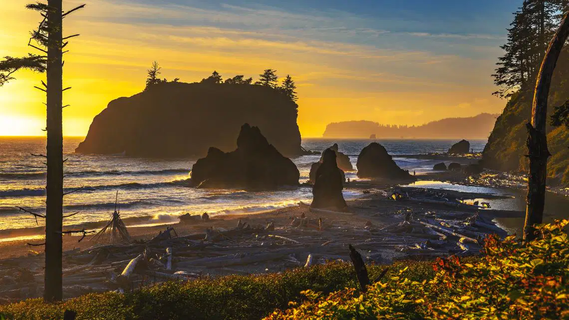
In what region would you find the ocean and beaches?
Columbia Plateau
Coastal Range
Cascade Mountains
Rocky Mountains
Which of the following is a significant fault located under a major Washington city?
Lake Chelan fault
Satsop fault
Seattle fault
Des Moines fault

What geological event is associated with the Cascadia Subduction Zone?
Tornadoes
Earthquakes
Hurricanes
Tsunamis

