
 Worksheets
S1 G S1
Total questions: 66
Worksheet time: 2hrs 36mins
The study of places on earth and the relationships between people and their environments
location
geography
place
describes what a place looks like by describing the landforms and man made buildings
location
place
region
human environment interaction
Which of the following are examples of a physical feature? (check all that apply)
bridges
mountains
deserts
buildings
oceans
Which of the following are examples of human features? (select all that apply)
roads
bridges
plants
rivers
buildings
describes how humans interact with the environment
place
regions
human environment interaction
movement
describes how people, goods, and ideas move throughout the area
movement
transportation
region
location
describes what the area has in common - religion, landforms, weather
place
region
location
human environment interaction

Which theme answer the question "Where is it?"
Human Environment Interaction
Place
Location
Region
Which planet is furthest from the sun?
Pluto
Neptune
Uranus
Jupiter
What is the length of Earth's period of revolution?
24 hours
30 - 31 days
365.25 days
6 months
How long is Earth's period of rotation?
60 minutes
365.25 days
30 - 31 days
24 hours
True or false: Earth's distance from the Sun is responsible for the seasons.
True
False


What season would be experienced in the Northern Hemisphere?
Summer
Winter
Spring
Fall
What effect would the season in the Northern Hemisphere have on the length of daytime?
Longer daytime
Shorter daytime
Equal daytime and nightime
Double daytime
What season would be experienced in the Southern Hemisphere?
Summer
Winter
Spring
Fall
Why is the Earth hotter in the Summer?
It is closer to the sun
It is tilted towards the sun
the sun is hotter during summer
The moon reflects more light during the summer
Physical Map


Political map


What is a compass?
name of a map
shows meaning of symbols on map
shows directions
What are the four cardinal directions?
North, South, Windy, Sunny
Never Eat Slimy Worms
North, South, East, West
South Never Eat West
The horizontal lines in a grid are known as...
Eastings
Northings
What are the reference numbers that appear first in a grid reference?
Northings
Eastlings
Northlings
Eastings

what is the four digit grid reference for the Hospital?
4319
1943
1843
4320

What is the six figure grid reference for the train station?
180 440
181 444
183 445
180 443
All lakes, rivers, oceans, and seas belong to the hydrosphere.
True
False
All plants, rocks, grass, and caves belong to the geosphere.
True
False

Select all the spheres that you see in the image.
Hydrosphere
Cryosphere
Atmosphere
Biosphere
Geosphere
Bubbles of air in a glass of water.
Atmosphere and hydrosphere.
Cryosphere and atmosphere.
Geosphere and biosphere.

Geosphere and biosphere.
Hydrosphere and cryosphere.
Biosphere and atmosphere.

The animals that live in land and water are part of __________.
atmosphere
hydrosphere
biosphere
geosphere

When plants use their roots to get water from the ground, which 2 spheres are interacting? (choose 2)
Geosphere
Hydrosphere
Atmosphere
Biosphere
The tropic of capricon is located at
201/2° S
20 1/2 ° N
23 1/2 ° S
23 1/2 ° N
The 0° meredian is also known as
Pole
Equtar
Prime Meridian
The Tropic of capricorn is located at
23 1/2° N
23 1/2° S
82 1/2° E
82 1/2° W
The Antarctic circle is located are
the Northern hemisphere
the Sourthern hemisphere
the Eastern hemisphere
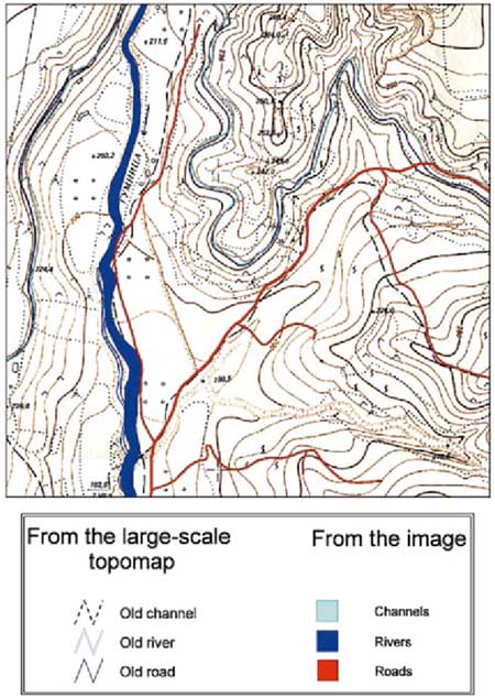
This map is an example of a . . .
Geologic Map
3D Map
Projection Map
Topographic Map
Which one is a road map?


What type of map is this?
Climate
Political
Topological
Physical

What is the elevation of Point B?
(a)
What is the contour interval for this map?
(a)

What landform is being represented in the topographic map above?
a mountain with one peak
two craters
a mountain with two peaks
a steep cliff over looking a river valley

What type of image is it?
aerial photograph
Landscape photograph
satellite image
Choose the wrong information about this photograph.
is taken from a height.
provides us with a bird's eye view of an area.
shows a big area.
helps to estimate the size of an area.
is used to study a feature in detail.

What type of image is it?
aerial photograph
Landscape photograph
satellite image
Choose the wrong information about this photograph.
is taken at the ground level.
shows a big picture of an area.
shows the main physical or human features.
is used to study a feature in detail.
is taken from a height.

What type of image is it?
aerial photograph
Landscape photograph
satellite image

