
Font size
 Worksheets
China Geography Review
Total questions: 18
Worksheet time: 10mins
Which of these are deserts that can be found in China? (Select ALL correct answers)
The Gobi
The Sahara
The Yellow Desert
The Taklamakan
Which of these is NOT a mountain range that can be found in China?
The Himalaya
The Alps
The Pamir
The Tian Shan
Identify ALL the bodies of water that isolate China from other parts of the world:
Indian Ocean
Pacific Ocean
East China Sea
Yellow Sea
What is the Chinese name for the Yellow River?
Yangtze
Chang Jiang
Huang He
Himalaya
This river is the 3rd longest in the world and maintains a relatively predictable course providing a useful transportation network as it flows through the south of China.
Yangtze/Chang Jiang
Huang He/Yellow
Yahtzee/Yellow
Yangtze/Two Chains
What is the name of the large, fertile area located between the Huang He and Chang Jiang rivers where most Chinese cultures developed?
North China Plain
South China Plain
East China Plain
West China Plain
The Yellow River can be limiting to human activity because of:
an unpredictable course and deadly floods
large amounts of fertile silt deposited along its banks
it dries up often and leaves people without water
it restricts the ability of people to communicate easily
Fine, fertile soil deposited by rivers is known as:
silk
still
silt
clay
A time period of great economic, cultural, and scientific advancement in a society may be known as a:
Golden Parachute
Golden Age
Golden Oldie
Golden Doodle
A sequence of family members that rule a country for a period of time is called a:
dynasty
dynamic
kingdom
empire
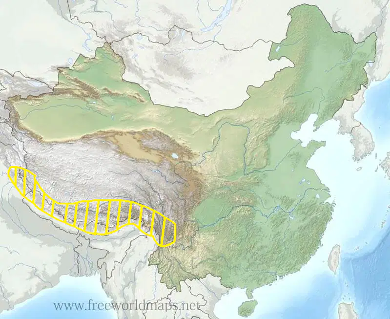
Identify the physical feature of China highlighted on this map.
The North China Plain
The Gobi
The Himalayas
The East China Sea

Identify the physical feature of China highlighted on this map.
Yellow River
Yangtze River
Nile River
Huang He River
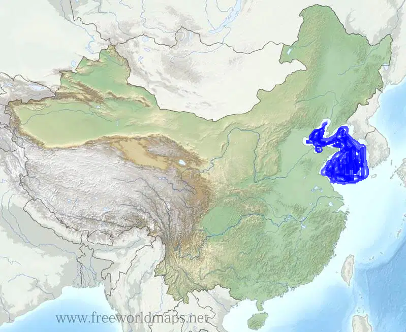
Identify the physical feature of China highlighted on this map.
East China Sea
Pacific Ocean
Yellow River
Yellow Sea

Identify the physical feature of China highlighted on this map.
Chang Jiang River
North China Plain
Beijing River
Huang He River
Select ALL the reasons for Buddhism's spread.
Burning Buddhist texts and temples in a campaign against Buddhism
Wealthy people donating land and money to Buddhist temples
Buddhist missionaries spreading the religion to other lands
People taking comfort from Buddhist teachings during the period of disunion
The period from 220-548 A.D. when China had no central authority after the fall of the Han Dynasty is called what?
The Period of Unity
The Period of Disunion
The Age of Aquarius
The Period of Reunification
Which of the following did the Sui Dynasty construct after reunifying China?
The Great Wall
Grand Central Station
The Tibetan Plateau
The Grand Canal
Why is the Tang Dynasty period considered to be the “Golden Age of China”?
Chinese culture thrived during this time period.
The country had strong leadership and there was relative peace in the country during this time period.
The legal system was improved with a new set of laws during this time period.
All of these led to a “Golden Age of China” during the Tang dynasty period.

