
 Worksheets
Pre-AICE Rivers, Coasts, and severe weather Review
Total questions: 51
Worksheet time: 28mins
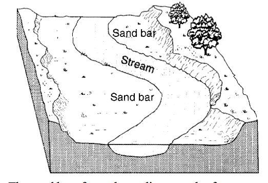
The sand bar formed as a direct result of
(SID)
erosion due to a decrease in stream velocity
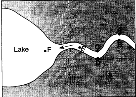
At which locations is the amount of deposition greater than the amount of erosion?
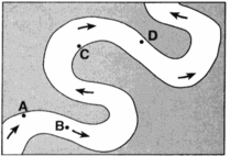
Where is the greatest amount of deposition?
Look for SID
What is a bend of a river?
Meander
Erosion
Water on the inner bend of a river is ___. (SID)
Faster
Wetter
Slower
Water on the inner bend is slower, causing the ____ of sediments
Erosion
Deposition

What is this landform?

Which letter has a higher velocity? (faster) FOE
A
B

What is this?
Oxbow Lake
Tributary
Which graph best represents the relationship between the discharge of a stream and the velocity of stream flow?


Which letter is there more deposition occurring?
A
B

Which letter has the lowest velocity?
A
B

Which letter has the most erosion occurring?
A
B
What settles faster?
Flat sediments
low density sediments
larger particles
What type of particles get deposited first?
small
big / heavy
flat
light
When the stream velocity decreases there will be more __________
deposition
erosion

What kind of river produces meanders like the ones in the image?
Young
Old

The most influential force that shapes the shoreline is
wave action
human activity
wind
currents

All of the following are features of an erosional coast except
sea cliff
sea caves
arches
dunes

A current moving parallel to shore is called a
longshore current
riptide
dune
upwelling

A steep narrow beach most likely indicates
high energy waves are common
low energy waves are common
a depositional coast
a typical east coast beach

A longshore current is created by
high tides
sharks
waves approaching at an angle to shore
cyclones
Oceanographers classify coasts as
fun or lame
water temperature
the physical processes at work (deposition or erosion)
republican or democrat

Types of estuaries include
a salt wedge estuary
a well mixed estuary
a partially mixed estuary
all of the above

With a ................................... wave, the swash is stronger than the backwash.
destructive
constructive
swash
backwash

With a ................................... wave, the backwash is stronger than the swash.
destructive
constructive
swash
backwash


What is this type of wave?
Constructive wave
Destructive wave

What is this type of wave?
Coast building - constructive
Coast destroying - destructive
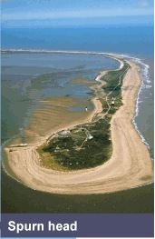
Identify this coastal landform.
Spit
Tombolo
Headland
Sandbar
Which of these is created by deposition?
cave
Sea stack
bay
beach
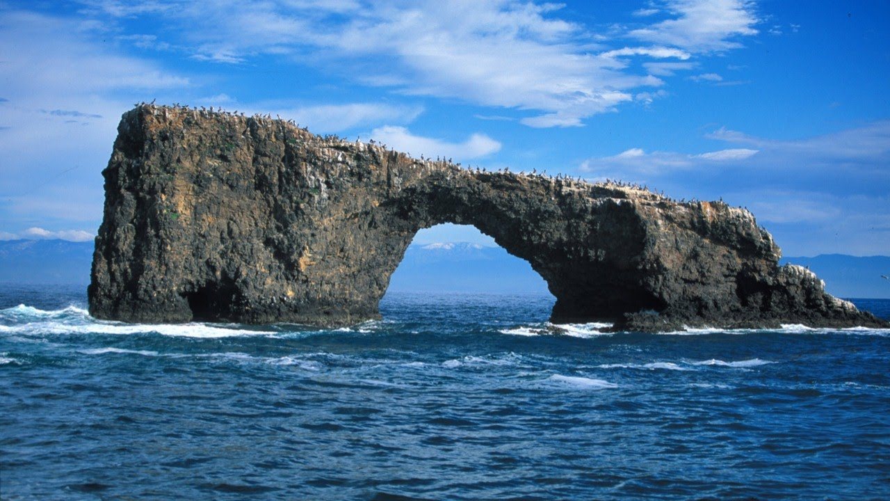
Identify the landform.
Sea arch
Tombolo
Sea Stack
Stump
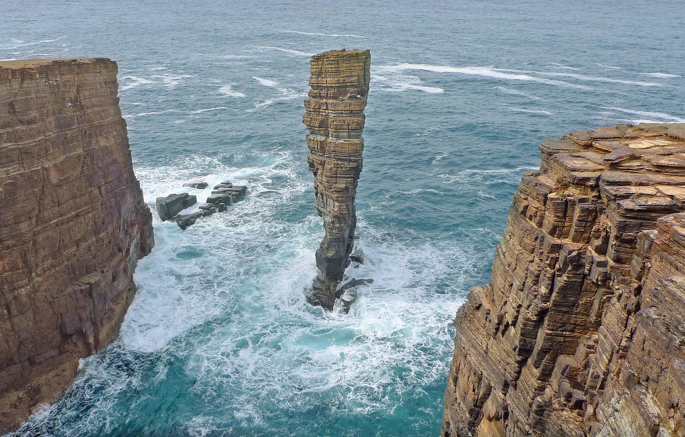
Identify the landform type.
Sea Stack
Sea Stump
Arch
Bay
Bays are created by:
Deposition
Erosion
Weathering
Transportation
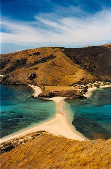
Identify the landform type.
Sand Bar
Tombolo
Spit
Peninsula
What is the calm center of a hurricane called?
funnel cloud
downburst
eyewall
eye
The major difference between a tropical storm and a hurricane is __________.
rainfall amounts
wind speed
air temperature
What is the strongest category of hurricane?

What social reasons make some places more vulnerable to tropical storms than others?
Poor quality infrastructure
Poor healthcare
No flood defences
Access to education
What does the Saffir-Simpson Hurricane Scale use to determine a hurricane's category?
Rain
Wind speed
Size
True or False
The edge of the eye, called the "eye wall" has the storms worst winds and rain.
True
False

