
 Worksheets
Social 3 Review
Total questions: 52
Worksheet time: 38mins

_______ are small spheres that show the Earth on a small scale.
Globes
Axis
Map
The Equater
(a) are small spheres that show the Earth on a small scale.

_______ are flat pictures that show parts of the Earth's surface.
Globes
Axis
Maps
The Equater
(a) are flat pictures that show parts of the Earth's surface.
_______ are people who make maps.
Globes
Axis
Maps
Cartographers
(a) are people who make maps.

_______ is the point on Earth that is the farthest south.
The South Pole
The North Pole
The Equator
The Axis
(a) is the point on Earth that is the farthest south.
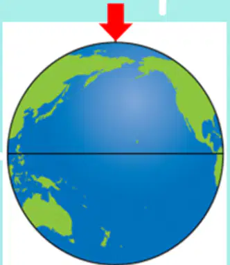
_______ is the point on Earth that is the farthest north.
The South Pole
The North Pole
The Equator
The Axis
(a) is the point on Earth that is the farthest north.

_______ is an imaginary line that divides the Earth into two halves: The Northern Hemisphere and The Southern Hemisphere.
The South Pole
The North Pole
The Equator
The Axis
(a) is an imaginary line that divides the Earth into two halves: The Northern Hemisphere and The Southern Hemisphere.

The Earth spins on an imaginary _______.
map
pole
equator
axis
The Earth spins on an imaginary (a) .
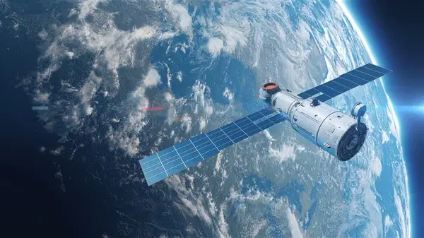
_______ take photos of the Earth from the space. These photos show exact shape of the land and the oceans.
Maps
Cartographers
Artificial satellites
Axis
(a) take photos of the Earth from the space. These photos show exact shape of the land and the oceans.

Today everyone knows that the Earth is _______.
flat
round
cube
square
Today everyone knows that the shape of the Earth is (a) .

In the past, people thought our planet was a _______ surface.
flat
round
cube
square
In the past, people thought our planet was a (a) surface.
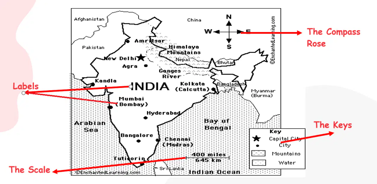
This is a text on the map. The text tells us the names of the places.
The compass rose
labels
The keys
The scale
This is a text on the map. The text tells us the names of the places.
(a)
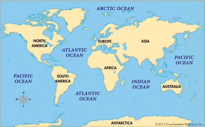
_____ are very large areas of salt water. They cover most of the Earth's surface, and they are connected.
Mountains
Oceans
Rivers
Lakes
(a) are very large areas of salt water. They cover most of the Earth's surface, and they are connected.
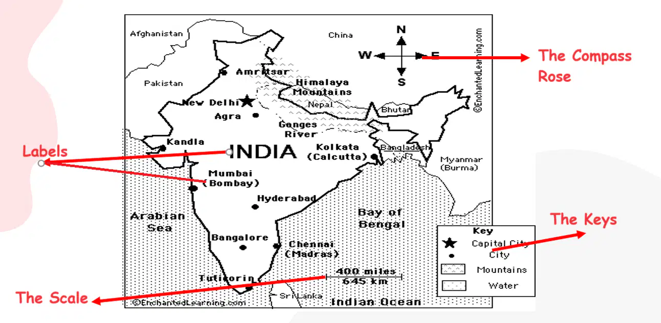
A map shows the four points of the compass (North, South, West, East) with their initials N, S, W, and E. It helps us to find different places.
The compass rose
labels
The keys
The scale
A map shows the four points of the compass (North, South, West, East) with their initials N, S, W, and E. It helps us to find different places.
(a)

This is the box that explains the symbols and colors on the map.
The compass rose
labels
The keys
The scale
This is the box that explains the symbols and colors on the map.
(a)

This is a line with numbers. The numbers on the right show how many times the real distance is reduced on the map.
The compass rose
labels
The keys
The scale
This is a line with numbers. The numbers on the right show how many times the real distance is reduced on the map.
(a)
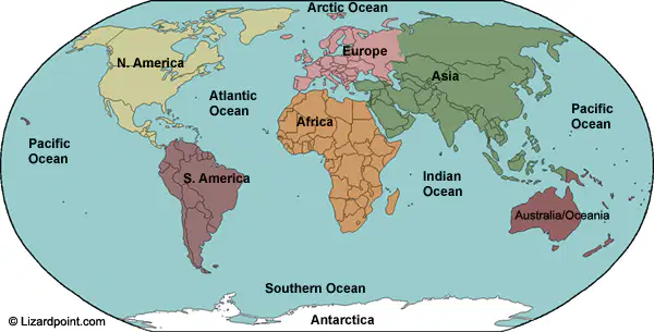
_______ is the largest of the oceans covering around one third of the Earth's surface.
The Pacific Ocean
The Atlantic Ocean
The Indian Ocean
The Artic Ocean
(a) is the largest of the oceans covering around one third of the Earth's surface.
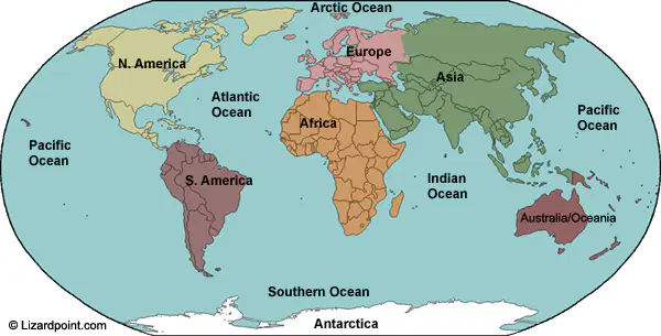
_______ is the world's second-largest ocean. It separates Europe and Africa from North and South America.
The Pacific Ocean
The Atlantic Ocean
The Indian Ocean
The Artic Ocean
(a) is the world's second-largest ocean. It separates Europe and Africa from North and South America.

___________ is the third largest ocean in the world. It lies south of Asia, and India, and separates East Africa from Australia. It is the warmest ocean in the world.
The Pacific Ocean
The Atlantic Ocean
The Indian Ocean
The Artic Ocean
(a) is the third largest ocean in the world. It lies south of Asia, and India, and separates East Africa from Australia. It is the warmest ocean in the world.
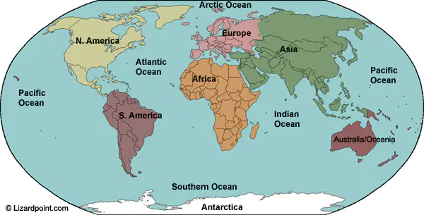
___________ is in the northern part of the Earth, primarily around the North Pole. It is the smallest and shallowest of the world's oceans.
The Pacific Ocean
The Atlantic Ocean
The Indian Ocean
The Artic Ocean
(a) is in the northern part of the Earth, primarily around the North Pole. It is the smallest and shallowest of the world's oceans.
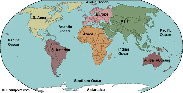
The Southern Ocean (__________) is the fourth largest, or second smallest of the oceans. It sits at the South Pole and the southern part of the Earth.
The Pacific Ocean
The Atlantic Ocean
Antarctic Ocean
The Artic Ocean
The Southern Ocean ( (a) ) is the fourth largest, or second smallest of the oceans. It sits at the South Pole and the southern part of the Earth.

________are large areas of land that rise out of the oceans. They take up a quarter of the Earth's surface.
Continents
Oceans
Mountains
Rivers
(a) are large areas of land that rise out of the oceans. They take up a quarter of the Earth's surface.

According to National Geographic, there are seven _______: Asia, North America, South America, Africa, Europe, Oceania and Antarctica.
Continents
Oceans
Mountains
Rivers
According to National Geographic, there are seven (a) : Asia, North America, South America, Africa, Europe, Oceania and Antarctica.

________ is the third-largest continent. The continent includes the enormous island of Greenland in the northeast.
South America
North America
Europe
Asia

________ is the fourth-largest continent and extends from the sunny beaches of the Caribbean Sea to the frigid waters near the Antarctic Circle.
South America
North America
Europe
Asia
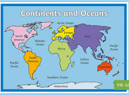
________ is the sixth-largest continent, contains just 7 percent of the world's land.
South America
North America
Europe
Asia
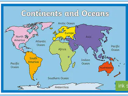
________ is the largest continent, stretches from the eastern Mediterranean Sea to the western Pacific Ocean.
South America
North America
Europe
Asia

________ the second-largest continent, covers an area more than three times that of the United States.
Africa
North America
Europe
Asia

__________ is the windiest, driest, and iciest place on Earth. It is larger than Europe or Australia, but unlike those continents, it has no permanent population. People who work there are scientific researchers and support staff, such as pilots and cooks.
Africa
North America
Europe
Antarctica
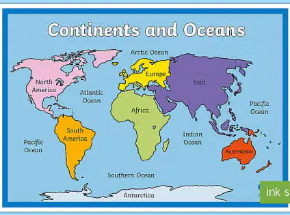
_________ is the smallest continent. It is the flattest and the second-driest continent, after Antarctica. It is also called Oceania and includes the thousands of tiny islands of the Central Pacific and South Pacific, most notably Melanesia, Micronesia, and Polynesia
(including the U.S. state of Hawaii).
Africa
Australia
Europe
Antarctica
(a) are small spheres that show the Earth on a small scale.

