
 Worksheets
Topography & Geological Dating
Total questions: 12
Worksheet time: 1hrs 25mins
Match the following:
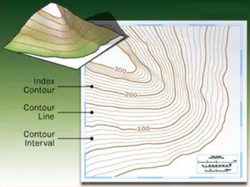
a map that uses contour lines to depict variations in elevation across a landscape
Topographic Map
lines on a topographic map of equal elevation
Contour Line
the change in elevation between adjacent contour lines;
stays constant for the whole map.
Contour Interval
Contour Lines that are marked with their elevation.
Usually in bold.
Index Contour
Match the following:
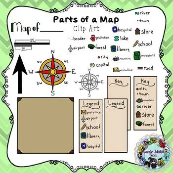
Shows the symbols used on a map and their meanings
Legend/Key
Helps determine direction
Compass
Used to determine
distances on a map.
For example
1 in = 100 km
Scale

Match the following
Side view of a topographic map. Helps visualize peaks, valleys, steepness.
Profile View
The distance above Sea Level for a point
Elevation
Measures how quickly or slowly elevation changes over an area
Slope or Gradient
Max – Min:
The difference in elevation between the highest and lowest points on a map.
Relief

In which direction is Mill River flowing?
The green V/U lines are a valley

Which direction is Up-Stream?
(alway opposite direction of the river)

Match the following terms for dating layers
Compares layers that are next to each other to determine age
Relative dating
Uses methods and instruments to measure more accurate age of layers
Absolute dating
Law or Idea that says:
younger layers are found above older layers.
Principle of Superposition
Commonly found fossils from known time periods. Useful to help date layers.
Index Fossils

Match the following
Lava flow outside or above the Earth's surface affects layers
EXtrusion
Lava flow inside or below the Earth's surface affects layers
INtrusion
Layers have moved around. Causes problems with relative dating.
Faults & Folds
When we find erosion, changes or gaps to layers, these are called:
Unconformities
When the V (or U shapes) of contour lines
point toward the hills/peaks, they are called?
valleys
ridges
When the V (or U shapes) of contour lines
point away the hills/peaks, they are called?
valleys
ridges

Calculate the contour interval for the map
100
200
500
10
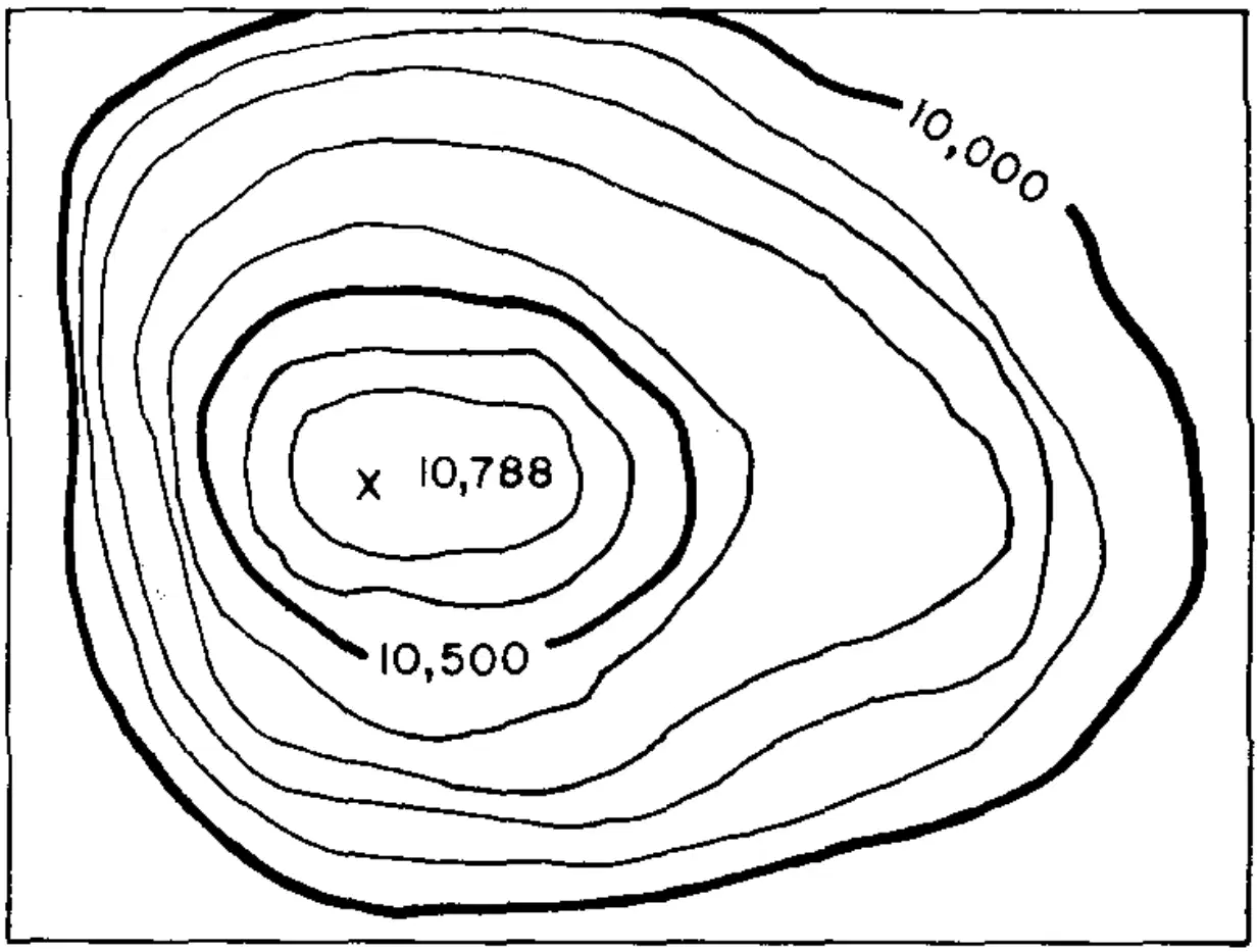
Which contour lines are Index Contours?
***SELECT ALL***
*** THERE ARE TWO***
10,000
10,500
10,788
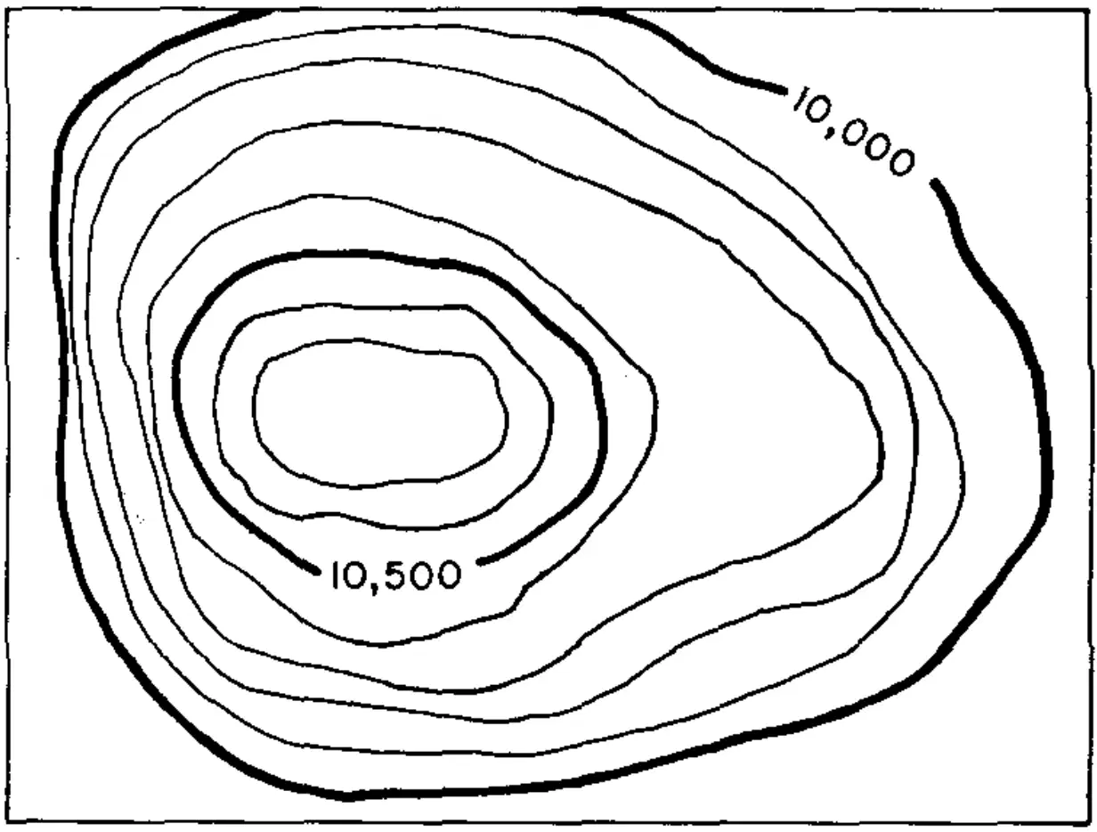
Calculate the highest possible
elevation on this map.
The contour interval is 100.
10,500 + 100 – 1 =
10,599
10,600 + 100 – 1 =
10,699
10,700 + 100 – 1 =
10,799

