
 Worksheets
Longitude & Latitude Geography Retrieval Quiz Yr4 Trinity
Total questions: 20
Worksheet time: 10mins
The earth can be divided in a northern and southern part. What are the two parts called?
Halfspere.
Hemisphere.
I'm not sure.
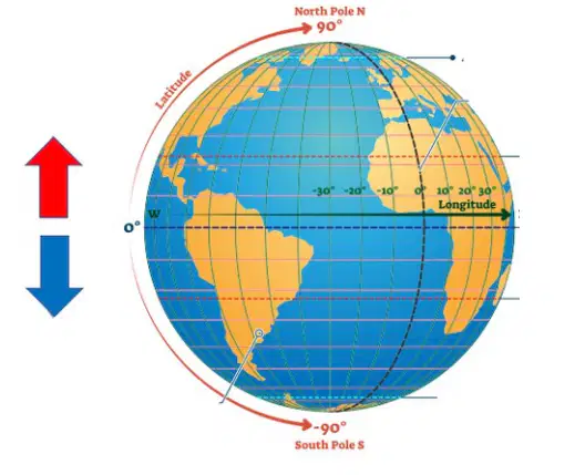
What hemisphere does the RED arrow show?
Northern hemisphere.
Southern hemisphere.
I'm not sure.
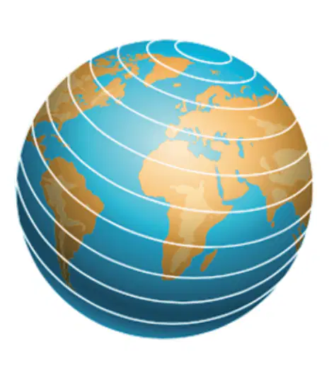
Name these horizontal measurement lines.
Longitude.
Latitude.
I'm not sure.

What is the name of line A?
Arctic Circle
Southern Hemisphere
Northern Hemisphere
Tropic of Cancer
Antarctic Circle
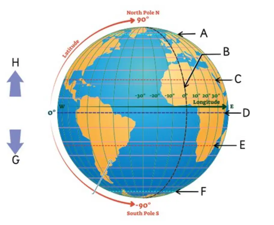
What is the name of line C?
Southern Hemisphere
Arctic Circle
Tropic of Cancer
Antarctic Circle
Equator

What is the name of line D?
Greenwich Meridian Line
Equator
Tropic of Capricorn
Antarctic Circle
Arctic Circle

What is the name of line E?
Tropic of Cancer
Northern Hemisphere
Equator
Greenwich Meridian Line
Tropic of Capricorn
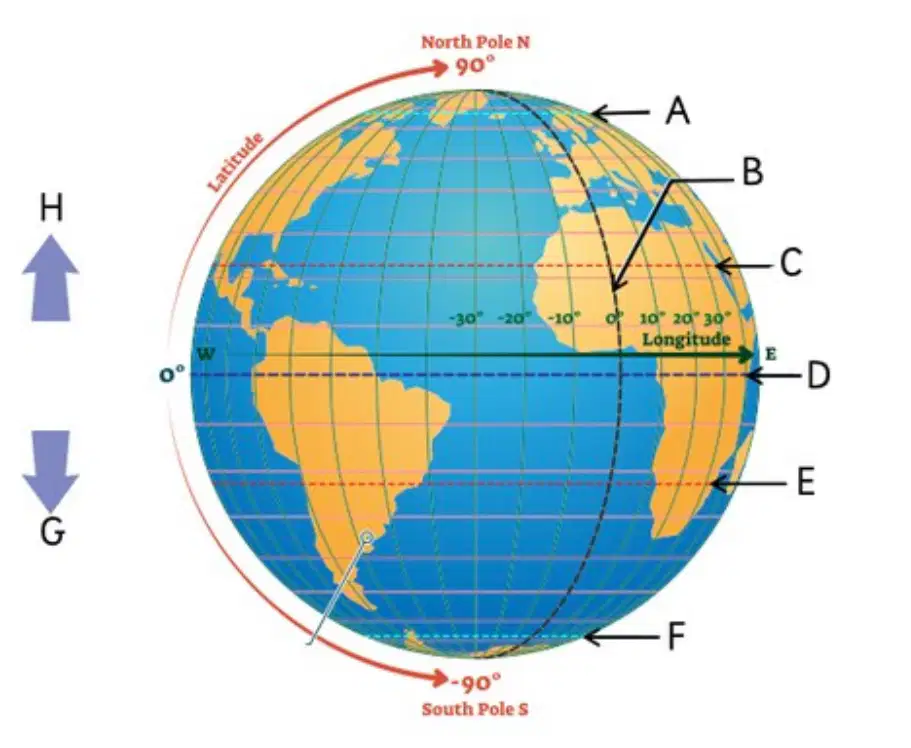
What is the name of line F?
Southern Hemisphere
Northern Hemisphere
Antarctic Circle
Arctic Circle
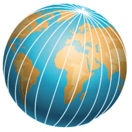
Name these vertical measurement lines.
Longitude
Latitude
I'm not sure
0° longitude is called the...
equator
prime meridian
Tropic of Cancer
I'm not sure

What is the name of line B?
Southern Hemisphere.
Northern Hemisphere.
Antarctic Circle.
Greenwich Meridian Line
Arctic Circle.
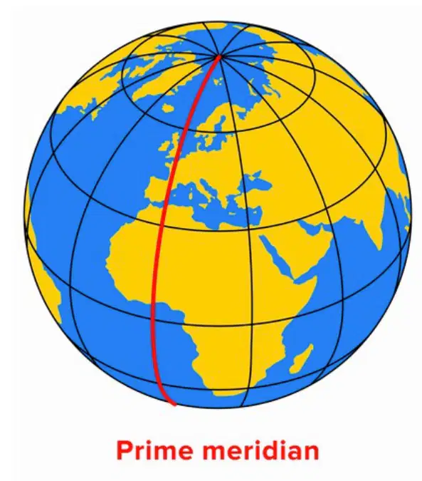
The prime meridian divides...
eastern and western hemispheres.
northern and Southern hemispheres.
I'm not sure.
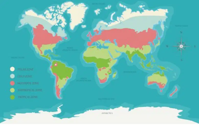
The tropics are...
polar (very, very cold) regions.
tropical (hot and wet) and desert (hot and dry) regions.
temperate (not too hot and not too cold) regions.
I'm not sure.

The milder regions above the Tropic of Cancer and below the Tropic of Capricorn are...
polar (very, very cold) regions.
tropical (hot and wet) and desert (hot and dry) regions.
temperate (not too hot and not too cold) regions.
I'm not sure.
Remember latitude first, then longitude. Finland is located about...
65°N and 25° E.
25° N and 60° E.
I'm not sure.
Countries to the east → of the prime meridian are...
ahead in time of the UK (+ hours).
behind in time of the UK (- hours).
I'm not sure.
Countries to the west ← of the prime meridian are...
ahead in time of the UK (+ hours).
behind in time of the UK (- hours).
I'm not sure.
What's the purpose of latitude and longitude?
To divide the world into regions.
To help measure location and time.
I'm not sure.
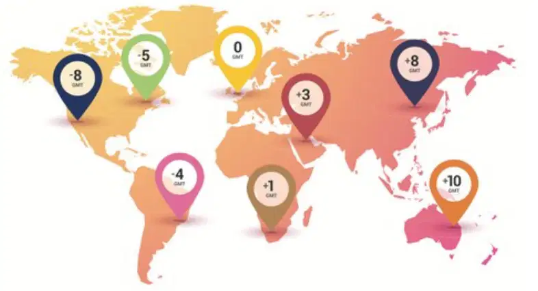
Australia (orange pin) is...
ahead of UK time → (east of prime meridian).
behind UK time ← (west of prime meridian).
I'm not sure.
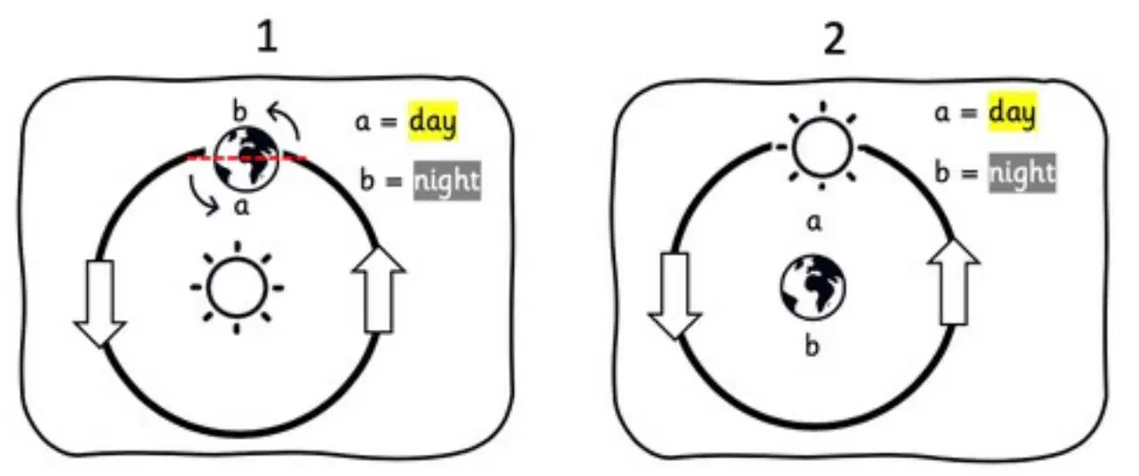
Day and night: which diagram is CORRECT?
1
2
I'm not sure.

